|
|
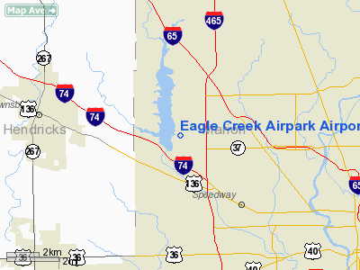
Eagle Creek Airpark Airport |
| Eagle Creek Airpark |
| IATA: none â ICAO: KEYE â FAA LID: EYE |
| Summary |
| Airport type |
Public |
| Owner |
Indianapolis Airport Authority |
| Serves |
Indianapolis, Indiana |
| Elevation AMSL |
823 ft / 251 m |
| Coordinates |
39°49â²51â³N 086°17â²40â³W / 39.83083°N 86.29444°W / 39.83083; -86.29444 |
| Runways |
| Direction |
Length |
Surface |
| ft |
m |
| 3/21 |
4,200 |
1,280 |
Asphalt |
| Statistics (2007) |
| Aircraft operations |
46,371 |
| Based aircraft |
103 |
| Source: Federal Aviation Administration |
Eagle Creek Airpark (ICAO: KEYE, FAA LID: EYE) is a public use airport located seven nautical miles (13 km) west of the central business district of Indianapolis, a city in Marion County, Indiana, United States. It is owned by the Indianapolis Airport Authority and serves as a reliever airport for Indianapolis International Airport.
Although most U.S. airports use the same three-letter location identifier for the FAA and IATA, this airport is assigned EYE by the FAA but has no designation from the IATA. Facilities and aircraft
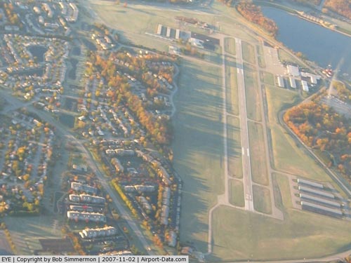
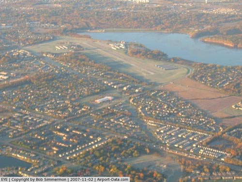
Eagle Creek Airpark covers an area of 315 acres (127 ha) at an elevation of 823 feet (251 m) above mean sea level. It has one asphalt paved runway designated 3/21 which measures 4,200 by 75 feet (1,280 x 23 m).
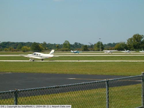
For the 12-month period ending December 31, 2007, the airport had 46,371 aircraft operations, an average of 127 per day: 94% general aviation and 6% air taxi. At that time there were 103 aircraft based at this airport: 83% single-engine, 14% multi-engine, 1% jet and 2% helicopter.
Eagle Creek Aviation Services, the airport's fixed base operator (FBO) is an authorized service center for Cessna Citation, Cirrus Design and Twin Commander aircraft. ECAS is also one of the eight U.S. service centers for the Embraer Phenom.
Media appearances
Eagle Creek Airpark (as Eagle Creek Airport) appears in three of the missions supplied with Microsoft Flight Simulator X.
The above content comes from Wikipedia and is published under free licenses – click here to read more.
|
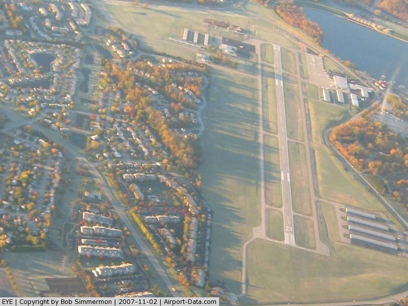
 |
(Click on the photo to enlarge) |
|
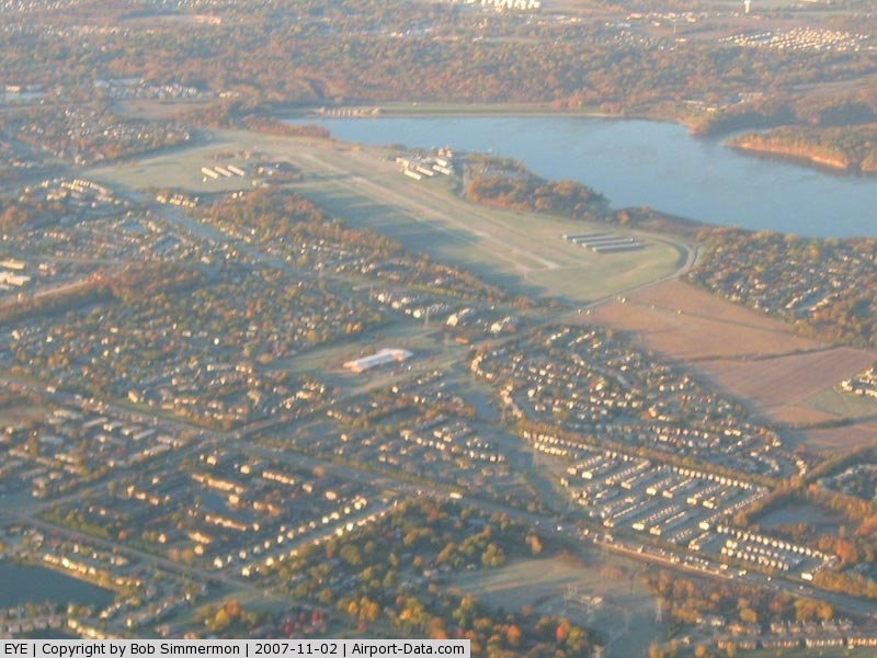
 |
(Click on the photo to enlarge) |
|
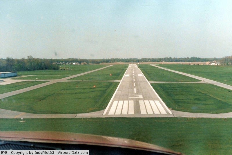
 |
(Click on the photo to enlarge) |
|
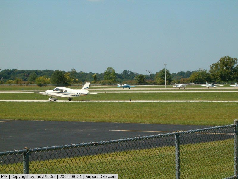
 |
(Click on the photo to enlarge) |
Location
& QuickFacts
|
FAA
Information Effective: |
2007-12-20 |
|
Airport
Identifier: |
EYE |
|
Airport
Status: |
Operational |
|
Longitude/Latitude: |
086-17-39.8000W/39-49-50.9000N
-86.294389/39.830806 (Estimated) |
|
Elevation: |
823 ft / 250.85 m (Surveyed) |
|
Land: |
315 acres |
|
From nearest
city: |
7 nautical miles W of Indianapolis, IN |
|
Location: |
Marion County, IN |
|
Magnetic
Variation: |
02W (1985) |
Owner
& Manager
|
Ownership: |
Publicly
owned |
|
Owner: |
Indianapolis Arpt Auth |
|
Address: |
Box 100 2500 S High School Rd
Indianapolis, IN 46241 |
|
Phone
number: |
317-487-9594 |
|
Manager: |
Michael T. Medvescek |
|
Address: |
2500 S. High School Road, Ste. 100
Indianapolis,
IN 46241 |
|
Phone
number: |
317-487-5024 |
Airport Operations
and Facilities
|
Airport
Use: |
Open
to public |
|
Wind indicator: |
Yes |
|
Segmented
Circle: |
Yes |
|
Control
Tower: |
No |
|
Lighting
Schedule: |
DUSK-DAWN
MIRL RY 03/21 PRESET ON LOW INTST; TO INCR INTST & ACTVT
MALS RY 21 & REIL RY 03 - CTAF. |
|
Beacon
Color: |
Clear-Green (lighted land airport) |
|
Landing
fee charge: |
No |
|
Sectional
chart: |
St Louis |
|
Region: |
AGL - Great Lakes |
|
Boundary
ARTCC: |
ZID - Indianapolis |
|
Tie-in
FSS: |
HUF - Terre Haute |
|
FSS on
Airport: |
No |
|
FSS Toll
Free: |
1-800-WX-BRIEF |
|
NOTAMs
Facility: |
EYE (NOTAM-d service avaliable) |
|
Federal
Agreements: |
NGY |
Airport Communications
|
CTAF: |
122.800 |
|
Unicom: |
122.800
|
Airport
Services
|
Fuel
available: |
100LLA
100LL HAS 24 HR SELF SERVICE |
|
Airframe
Repair: |
MAJOR |
|
Power
Plant Repair: |
MAJOR |
|
Bottled
Oxygen: |
NONE |
|
Bulk Oxygen: |
HIGH |
|
Runway Information
Runway 03/21
|
Dimension: |
4200 x 75 ft
/ 1280.2 x 22.9 m |
|
Surface: |
ASPH, Good Condition |
|
Weight Limit: |
Single wheel: 12500 lbs. |
|
Edge Lights: |
Medium |
|
|
Runway 03 |
Runway 21 |
|
Longitude: |
086-17-51.3905W |
086-17-28.1868W |
|
Latitude: |
39-49-31.8568N |
39-50-09.3086N |
|
Elevation: |
817.00 ft |
822.00 ft |
|
Alignment: |
26 |
127 |
|
ILS Type: |
|
LOCALIZER |
|
Traffic
Pattern: |
Left |
Left |
|
Markings: |
Non-precision instrument, Good Condition |
Non-precision instrument, Good Condition |
|
Crossing
Height: |
30.00 ft |
30.00 ft |
|
VASI: |
2-light PAPI on left side |
2-light PAPI on left side |
|
Visual Glide
Angle: |
3.00° |
3.00° |
|
Approach
lights: |
|
MALS |
|
Runway End
Identifier: |
Yes |
|
|
Centerline
Lights: |
No |
No |
|
Touchdown
Lights: |
No |
No |
|
Obstruction: |
37 ft trees, 1110.0 ft from runway, 24:1 slope
to clear |
13 ft road, 608.0 ft from runway, 31:1 slope
to clear
CLOSEST INTCP POINT. |
|
Radio Navigation
Aids
|
ID |
Type |
Name |
Ch |
Freq |
Var |
Dist |
|
HZP |
NDB |
Zionsville |
|
248.00 |
03W |
6.9 nm |
|
UMP |
NDB |
Metropolitan |
|
338.00 |
03W |
13.0 nm |
|
HFY |
NDB |
Greenwood |
|
398.00 |
02W |
15.2 nm |
|
TVX |
NDB |
Greencastle |
|
521.00 |
03W |
24.7 nm |
|
FKR |
NDB |
Frankfort |
|
278.00 |
02W |
29.2 nm |
|
CFJ |
NDB |
Crawfordsville |
|
388.00 |
02W |
30.0 nm |
|
BA |
NDB |
Clifs |
|
410.00 |
03W |
37.7 nm |
|
AI |
NDB |
Video |
|
371.00 |
03W |
38.9 nm |
|
UWL |
NDB |
New Castle |
|
385.00 |
02W |
45.1 nm |
|
BM |
NDB |
Claye |
|
382.00 |
02W |
48.6 nm |
|
MIE |
VOR/DME |
Muncie |
091X |
114.40 |
03W |
48.1 nm |
|
MZZ |
VOR/DME |
Marion |
023X |
108.60 |
03W |
48.8 nm |
|
VHP |
VORTAC |
Brickyard |
110X |
116.30 |
01E |
3.5 nm |
|
SHB |
VORTAC |
Shelbyville |
057X |
112.00 |
01E |
24.8 nm |
|
OKK |
VORTAC |
Kokomo |
082X |
113.50 |
00E |
43.3 nm |
|
OOM |
VORTAC |
Hoosier |
039X |
110.20 |
02W |
43.9 nm |
|
TTH |
VORTAC |
Terre Haute |
100X |
115.30 |
02E |
48.7 nm |
|
GUS |
VORTAC |
Grissom |
21Y |
108.45 |
02W |
49.4 nm |
|
IND |
VOT |
Indianapolis Intl |
|
109.60 |
|
6.4 nm |
Remarks
- OUTSIDE
PHONES AVBL.
- ACFT
TKOF/LNDG FM RY 03 DURING CALM WIND/CROSSWIND CONDS; DURING ANY QUESTIONABLE
PERIOD RY 03 SHALL BE PREFERRED RY - CALL AMGR 317-487-9594.
Based Aircraft
|
Aircraft
based on field: |
115 |
|
Single Engine
Airplanes: |
91 |
|
Multi Engine Airplanes: |
21 |
|
Jet Engine Airplanes: |
1 |
|
Helicopters: |
2 |
Operational Statistics
Time
Period: 2005-06-16 - 2006-06-15
|
Aircraft
Operations: |
119/Day |
|
Air Taxi: |
6.0% |
|
General Aviation
Local: |
58.0% |
|
General Aviation
Itinerant: |
36.0% |
Eagle Creek Airpark Airport
Address:
Marion County, IN
Tel:
317-487-9594,
317-487-5024
Images
and information placed above are from
http://www.airport-data.com/airport/EYE/
We
thank them for the data!
| General
Info |
| Country |
United
States |
| State |
INDIANA
|
| FAA ID |
EYE |
| Latitude |
39-49-50.554N
|
| Longitude |
086-17-39.770W
|
| Elevation |
823 feet
|
| Near City |
INDIANAPOLIS
|
We don't guarantee the information is fresh and accurate. The data may
be wrong or outdated.
For more up-to-date information please refer to other sources.
|
|