 |
|
Location
& QuickFacts
|
FAA
Information Effective: |
2007-12-20 |
|
Airport
Identifier: |
II68 |
|
Airport
Status: |
Operational |
|
Longitude/Latitude: |
086-57-33.0340W/39-51-18.1590N
-86.959176/39.855044 (Estimated) |
|
Elevation: |
852 ft / 259.69 m (Estimated) |
|
Land: |
6 acres |
|
From nearest
city: |
2 nautical miles E of Russellville, IN |
|
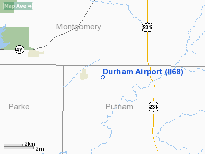
Location: |
Putnam County, IN |
|
Magnetic
Variation: |
01W (1985) |
Owner
& Manager
|
Ownership: |
Privately
owned |
|
Owner: |
J. Frank Durham |
|
Address: |
11 East Walnut St
Greencastle,
IN 46135 |
|
Phone
number: |
317-653-3818 |
|
Address: |
|
Airport Operations
and Facilities
|
Airport
Use: |
Private |
|
Segmented
Circle: |
No |
|
Control
Tower: |
No |
|
Landing
fee charge: |
No |
|
Sectional
chart: |
St Louis |
|
Region: |
AGL - Great Lakes |
|
Boundary
ARTCC: |
ZID - Indianapolis |
|
Tie-in
FSS: |
HUF - Terre Haute |
|
FSS Toll
Free: |
1-800-WX-BRIEF |
|
Runway Information
Runway 08/26
|
Dimension: |
2200 x 100 ft
/ 670.6 x 30.5 m |
|
Surface: |
TURF, |
|
|
Runway 08 |
Runway 26 |
|
Traffic
Pattern: |
Left |
Left |
|
Radio Navigation
Aids
|
ID |
Type |
Name |
Ch |
Freq |
Var |
Dist |
|
CFJ |
NDB |
Crawfordsville |
|
388.00 |
02W |
7.8 nm |
|
TVX |
NDB |
Greencastle |
|
521.00 |
03W |
11.0 nm |
|
FKR |
NDB |
Frankfort |
|
278.00 |
02W |
30.9 nm |
|
HZP |
NDB |
Zionsville |
|
248.00 |
03W |
33.1 nm |
|
PRG |
NDB |
Paris |
|
341.00 |
01E |
34.3 nm |
|
HU |
NDB |
Yinno |
|
245.00 |
02W |
34.7 nm |
|
UMP |
NDB |
Metropolitan |
|
338.00 |
03W |
42.2 nm |
|
HFY |
NDB |
Greenwood |
|
398.00 |
02W |
42.3 nm |
|
HMJ |
NDB |
Homer |
|
281.00 |
01E |
46.9 nm |
|
SIV |
NDB |
Sullivan |
|
326.00 |
02W |
50.0 nm |
|
TTH |
VORTAC |
Terre Haute |
100X |
115.30 |
02E |
25.8 nm |
|
VHP |
VORTAC |
Brickyard |
110X |
116.30 |
01E |
27.4 nm |
|
DNV |
VORTAC |
Danville |
047X |
111.00 |
02E |
38.1 nm |
|
BVT |
VORTAC |
Boiler |
098X |
115.10 |
01E |
42.4 nm |
|
OOM |
VORTAC |
Hoosier |
039X |
110.20 |
02W |
45.7 nm |
|
IND |
VOT |
Indianapolis Intl |
|
109.60 |
|
32.2 nm |
Remarks
- FILED
FOR RECORD PURPOSES ONLY.
Based Aircraft
|
Aircraft
based on field: |
2 |
|
Single Engine
Airplanes: |
2 |
Durham Airport
Address:
Putnam County, IN
Tel:
317-653-3818
Images
and information placed above are from
http://www.airport-data.com/airport/II68/
We
thank them for the data!
| General
Info |
| Country |
United
States |
| State |
INDIANA
|
| FAA ID |
II68 |
| Latitude |
39-51-18.159N
|
| Longitude |
086-57-33.034W
|
| Elevation |
852 feet
|
| Near City |
RUSSELLVILLE
|
We don't guarantee the information is fresh and accurate. The data may
be wrong or outdated.
For more up-to-date information please refer to other sources.
|
|


