 |
|
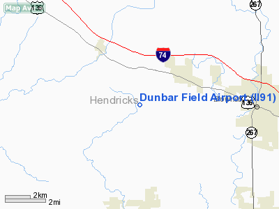
Location
& QuickFacts
|
FAA
Information Effective: |
2007-12-20 |
|
Airport
Identifier: |
II91 |
|
Airport
Status: |
Operational |
|
Longitude/Latitude: |
086-30-18.9900W/39-50-38.1600N
-86.505275/39.843933 (Estimated) |
|
Elevation: |
940 ft / 286.51 m (Estimated) |
|
Land: |
0 acres |
|
From nearest
city: |
6 nautical miles N of Pittsboro, IN |
|
Location: |
Hendricks County, IN |
|
Magnetic
Variation: |
02W (1990) |
Owner
& Manager
|
Ownership: |
Privately
owned |
|
Owner: |
Kent Dunbar |
|
Address: |
801 E. Co Rd. 600n
Pittsboro, IN 46167 |
|
Phone
number: |
317-892-3764 |
|
Manager: |
Kent Dunbar |
|
Address: |
801 E. Co Rd. 600n
Pittsboro, IN 46167 |
|
Phone
number: |
317-892-3764 |
Airport Operations
and Facilities
|
Airport
Use: |
Private |
|
Wind indicator: |
Yes |
|
Segmented
Circle: |
No |
|
Control
Tower: |
No |
|
Sectional
chart: |
St Louis |
|
Region: |
AGL - Great Lakes |
|
Boundary
ARTCC: |
ZID - Indianapolis |
|
Tie-in
FSS: |
HUF - Terre Haute |
|
FSS Toll
Free: |
1-800-WX-BRIEF |
|
Runway Information
Runway 18/36
|
Dimension: |
1600 x 75 ft
/ 487.7 x 22.9 m |
|
Surface: |
TURF, |
|
|
Runway 18 |
Runway 36 |
|
Traffic
Pattern: |
Left |
Right |
|
Obstruction: |
30 ft plines, 1000.0 ft from runway |
6 ft fence, 140.0 ft from runway |
|
Radio Navigation
Aids
|
ID |
Type |
Name |
Ch |
Freq |
Var |
Dist |
|
HZP |
NDB |
Zionsville |
|
248.00 |
03W |
13.1 nm |
|
TVX |
NDB |
Greencastle |
|
521.00 |
03W |
15.9 nm |
|
CFJ |
NDB |
Crawfordsville |
|
388.00 |
02W |
20.6 nm |
|
UMP |
NDB |
Metropolitan |
|
338.00 |
03W |
21.7 nm |
|
HFY |
NDB |
Greenwood |
|
398.00 |
02W |
23.0 nm |
|
FKR |
NDB |
Frankfort |
|
278.00 |
02W |
25.8 nm |
|
BA |
NDB |
Clifs |
|
410.00 |
03W |
44.7 nm |
|
BM |
NDB |
Claye |
|
382.00 |
02W |
47.5 nm |
|
AI |
NDB |
Video |
|
371.00 |
03W |
47.8 nm |
|
HU |
NDB |
Yinno |
|
245.00 |
02W |
49.6 nm |
|
VHP |
VORTAC |
Brickyard |
110X |
116.30 |
01E |
6.6 nm |
|
SHB |
VORTAC |
Shelbyville |
057X |
112.00 |
01E |
33.9 nm |
|
TTH |
VORTAC |
Terre Haute |
100X |
115.30 |
02E |
40.5 nm |
|
OOM |
VORTAC |
Hoosier |
039X |
110.20 |
02W |
42.4 nm |
|
OKK |
VORTAC |
Kokomo |
082X |
113.50 |
00E |
46.0 nm |
|
IND |
VOT |
Indianapolis Intl |
|
109.60 |
|
12.5 nm |
Remarks
- OWNER
DESIRES ARPT NOT BE CHARTED.
- PRVDD
OBSTN IN THR RY APCH SLOPE ARE REMOVED/LOWERED ON RY THR IS DSPLCD &
MARKED TO PRVDD A 20:1 APCH SLOPE; AREA 125 FT EITHER SIDE OF RY CNTRLN
& 200 FT OFF RY END BE CLEAR OF OBSTN; & RIGHT HAND TRAFFIC
PATTERN FOR RY 36.
Based Aircraft
|
Aircraft
based on field: |
1 |
|
Single Engine
Airplanes: |
1 |
Dunbar Field Airport
Address:
Hendricks County, IN
Tel:
317-892-3764
Images
and information placed above are from
http://www.airport-data.com/airport/II91/
We
thank them for the data!
| General
Info |
| Country |
United
States |
| State |
INDIANA
|
| FAA ID |
II91 |
| Latitude |
39-50-38.160N
|
| Longitude |
086-30-18.990W
|
| Elevation |
940 feet
|
| Near City |
PITTSBORO
|
We don't guarantee the information is fresh and accurate. The data may
be wrong or outdated.
For more up-to-date information please refer to other sources.
|
|


