 |
|
Location
& QuickFacts
|
FAA
Information Effective: |
2007-12-20 |
|
Airport
Identifier: |
17II |
|
Airport
Status: |
Operational |
|
Longitude/Latitude: |
086-30-37.0470W/41-27-00.1590N
-86.510291/41.450044 (Estimated) |
|
Elevation: |
706 ft / 215.19 m (Estimated) |
|
Land: |
0 acres |
|
From nearest
city: |
2 nautical miles SW of Walkerton, IN |
|
Location: |
St Joseph County, IN |
|
Magnetic
Variation: |
02W (1980) |
Owner & Manager
|
Ownership: |
Privately
owned |
|
Owner: |
Carl Dreessen |
|
Address: |
33150 Union Rd
Walkerton,
IN 46574 |
|
Phone
number: |
219-586-2458 |
|
Manager: |
Carl Dreessen |
|
Address: |
33150 Union Rd.
Walkerton,
IN 46574 |
|
Phone
number: |
219-586-2458 |
Airport Operations
and Facilities
|
Airport Use: |
Private |
|
Wind
indicator: |
Yes |
|
Segmented
Circle: |
No |
|
Control
Tower: |
No |
|
Sectional
chart: |
Chicago |
|
Region: |
AGL - Great Lakes |
|
Boundary
ARTCC: |
ZAU - Chicago |
|
Tie-in
FSS: |
HUF - Terre Haute |
|
FSS Toll
Free: |
1-800-WX-BRIEF |
Airport
Communications
|
Runway Information
Runway 09/27
|
Dimension: |
2600 x 75 ft
/ 792.5 x 22.9 m |
|
Surface: |
TURF, |
|
|
Runway 09 |
Runway 27 |
|
Traffic
Pattern: |
Left |
Left |
|
Obstruction: |
|
30 ft trees |
|
Radio Navigation
Aids
|
ID |
Type |
Name |
Ch |
Freq |
Var |
Dist |
|
IUL |
NDB |
La Porte |
|
356.00 |
03W |
12.1 nm |
|
CPB |
NDB |
Culver |
|
391.00 |
01W |
15.1 nm |
|
VP |
NDB |
Sedly |
|
212.00 |
02W |
16.5 nm |
|
MGC |
NDB |
Michigan City |
|
203.00 |
01W |
20.7 nm |
|
RWN |
NDB |
Winamac/dcmsnd |
|
335.00 |
00W |
21.8 nm |
|
RCR |
NDB |
Rochester |
|
216.00 |
03W |
27.3 nm |
|
RZL |
NDB |
Rensselaer |
|
362.00 |
02W |
42.9 nm |
|
GGP |
NDB |
Logansport |
|
263.00 |
01W |
45.0 nm |
|
MCX |
NDB |
White County |
|
377.00 |
03W |
45.9 nm |
|
OLK |
VOR |
Wolf Lake |
|
110.40 |
03W |
47.3 nm |
|
OXI |
VOR/DME |
Knox |
103X |
115.60 |
00E |
9.9 nm |
|
ELX |
VOR/DME |
Keeler |
113X |
116.60 |
00E |
45.2 nm |
|
GIJ |
VORTAC |
Gipper |
101X |
115.40 |
00E |
21.0 nm |
|
GSH |
VORTAC |
Goshen |
084X |
113.70 |
00E |
22.2 nm |
|
CGT |
VORTAC |
Chicago Heights |
089X |
114.20 |
02E |
47.9 nm |
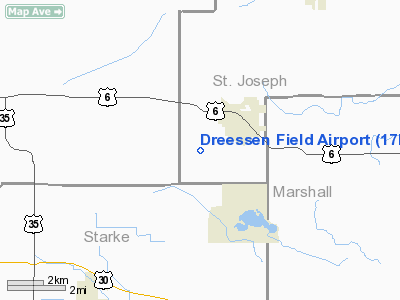
Dreessen Field Airport
Address:
St Joseph County, IN
Tel:
219-586-2458
Images
and information placed above are from
http://www.airport-data.com/airport/17II/
We
thank them for the data!
| General
Info |
| Country |
United
States |
| State |
INDIANA
|
| FAA ID |
17II |
| Latitude |
41-27-00.159N
|
| Longitude |
086-30-37.047W
|
| Elevation |
706 feet
|
| Near City |
WALKERTON
|
We don't guarantee the information is fresh and accurate. The data may
be wrong or outdated.
For more up-to-date information please refer to other sources.
|
|


