 |
|
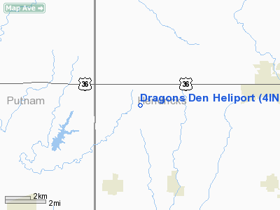
Location
& QuickFacts
|
FAA
Information Effective: |
2007-12-20 |
|
Airport
Identifier: |
4IN6 |
|
Airport
Status: |
Operational |
|
Longitude/Latitude: |
086-38-40.0000W/39-44-44.0000N
-86.644444/39.745556 (Estimated) |
|
Elevation: |
934 ft / 284.68 m (Estimated) |
|
Land: |
0 acres |
|
From nearest
city: |
6 nautical miles W of Danvillle, IN |
|
Location: |
Hendricks County, IN |
|
Magnetic
Variation: |
02W (1995) |
Owner & Manager
|
Ownership: |
Privately
owned |
|
Address: |
|
|
Manager: |
Billy C Budny |
|
Address: |
2015 Valiant Dr
Indianapolis,
IN 46241 |
Airport
Operations and Facilities
|
Airport
Use: |
Private |
|
Segmented
Circle: |
No |
|
Control
Tower: |
No |
|
Sectional
chart: |
St Louis |
|
Region: |
AGL - Great Lakes |
|
Boundary
ARTCC: |
ZID - Indianapolis |
|
Tie-in
FSS: |
HUF - Terre Haute |
|
FSS Toll
Free: |
1-800-WX-BRIEF |
|
Runway Information
Helipad H1
|
Dimension: |
20 x 20 ft /
6.1 x 6.1 m |
|
Surface: |
TURF, |
|
|
Runway H1 |
Runway |
|
Traffic
Pattern: |
Left |
Left |
|
Radio Navigation
Aids
|
ID |
Type |
Name |
Ch |
Freq |
Var |
Dist |
|
TVX |
NDB |
Greencastle |
|
521.00 |
03W |
7.7 nm |
|
CFJ |
NDB |
Crawfordsville |
|
388.00 |
02W |
18.9 nm |
|
HZP |
NDB |
Zionsville |
|
248.00 |
03W |
21.6 nm |
|
HFY |
NDB |
Greenwood |
|
398.00 |
02W |
26.5 nm |
|
UMP |
NDB |
Metropolitan |
|
338.00 |
03W |
29.8 nm |
|
FKR |
NDB |
Frankfort |
|
278.00 |
02W |
31.8 nm |
|
HU |
NDB |
Yinno |
|
245.00 |
02W |
41.0 nm |
|
BM |
NDB |
Claye |
|
382.00 |
02W |
41.5 nm |
|
BA |
NDB |
Clifs |
|
410.00 |
03W |
46.0 nm |
|
PRG |
NDB |
Paris |
|
341.00 |
01E |
47.7 nm |
|
VHP |
VORTAC |
Brickyard |
110X |
116.30 |
01E |
13.4 nm |
|
TTH |
VORTAC |
Terre Haute |
100X |
115.30 |
02E |
32.0 nm |
|
OOM |
VORTAC |
Hoosier |
039X |
110.20 |
02W |
36.2 nm |
|
SHB |
VORTAC |
Shelbyville |
057X |
112.00 |
01E |
38.5 nm |
|
IND |
VOT |
Indianapolis Intl |
|
109.60 |
|
16.7 nm |
Remarks
- PRVDD
ALL DEP/APCH FM 290-120, AREA IS MKD, WIND INDICATOR IS MAINTAINED,
COMPLY WITH FAR 91.126(B)(2).
Dragons Den Heliport
Address:
Hendricks County, IN
Tel:
Images
and information placed above are from
http://www.airport-data.com/airport/4IN6/
We
thank them for the data!
| General
Info |
| Country |
United
States |
| State |
INDIANA
|
| FAA ID |
4IN6 |
| Latitude |
39-44-44.000N
|
| Longitude |
086-38-40.000W
|
| Elevation |
934 feet
|
| Near City |
DANVILLLE
|
We don't guarantee the information is fresh and accurate. The data may
be wrong or outdated.
For more up-to-date information please refer to other sources.
|
|


