 |
|
Location
& QuickFacts
|
FAA
Information Effective: |
2007-12-20 |
|
Airport
Identifier: |
02IN |
|
Airport
Status: |
Operational |
|
Longitude/Latitude: |
085-32-27.0000W/40-12-32.0000N
-85.540833/40.208889 (Estimated) |
|
Elevation: |
904 ft / 275.54 m (Estimated) |
|
Land: |
0 acres |
|
From nearest
city: |
5 nautical miles W of Muncie, IN |
|
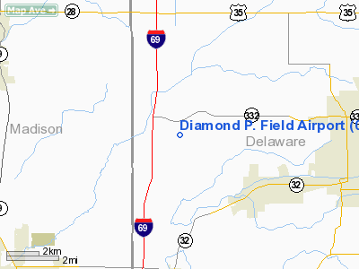
Location: |
Delaware County, IN |
|
Magnetic
Variation: |
03W (1995) |
Owner
& Manager
|
Ownership: |
Privately
owned |
|
Owner: |
Greg Phillips |
|
Address: |
1707 N Co Rd 800 W
Yorktown, IN 47396 |
|
Phone
number: |
765-286-1882 |
|
Manager: |
Greg Phillips |
|
Address: |
1707 N Co Rd 800 W
Yorktown, IN 47396 |
|
Phone
number: |
765-286-1882 |
Airport Operations
and Facilities
|
Airport
Use: |
Private |
|
Wind indicator: |
Yes |
|
Segmented
Circle: |
No |
|
Control
Tower: |
No |
|
Sectional
chart: |
St Louis |
|
Region: |
AGL - Great Lakes |
|
Boundary
ARTCC: |
ZID - Indianapolis |
|
Tie-in
FSS: |
HUF - Terre Haute |
|
FSS Toll
Free: |
1-800-WX-BRIEF |
|
Runway Information
Runway 09/27
|
Dimension: |
1020 x 150 ft
/ 310.9 x 45.7 m |
|
Surface: |
TURF, |
|
|
Runway 09 |
Runway 27 |
|
Traffic
Pattern: |
Left |
Left |
|
Radio Navigation
Aids
|
ID |
Type |
Name |
Ch |
Freq |
Var |
Dist |
|
AI |
NDB |
Video |
|
371.00 |
03W |
8.5 nm |
|
UWL |
NDB |
New Castle |
|
385.00 |
02W |
22.3 nm |
|
UMP |
NDB |
Metropolitan |
|
338.00 |
03W |
28.5 nm |
|
PLD |
NDB |
Portland |
|
257.00 |
03W |
29.5 nm |
|
IWH |
NDB |
Wabash |
|
329.00 |
03W |
35.4 nm |
|
HZP |
NDB |
Zionsville |
|
248.00 |
03W |
36.4 nm |
|
HHG |
NDB |
Huntington |
|
417.00 |
03W |
39.0 nm |
|
HFY |
NDB |
Greenwood |
|
398.00 |
02W |
42.9 nm |
|
VES |
NDB |
Versailles |
|
356.00 |
04W |
46.7 nm |
|
FKR |
NDB |
Frankfort |
|
278.00 |
02W |
47.0 nm |
|
CQA |
NDB |
Lakefield |
|
205.00 |
04W |
47.6 nm |
|
GGP |
NDB |
Logansport |
|
263.00 |
01W |
48.5 nm |
|
MIE |
VOR/DME |
Muncie |
091X |
114.40 |
03W |
7.0 nm |
|
MZZ |
VOR/DME |
Marion |
023X |
108.60 |
03W |
18.2 nm |
|
OKK |
VORTAC |
Kokomo |
082X |
113.50 |
00E |
30.5 nm |
|
SHB |
VORTAC |
Shelbyville |
057X |
112.00 |
01E |
37.0 nm |
|
GUS |
VORTAC |
Grissom |
21Y |
108.45 |
02W |
38.3 nm |
|
RID |
VORTAC |
Richmond |
043X |
110.60 |
03W |
42.3 nm |
|
VHP |
VORTAC |
Brickyard |
110X |
116.30 |
01E |
44.8 nm |
|
FWA |
VORTAC |
Fort Wayne |
125X |
117.80 |
00E |
49.0 nm |
|
IND |
VOT |
Indianapolis Intl |
|
109.60 |
|
44.9 nm |
|
FWA |
VOT |
Fort Wayne Baer |
|
111.00 |
|
48.9 nm |
Remarks
- MAINTAIN
20:1 APCH SLOPE OVR OBSTNS. AREA 125 FT ON EITHER SIDE OF R/W 200 FT
BYD RY & BE CLEAR OF OBSTNS; AREA 60 FT EITHER SIDE OF RY CNTRLN
AND 240 FT OFF RY ENDS IS CLEAR.
Based Aircraft
|
Aircraft
based on field: |
1 |
|
Single Engine
Airplanes: |
1 |
Diamond P. Field Airport
Address:
Delaware County, IN
Tel:
765-286-1882
Images
and information placed above are from
http://www.airport-data.com/airport/02IN/
We
thank them for the data!
| General
Info |
| Country |
United
States |
| State |
INDIANA
|
| FAA ID |
02IN |
| Latitude |
40-12-32.000N
|
| Longitude |
085-32-27.000W
|
| Elevation |
904 feet
|
| Near City |
MUNCIE
|
We don't guarantee the information is fresh and accurate. The data may
be wrong or outdated.
For more up-to-date information please refer to other sources.
|
|


