 |
|
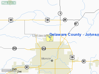
Delaware County - Johnson Field Airport |
Delaware County Airport
Johnson Field |
| IATA: MIE â ICAO: KMIE â FAA LID: MIE |
| Summary |
| Airport type |
Public |
| Owner |
Delaware County Airport Authority |
| Location |
Muncie, Indiana |
| Elevation AMSL |
937 ft / 286 m |
| Coordinates |
40°14â²32â³N 085°23â²45â³W / 40.24222°N 85.39583°W / 40.24222; -85.39583 |
| Runways |
| Direction |
Length |
Surface |
| ft |
m |
| 14/32 |
6,500 |
1,981 |
Asphalt |
| 2/20 |
4,998 |
1,523 |
Asphalt |
| Statistics (2007) |
| Aircraft operations |
27,129 |
| Based aircraft |
36 |
| Source: Federal Aviation Administration |
Delaware County Airport (IATA: MIE, ICAO: KMIE, FAA LID: MIE), also known as Johnson Field, is a public use airport located three nautical miles (6 km) north of the central business district of Muncie, a city in Delaware County, Indiana, United States. It is owned by the Delaware County Airport Authority.
Facilities and aircraft
Delaware County Airport covers an area of 963 acres (390 ha) at an elevation of 937 feet (286 m) above mean sea level. It has two paved runways with asphalt surfaces: 14/32 is 6,500 by 150 feet (1,981 x 46 m) and 2/20 is 4,998 by 100 feet (1,523 x 30 m).
For the 12-month period ending February 28, 2007, the airport had 27,129 aircraft operations, an average of 74 per day: 97.7% general aviation, 1.5% military, 0.79% air taxi and 0.01% scheduled commercial. At that time there were 36 aircraft based at this airport: 83% single-engine, 14% multi-engine and 3% jet.
The above content comes from Wikipedia and is published under free licenses – click here to read more.
Location
& QuickFacts
|
FAA
Information Effective: |
2007-12-20 |
|
Airport
Identifier: |
MIE |
|
Airport
Status: |
Operational |
|
Longitude/Latitude: |
085-23-45.1000W/40-14-32.5000N
-85.395861/40.242361 (Estimated) |
|
Elevation: |
937 ft / 285.60 m (Surveyed) |
|
Land: |
963 acres |
|
From nearest
city: |
3 nautical miles N of Muncie, IN |
|
Location: |
Delaware County, IN |
|
Magnetic
Variation: |
03W (1985) |
Owner
& Manager
|
Ownership: |
Publicly
owned |
|
Owner: |
Delaware County Arpt Auth |
|
Address: |
311 W. Carl Simmons Rd.
Muncie,
IN 47303 |
|
Phone
number: |
765-747-5690 |
|
Manager: |
Steve Leach |
|
Address: |
311 W. Carl Simmons Rd.
Muncie,
IN 47303 |
|
Phone
number: |
765-747-5690 |
Airport Operations
and Facilities
|
Airport
Use: |
Open
to public |
|
Wind indicator: |
Yes |
|
Segmented
Circle: |
Yes |
|
Control
Tower: |
Yes |
|
Lighting
Schedule: |
DUSK-DAWN
ACTVT MIRL RY 02/20; PAPI RYS 2 & 20; REIL RYS 14; 2
& 20 (WITH HIGHEST INTENSITY ONLY); HIRL RY 14/32; MALSR
RY 32; VASI RY 14 - CTAF. |
|
Beacon
Color: |
Clear-Green (lighted land airport) |
|
Sectional
chart: |
Chicago |
|
Region: |
AGL - Great Lakes |
|
Traffic
Pattern Alt: |
1000 ft |
|
Boundary
ARTCC: |
ZID - Indianapolis |
|
Tie-in
FSS: |
HUF - Terre Haute |
|
FSS on
Airport: |
No |
|
FSS Toll
Free: |
1-800-WX-BRIEF |
|
NOTAMs
Facility: |
MIE (NOTAM-d service avaliable) |
|
Certification
type/date: |
IV A U 11/197
48 HRS PPR FOR UNSKED ACR OPNS WITH MORE THAN 30 PSGR SEATS
CALL AMGR 765-747-5690. |
|
Federal
Agreements: |
NGY |
Airport Communications
|
CTAF: |
120.100 |
|
Unicom: |
122.950
|
Airport
Services
|
Fuel
available: |
100LLA |
|
Airframe
Repair: |
MINOR |
|
Power
Plant Repair: |
MINOR |
|
Bottled
Oxygen: |
HIGH |
|
Bulk Oxygen: |
HIGH |
|
Runway Information
Runway 02/20
|
Dimension: |
4998 x 100 ft
/ 1523.4 x 30.5 m |
|
Surface: |
ASPH, Fair Condition |
|
Surface Treatment: |
Saw-cut or plastic Grooved |
|
Weight Limit: |
Single wheel: 50000 lbs.
Dual wheel: 66000 lbs.
Dual tandem wheel: 100000 lbs. |
|
Edge Lights: |
Medium |
|
|
Runway 02 |
Runway 20 |
|
Longitude: |
085-23-47.7688W |
085-23-23.7727W |
|
Latitude: |
40-14-09.8685N |
40-14-55.7018N |
|
Elevation: |
937.00 ft |
934.00 ft |
|
Alignment: |
22 |
127 |
|
Traffic
Pattern: |
Left |
Left |
|
Markings: |
Non-precision instrument, Good Condition |
Non-precision instrument, Good Condition |
|
Crossing
Height: |
27.00 ft |
45.00 ft |
|
VASI: |
4-light PAPI on left side |
4-light PAPI on left side
RY 20 PAPI OTS INDEFLY. |
|
Visual Glide
Angle: |
3.00° |
3.00° |
|
Runway End
Identifier: |
Yes |
Yes |
|
Centerline
Lights: |
No |
No |
|
Touchdown
Lights: |
No |
No |
|
Obstruction: |
58 ft tree, 1570.0 ft from runway, 241 ft left
of centerline, 23:1 slope to clear |
44 ft tree, 1281.0 ft from runway, 424 ft left
of centerline, 25:1 slope to clear |
|
Runway 14/32
|
Dimension: |
6500 x 150 ft
/ 1981.2 x 45.7 m |
|
Surface: |
ASPH, Fair Condition |
|
Surface Treatment: |
Saw-cut or plastic Grooved |
|
Weight Limit: |
Single wheel: 45000 lbs.
Dual wheel: 60000 lbs.
Dual tandem wheel: 75000 lbs. |
|
Edge Lights: |
High |
|
|
Runway 14 |
Runway 32 |
|
Longitude: |
085-24-21.2482W |
085-23-23.1375W |
|
Latitude: |
40-14-55.4133N |
40-14-09.1229N |
|
Elevation: |
929.00 ft |
936.00 ft |
|
Alignment: |
127 |
127 |
|
ILS Type: |
|
ILS |
|
Traffic
Pattern: |
Left |
Left |
|
Markings: |
Precision instrument, Fair Condition |
Precision instrument, Good Condition |
|
Crossing
Height: |
50.00 ft |
0.00 ft |
|
VASI: |
4-box on left side |
|
|
Visual Glide
Angle: |
3.00° |
0.00° |
|
Approach
lights: |
|
MALSR |
|
Runway End
Identifier: |
Yes
RY 14 REIL OTS INDEFLY. |
No |
|
Centerline
Lights: |
No |
No |
|
Touchdown
Lights: |
No |
No |
|
Obstruction: |
98 ft trees, 4200.0 ft from runway, 50 ft right
of centerline, 40:1 slope to clear |
73 ft trees, 3066.0 ft from runway, 857 ft
left of centerline, 39:1 slope to clear |
|
Radio Navigation
Aids
|
ID |
Type |
Name |
Ch |
Freq |
Var |
Dist |
|
AI |
NDB |
Video |
|
371.00 |
03W |
11.7 nm |
|
UWL |
NDB |
New Castle |
|
385.00 |
02W |
22.1 nm |
|
PLD |
NDB |
Portland |
|
257.00 |
03W |
22.8 nm |
|
UMP |
NDB |
Metropolitan |
|
338.00 |
03W |
35.2 nm |
|
IWH |
NDB |
Wabash |
|
329.00 |
03W |
36.3 nm |
|
HHG |
NDB |
Huntington |
|
417.00 |
03W |
37.0 nm |
|
VES |
NDB |
Versailles |
|
356.00 |
04W |
40.1 nm |
|
CQA |
NDB |
Lakefield |
|
205.00 |
04W |
40.7 nm |
|
HZP |
NDB |
Zionsville |
|
248.00 |
03W |
43.3 nm |
|
HFY |
NDB |
Greenwood |
|
398.00 |
02W |
48.7 nm |
|
MIE |
VOR/DME |
Muncie |
091X |
114.40 |
03W |
0.3 nm |
|
MZZ |
VOR/DME |
Marion |
023X |
108.60 |
03W |
19.9 nm |
|
DQN |
VOR/DME |
Dayton |
092X |
114.50 |
01W |
47.9 nm |
|
OKK |
VORTAC |
Kokomo |
082X |
113.50 |
00E |
34.8 nm |
|
RID |
VORTAC |
Richmond |
043X |
110.60 |
03W |
38.9 nm |
|
SHB |
VORTAC |
Shelbyville |
057X |
112.00 |
01E |
41.6 nm |
|
GUS |
VORTAC |
Grissom |
21Y |
108.45 |
02W |
42.2 nm |
|
FWA |
VORTAC |
Fort Wayne |
125X |
117.80 |
00E |
45.3 nm |
|
FWA |
VOT |
Fort Wayne Baer |
|
111.00 |
|
45.2 nm |
Remarks
Based Aircraft
|
Aircraft
based on field: |
30 |
|
Single Engine
Airplanes: |
19 |
|
Multi Engine Airplanes: |
10 |
|
Jet Engine Airplanes: |
1 |
Operational Statistics
Time
Period: 2006-03-01 - 2007-02-28
|
Aircraft
Operations: |
75/Day |
|
Commerical: |
0.0% |
|
Air Taxi: |
0.8% |
|
General Aviation
Local: |
18.6% |
|
General Aviation
Itinerant: |
79.1% |
|
Military: |
1.5% |
Delaware County - Johnson Field Airport
Address:
Delaware County, IN
Tel:
765-747-5690
Images
and information placed above are from
http://www.airport-data.com/airport/MIE/
We
thank them for the data!
| General
Info |
| Country |
United
States |
| State |
INDIANA
|
| FAA ID |
MIE |
| Latitude |
40-14-32.500N
|
| Longitude |
085-23-45.100W
|
| Elevation |
937 feet
|
| Near City |
MUNCIE
|
We don't guarantee the information is fresh and accurate. The data may
be wrong or outdated.
For more up-to-date information please refer to other sources.
|
|


