 |
|
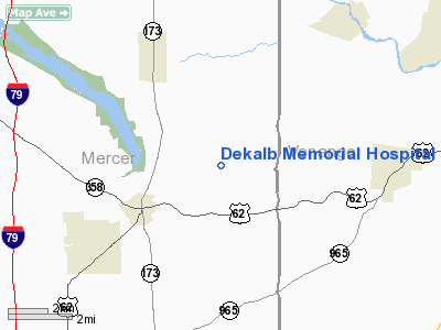
Dekalb Memorial Hospital Heliport |
Location
& QuickFacts
|
FAA
Information Effective: |
2007-12-20 |
|
Airport
Identifier: |
9II7 |
|
Airport
Status: |
Operational |
|
Longitude/Latitude: |
080-02-03.0000W/41-22-12.0000N
-80.034167/41.370000 (Estimated) |
|
Elevation: |
900 ft / 274.32 m (Estimated) |
|
Land: |
0 acres |
|
From nearest
city: |
1 nautical miles E of Auburn, IN |
|
Location: |
De Kalb County, IN |
|
Magnetic
Variation: |
08W (1990) |
Owner
& Manager
|
Ownership: |
Privately
owned |
|
Owner: |
Al J. Wieklinski |
|
Address: |
Dekalb Memorial Hosp., Inc.
East 7th St-auburn, IN 46706 |
|
Phone
number: |
219-925-4600 |
|
Manager: |
Al J. Wieklinski |
|
Address: |
Dekalb Memorial Hosp., Inc.
East 7th St-auburn, IN 46706 |
|
Phone
number: |
219-925-4600 |
Airport Operations
and Facilities
|
Airport
Use: |
Private
MEDICAL USE. |
|
Wind indicator: |
Yes |
|
Segmented
Circle: |
No |
|
Control
Tower: |
No |
|
Sectional
chart: |
Detroit |
|
Region: |
AGL - Great Lakes |
|
Boundary
ARTCC: |
ZOB - Cleveland |
|
Tie-in
FSS: |
HUF - Terre Haute |
|
FSS Toll
Free: |
1-800-WX-BRIEF |
|
Runway Information
Helipad H1
|
Dimension: |
30 x 30 ft /
9.1 x 9.1 m |
|
Surface: |
CONC, |
|
|
Runway H1 |
Runway |
|
Traffic
Pattern: |
Left |
Left |
|
Radio Navigation
Aids
|
ID |
Type |
Name |
Ch |
Freq |
Var |
Dist |
|
HBD |
NDB |
Hubbard |
|
408.00 |
08W |
26.0 nm |
|
UCP |
NDB |
Castle |
|
272.00 |
09W |
27.1 nm |
|
ORJ |
NDB |
Corry |
|
258.00 |
09W |
36.9 nm |
|
CQD |
NDB |
Cascade |
|
372.00 |
08W |
45.1 nm |
|
FKL |
VOR |
Franklin |
|
109.60 |
06W |
9.0 nm |
|
CIP |
VOR/DME |
Clarion |
076X |
112.90 |
06W |
29.3 nm |
|
JFN |
VOR/DME |
Jefferson |
099X |
115.20 |
05W |
39.8 nm |
|
YNG |
VORTAC |
Youngstown |
027X |
109.00 |
05W |
29.0 nm |
|
EWC |
VORTAC |
Ellwood City |
105X |
115.80 |
08W |
33.7 nm |
|
TDT |
VORTAC |
Tidioute |
123X |
117.60 |
09W |
34.6 nm |
|
ERI |
VORTAC |
Erie |
031X |
109.40 |
06W |
40.6 nm |
Remarks
- PRVDD
APCH/DEP OPERS 280-115 DEGS; TKOF/LDG AREA IS APPROPRIATELY MARKED &
LOWERING OR REMOVAL OF A 30 FT LGT POLE LOCATED AT 30 DEG FM THE CTR
OF PAD. A
NON-OBSTRUCTING WIND INDICATOR IS MAINTAINED.
Dekalb Memorial Hospital Heliport
Address:
De Kalb County, IN
Tel:
219-925-4600
Images
and information placed above are from
http://www.airport-data.com/airport/9II7/
We
thank them for the data!
| General
Info |
| Country |
United
States |
| State |
INDIANA
|
| FAA ID |
9II7 |
| Latitude |
41-22-12.000N
|
| Longitude |
080-02-03.000W
|
| Elevation |
900 feet
|
| Near City |
AUBURN
|
We don't guarantee the information is fresh and accurate. The data may
be wrong or outdated.
For more up-to-date information please refer to other sources.
|
|


