 |
|
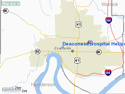
Deaconess Hospital Heliport |
|
|
Location
& QuickFacts
|
FAA
Information Effective: |
2007-12-20 |
|
Airport
Identifier: |
16IN |
|
Airport
Status: |
Operational |
|
Longitude/Latitude: |
087-34-20.0560W/37-59-05.1510N
-87.572238/37.984764 (Estimated) |
|
Elevation: |
390 ft / 118.87 m (Estimated) |
|
Land: |
0 acres |
|
From nearest
city: |
0 nautical miles N of Evansville, IN |
|
Location: |
Vanderburgh County, IN |
|
Magnetic
Variation: |
00W (1985) |
Owner
& Manager
|
Ownership: |
Privately
owned |
|
Owner: |
Deaconess Hospital |
|
Address: |
600 Mary St
Evansville, IN 47747 |
|
Phone
number: |
812-450-5000 |
|
Manager: |
Thomas J. Barnett
DIRECTOR, ENGINEERING AND MAINTENANCE. |
|
Address: |
Deaconess Hospital, 600 Mary St
Evansville, IN 47747 |
|
Phone
number: |
812-450-3432 |
Airport Operations
and Facilities
|
Airport
Use: |
Private
MEDICAL USE. |
|
Wind indicator: |
Yes |
|
Segmented
Circle: |
No |
|
Control
Tower: |
No |
|
Lighting
Schedule: |
PHONE REQ
FOR LGTS AND ROTG BCN PHONE 812-426-3500 |
|
Beacon
Color: |
Clear-Green-Yellow (heliport) |
|
Landing
fee charge: |
No |
|
Sectional
chart: |
St Louis |
|
Region: |
AGL - Great Lakes |
|
Boundary
ARTCC: |
ZID - Indianapolis |
|
Tie-in
FSS: |
HUF - Terre Haute |
|
FSS on
Airport: |
No |
|
FSS Toll
Free: |
1-800-WX-BRIEF |
Airport
Communications
|
Runway Information
Helipad H1
|
Dimension: |
70 x 70 ft /
21.3 x 21.3 m |
|
Surface: |
CONC, |
|
Edge Lights: |
Low |
|
|
Runway H1 |
Runway |
|
Traffic
Pattern: |
Left |
Left |
|
Radio Navigation
Aids
|
ID |
Type |
Name |
Ch |
Freq |
Var |
Dist |
|
PDW |
NDB |
Evansville |
|
284.00 |
00E |
3.9 nm |
|
GVA |
NDB |
Geneva |
|
224.00 |
01W |
14.4 nm |
|
CUL |
NDB |
Carmi |
|
332.00 |
01W |
26.7 nm |
|
TWT |
NDB |
Tradewater |
|
276.00 |
00E |
35.9 nm |
|
FNZ |
NDB |
Ferdinand |
|
239.00 |
00E |
38.2 nm |
|
AJG |
NDB |
Mount Carmel |
|
524.00 |
02W |
38.4 nm |
|
TEL |
NDB |
Tell City |
|
206.00 |
02W |
41.8 nm |
|
OEA |
NDB |
Vincennes |
|
251.00 |
00E |
42.5 nm |
|
FWC |
NDB |
Wayne County |
|
257.00 |
01E |
46.2 nm |
|
HSB |
NDB |
Harrisburg-raleigh |
|
230.00 |
00E |
47.3 nm |
|
DCY |
NDB |
Washington |
|
212.00 |
03W |
47.5 nm |
|
GMH |
NDB |
Muhlenberg |
|
362.00 |
01E |
49.6 nm |
|
OWB |
VOR/DME |
Owensboro |
023X |
108.60 |
01E |
24.1 nm |
|
HNB |
VOR/DME |
Huntingburg |
029X |
109.20 |
00E |
33.2 nm |
|
SAM |
VOR/DME |
Samsville |
113X |
116.60 |
03E |
38.6 nm |
|
LWV |
VOR/DME |
Lawrenceville |
025X |
108.80 |
01W |
47.2 nm |
|
PXV |
VORTAC |
Pocket City |
080X |
113.30 |
03E |
9.6 nm |
|
CCT |
VORTAC |
Central City |
035X |
109.80 |
01W |
39.1 nm |
Remarks
- PROVIDED
SUITABLE INGRESS/EGRESS RTE FM WEST ALONG DELAWARE ST & ANOTHER
FM SOUTH ALONG EDGAR ST; TAKEOFF/LDG AREA IS APPROPRIATELY MARKED; NON
OBSTRUCTING WIND INDICATOR MAINTAINED.
Based Aircraft
|
Aircraft
based on field: |
1 |
|
Helicopters: |
1 |
Deaconess Hospital Heliport
Address:
Vanderburgh County, IN
Tel:
812-450-5000,
812-450-3432
Images
and information placed above are from
http://www.airport-data.com/airport/16IN/
We
thank them for the data!
| General
Info |
| Country |
United
States |
| State |
INDIANA
|
| FAA ID |
16IN |
| Latitude |
37-59-05.151N
|
| Longitude |
087-34-20.056W
|
| Elevation |
390 feet
|
| Near City |
EVANSVILLE
|
We don't guarantee the information is fresh and accurate. The data may
be wrong or outdated.
For more up-to-date information please refer to other sources.
|
|


