 |
|
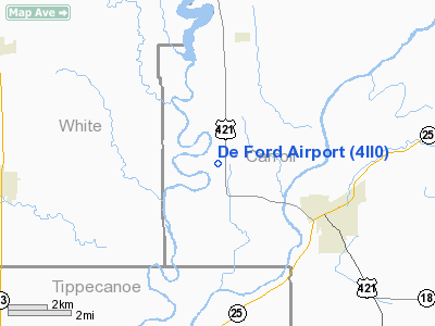
Location
& QuickFacts
|
FAA
Information Effective: |
2007-12-20 |
|
Airport
Identifier: |
4II0 |
|
Airport
Status: |
Operational |
|
Longitude/Latitude: |
086-44-18.0310W/40-36-34.1340N
-86.738342/40.609482 (Estimated) |
|
Elevation: |
640 ft / 195.07 m (Surveyed) |
|
Land: |
6 acres |
|
From nearest
city: |
4 nautical miles NW of Delphi, IN |
|
Location: |
Carroll County, IN |
|
Magnetic
Variation: |
02W (1985) |
Owner
& Manager
|
Ownership: |
Privately
owned |
|
Owner: |
Francis De Ford |
|
Address: |
Rr 1, Box 183a
Delphi, IN 46923 |
|
Phone
number: |
317-564-6917 |
|
Address: |
|
Airport Operations
and Facilities
|
Airport
Use: |
Private |
|
Wind indicator: |
Yes |
|
Segmented
Circle: |
No |
|
Control
Tower: |
No |
|
Landing
fee charge: |
No |
|
Sectional
chart: |
Chicago |
|
Region: |
AGL - Great Lakes |
|
Boundary
ARTCC: |
ZAU - Chicago |
|
Tie-in
FSS: |
HUF - Terre Haute |
|
FSS on
Airport: |
No |
|
FSS Toll
Free: |
1-800-WX-BRIEF |
|
Runway Information
Runway 18/36
|
Dimension: |
2300 x 100 ft
/ 701.0 x 30.5 m |
|
Surface: |
TURF, |
|
|
Runway 18 |
Runway 36 |
|
Traffic
Pattern: |
Left |
Left |
|
Obstruction: |
25 ft trees, 300.0 ft from runway |
50 ft trees, 600.0 ft from runway |
|
Radio Navigation
Aids
|
ID |
Type |
Name |
Ch |
Freq |
Var |
Dist |
|
MCX |
NDB |
White County |
|
377.00 |
03W |
6.2 nm |
|
GGP |
NDB |
Logansport |
|
263.00 |
01W |
17.7 nm |
|
FKR |
NDB |
Frankfort |
|
278.00 |
02W |
21.9 nm |
|
RZL |
NDB |
Rensselaer |
|
362.00 |
02W |
28.7 nm |
|
RWN |
NDB |
Winamac/dcmsnd |
|
335.00 |
00W |
29.7 nm |
|
RCR |
NDB |
Rochester |
|
216.00 |
03W |
37.0 nm |
|
CFJ |
NDB |
Crawfordsville |
|
388.00 |
02W |
38.6 nm |
|
CPB |
NDB |
Culver |
|
391.00 |
01W |
39.9 nm |
|
IWH |
NDB |
Wabash |
|
329.00 |
03W |
43.9 nm |
|
HZP |
NDB |
Zionsville |
|
248.00 |
03W |
46.1 nm |
|
OXI |
VOR/DME |
Knox |
103X |
115.60 |
00E |
43.0 nm |
|
MZZ |
VOR/DME |
Marion |
023X |
108.60 |
03W |
48.9 nm |
|
BVT |
VORTAC |
Boiler |
098X |
115.10 |
01E |
15.4 nm |
|
GUS |
VORTAC |
Grissom |
21Y |
108.45 |
02W |
26.8 nm |
|
OKK |
VORTAC |
Kokomo |
082X |
113.50 |
00E |
31.4 nm |
|
DNV |
VORTAC |
Danville |
047X |
111.00 |
02E |
42.0 nm |
Based Aircraft
|
Aircraft
based on field: |
12 |
|
Single Engine
Airplanes: |
8 |
|
Gliders: |
4 |
De Ford Airport
Address:
Carroll County, IN
Tel:
317-564-6917
Images
and information placed above are from
http://www.airport-data.com/airport/4II0/
We
thank them for the data!
| General
Info |
| Country |
United
States |
| State |
INDIANA
|
| FAA ID |
4II0 |
| Latitude |
40-36-34.134N
|
| Longitude |
086-44-18.031W
|
| Elevation |
640 feet
|
| Near City |
DELPHI
|
We don't guarantee the information is fresh and accurate. The data may
be wrong or outdated.
For more up-to-date information please refer to other sources.
|
|


