 |
|
Location
& QuickFacts
|
FAA
Information Effective: |
2007-12-20 |
|
Airport
Identifier: |
4IN8 |
|
Airport
Status: |
Operational |
|
Longitude/Latitude: |
087-04-06.0000W/40-52-03.0000N
-87.068333/40.867500 (Estimated) |
|
Elevation: |
673 ft / 205.13 m (Estimated) |
|
Land: |
0 acres |
|
From nearest
city: |
6 nautical miles SE of Rensselaer, IN |
|
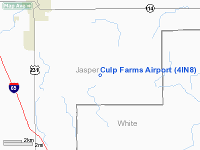
Location: |
Jasper County, IN |
|
Magnetic
Variation: |
02W (1995) |
Owner
& Manager
|
Ownership: |
Privately
owned |
|
Owner: |
Nevoy S. Culp |
|
Address: |
10098 S. County Rd 80 W
Rensselaer, IN 47978 |
|
Phone
number: |
219-866-3657 |
|
Manager: |
Nevoy S. Culp |
|
Address: |
10098 S. County Rd 80 W
Rensselaer, IN 47978 |
|
Phone
number: |
219-866-3657 |
Airport Operations
and Facilities
|
Airport
Use: |
Private |
|
Segmented
Circle: |
No |
|
Control
Tower: |
No |
|
Sectional
chart: |
Chicago |
|
Region: |
AGL - Great Lakes |
|
Boundary
ARTCC: |
ZAU - Chicago |
|
Tie-in
FSS: |
HUF - Terre Haute |
|
FSS Toll
Free: |
1-800-WX-BRIEF |
|
Runway Information
Runway 09/27
|
Dimension: |
3660 x 100 ft
/ 1115.6 x 30.5 m |
|
Surface: |
TURF, |
|
|
Runway 09 |
Runway 27 |
|
Traffic
Pattern: |
Left |
Left |
|
Displaced
threshold: |
0.00 ft |
1000.00 ft
RY 27 DSPLCD THLD MKD WITH TIRES. |
|
Obstruction: |
|
75 ft trees, 500.0 ft from runway |
|
Radio Navigation
Aids
|
ID |
Type |
Name |
Ch |
Freq |
Var |
Dist |
|
RZL |
NDB |
Rensselaer |
|
362.00 |
02W |
7.1 nm |
|
MCX |
NDB |
White County |
|
377.00 |
03W |
16.8 nm |
|
RWN |
NDB |
Winamac/dcmsnd |
|
335.00 |
00W |
25.1 nm |
|
GGP |
NDB |
Logansport |
|
263.00 |
01W |
33.0 nm |
|
VP |
NDB |
Sedly |
|
212.00 |
02W |
36.1 nm |
|
CPB |
NDB |
Culver |
|
391.00 |
01W |
37.4 nm |
|
IUL |
NDB |
La Porte |
|
356.00 |
03W |
40.3 nm |
|
RCR |
NDB |
Rochester |
|
216.00 |
03W |
41.6 nm |
|
FKR |
NDB |
Frankfort |
|
278.00 |
02W |
42.7 nm |
|
OXI |
VOR/DME |
Knox |
103X |
115.60 |
00E |
33.3 nm |
|
IKK |
VOR/DME |
Kankakee |
053X |
111.60 |
00E |
37.6 nm |
|
BVT |
VORTAC |
Boiler |
098X |
115.10 |
01E |
18.7 nm |
|
EON |
VORTAC |
Peotone |
079X |
113.20 |
02E |
40.7 nm |
|
DNV |
VORTAC |
Danville |
047X |
111.00 |
02E |
41.1 nm |
|
GUS |
VORTAC |
Grissom |
21Y |
108.45 |
02W |
43.8 nm |
|
CGT |
VORTAC |
Chicago Heights |
089X |
114.20 |
02E |
44.8 nm |
Remarks
- 303
FT TOWER 1.5 MILES E OF ARPT.
- PRVDD
CLEAR 20:1 APCHS, CLEAR OBSTACLE FREE ZONE & CLEAR RY SAFETY AREA.
Culp Farms Airport
Address:
Jasper County, IN
Tel:
219-866-3657
Images
and information placed above are from
http://www.airport-data.com/airport/4IN8/
We
thank them for the data!
| General
Info |
| Country |
United
States |
| State |
INDIANA
|
| FAA ID |
4IN8 |
| Latitude |
40-52-03.000N
|
| Longitude |
087-04-06.000W
|
| Elevation |
673 feet
|
| Near City |
RENSSELAER
|
We don't guarantee the information is fresh and accurate. The data may
be wrong or outdated.
For more up-to-date information please refer to other sources.
|
|


