 |
|
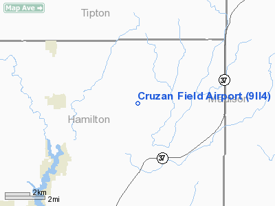
Location
& QuickFacts
|
FAA
Information Effective: |
2007-12-20 |
|
Airport
Identifier: |
9II4 |
|
Airport
Status: |
Operational |
|
Longitude/Latitude: |
085-56-41.0000W/40-10-21.0000N
-85.944722/40.172500 (Estimated) |
|
Elevation: |
845 ft / 257.56 m (Estimated) |
|
Land: |
0 acres |
|
From nearest
city: |
4 nautical miles E of Arcadia, IN |
|
Location: |
Hamilton County, IN |
|
Magnetic
Variation: |
03W (1990) |
Owner & Manager
|
Ownership: |
Privately
owned |
|
Owner: |
Robert E. Cruzan |
|
Address: |
26410 State Road 213
Arcadia, IN 46030 |
|
Phone
number: |
317-984-3830 |
|
Manager: |
Robert E. Cruzan Ii |
|
Address: |
13325 E. 266th
Arcadia, IN 46030 |
|
Phone
number: |
317-984-5802 |
Airport
Operations and Facilities
|
Airport
Use: |
Private |
|
Segmented
Circle: |
No |
|
Control
Tower: |
No |
|
Sectional
chart: |
St Louis |
|
Region: |
AGL - Great Lakes |
|
Boundary
ARTCC: |
ZAU - Chicago |
|
Tie-in
FSS: |
HUF - Terre Haute |
|
FSS Toll
Free: |
1-800-WX-BRIEF |
|
Runway Information
Runway 09/27
|
Dimension: |
2400 x 70 ft
/ 731.5 x 21.3 m |
|
Surface: |
TURF, |
|
|
Runway 09 |
Runway 27 |
|
Traffic
Pattern: |
Left |
Left |
|
Displaced
threshold: |
0.00 ft |
560.00 ft |
|
Obstruction: |
|
35 ft bldg, 140.0 ft from runway |
|
Radio Navigation
Aids
|
ID |
Type |
Name |
Ch |
Freq |
Var |
Dist |
|
UMP |
NDB |
Metropolitan |
|
338.00 |
03W |
14.9 nm |
|
HZP |
NDB |
Zionsville |
|
248.00 |
03W |
19.8 nm |
|
AI |
NDB |
Video |
|
371.00 |
03W |
20.9 nm |
|
FKR |
NDB |
Frankfort |
|
278.00 |
02W |
29.0 nm |
|
HFY |
NDB |
Greenwood |
|
398.00 |
02W |
33.1 nm |
|
UWL |
NDB |
New Castle |
|
385.00 |
02W |
33.8 nm |
|
IWH |
NDB |
Wabash |
|
329.00 |
03W |
36.2 nm |
|
GGP |
NDB |
Logansport |
|
263.00 |
01W |
37.7 nm |
|
CFJ |
NDB |
Crawfordsville |
|
388.00 |
02W |
46.1 nm |
|
HHG |
NDB |
Huntington |
|
417.00 |
03W |
46.6 nm |
|
PLD |
NDB |
Portland |
|
257.00 |
03W |
47.2 nm |
|
TVX |
NDB |
Greencastle |
|
521.00 |
03W |
48.3 nm |
|
MCX |
NDB |
White County |
|
377.00 |
03W |
49.4 nm |
|
MZZ |
VOR/DME |
Marion |
023X |
108.60 |
03W |
22.8 nm |
|
MIE |
VOR/DME |
Muncie |
091X |
114.40 |
03W |
25.6 nm |
|
OKK |
VORTAC |
Kokomo |
082X |
113.50 |
00E |
22.0 nm |
|
VHP |
VORTAC |
Brickyard |
110X |
116.30 |
01E |
29.0 nm |
|
GUS |
VORTAC |
Grissom |
21Y |
108.45 |
02W |
29.9 nm |
|
SHB |
VORTAC |
Shelbyville |
057X |
112.00 |
01E |
32.9 nm |
|
IND |
VOT |
Indianapolis Intl |
|
109.60 |
|
31.1 nm |
Remarks
- PRVDD
ALL APCH/DEP OPERS ACCORDING TO LOA 12/22/92 WITH WARD ARPT; OBSTNS
IN RY APCH SLOPE REMOVED/LOWERED OR THR DSPLCD & MKD SO AS TO PRVD
MIN 20:1 APCH CLNC OVER OBSTN.
Cruzan Field Airport
Address:
Hamilton County, IN
Tel:
317-984-3830,
317-984-5802
Images
and information placed above are from
http://www.airport-data.com/airport/9II4/
We
thank them for the data!
| General
Info |
| Country |
United
States |
| State |
INDIANA
|
| FAA ID |
9II4 |
| Latitude |
40-10-21.000N
|
| Longitude |
085-56-41.000W
|
| Elevation |
845 feet
|
| Near City |
ARCADIA
|
We don't guarantee the information is fresh and accurate. The data may
be wrong or outdated.
For more up-to-date information please refer to other sources.
|
|


