 |
|
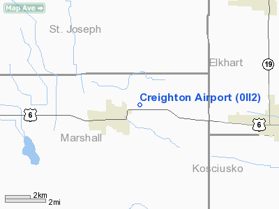
Location
& QuickFacts
|
FAA
Information Effective: |
2007-12-20 |
|
Airport
Identifier: |
0II2 |
|
Airport
Status: |
Operational |
|
Longitude/Latitude: |
086-07-28.0060W/41-27-26.1700N
-86.124446/41.457269 (Estimated) |
|
Elevation: |
820 ft / 249.94 m (Estimated) |
|
Land: |
0 acres |
|
From nearest
city: |
3 nautical miles NE of Bremen, IN |
|
Location: |
Marshall County, IN |
|
Magnetic
Variation: |
03W (1985) |
Owner & Manager
|
Ownership: |
Privately
owned |
|
Owner: |
Dewayne Creighton |
|
Address: |
1434 N. Douglas
Bremen, IN 46506 |
|
Phone
number: |
219-546-2405 |
|
Address: |
|
Airport
Operations and Facilities
|
Airport
Use: |
Private |
|
Wind indicator: |
Yes |
|
Segmented
Circle: |
No |
|
Control
Tower: |
No |
|
Sectional
chart: |
Chicago |
|
Region: |
AGL - Great Lakes |
|
Boundary
ARTCC: |
ZAU - Chicago |
|
Tie-in
FSS: |
HUF - Terre Haute |
|
FSS on
Airport: |
No |
|
FSS Toll
Free: |
1-800-WX-BRIEF |
|
Runway Information
Runway 09/27
|
Dimension: |
1300 x 75 ft
/ 396.2 x 22.9 m |
|
Surface: |
TURF, |
|
|
Runway 09 |
Runway 27 |
|
Traffic
Pattern: |
Left |
Left |
|
Radio Navigation
Aids
|
ID |
Type |
Name |
Ch |
Freq |
Var |
Dist |
|
CPB |
NDB |
Culver |
|
391.00 |
01W |
18.6 nm |
|
RCR |
NDB |
Rochester |
|
216.00 |
03W |
23.8 nm |
|
IUL |
NDB |
La Porte |
|
356.00 |
03W |
29.2 nm |
|
RWN |
NDB |
Winamac/dcmsnd |
|
335.00 |
00W |
30.8 nm |
|
VP |
NDB |
Sedly |
|
212.00 |
02W |
33.9 nm |
|
MGC |
NDB |
Michigan City |
|
203.00 |
01W |
34.6 nm |
|
IRS |
NDB |
Sturgis |
|
382.00 |
04W |
37.7 nm |
|
HAI |
NDB |
Three Rivers |
|
407.00 |
02W |
38.5 nm |
|
IWH |
NDB |
Wabash |
|
329.00 |
03W |
44.2 nm |
|
GGP |
NDB |
Logansport |
|
263.00 |
01W |
46.4 nm |
|
HHG |
NDB |
Huntington |
|
417.00 |
03W |
46.9 nm |
|
ANQ |
NDB |
Angola |
|
347.00 |
05W |
47.9 nm |
|
OLK |
VOR |
Wolf Lake |
|
110.40 |
03W |
31.0 nm |
|
OXI |
VOR/DME |
Knox |
103X |
115.60 |
00E |
25.0 nm |
|
ELX |
VOR/DME |
Keeler |
113X |
116.60 |
00E |
41.3 nm |
|
GSH |
VORTAC |
Goshen |
084X |
113.70 |
00E |
6.0 nm |
|
GIJ |
VORTAC |
Gipper |
101X |
115.40 |
00E |
20.6 nm |
|
GUS |
VORTAC |
Grissom |
21Y |
108.45 |
02W |
48.8 nm |
Remarks
- HOUSE
AND TREES WEST END OF RWY.
- LAND
RWY 27, DEP RWY 09
Based Aircraft
|
Aircraft
based on field: |
1 |
|
Single Engine
Airplanes: |
1 |
Creighton Airport
Address:
Marshall County, IN
Tel:
219-546-2405
Images
and information placed above are from
http://www.airport-data.com/airport/0II2/
We
thank them for the data!
| General
Info |
| Country |
United
States |
| State |
INDIANA
|
| FAA ID |
0II2 |
| Latitude |
41-27-26.170N
|
| Longitude |
086-07-28.006W
|
| Elevation |
820 feet
|
| Near City |
BREMEN
|
We don't guarantee the information is fresh and accurate. The data may
be wrong or outdated.
For more up-to-date information please refer to other sources.
|
|


