 |
|
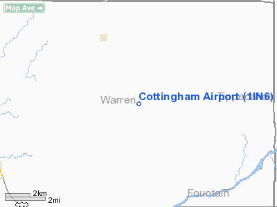
Location
& QuickFacts
|
FAA
Information Effective: |
2007-12-20 |
|
Airport
Identifier: |
1IN6 |
|
Airport
Status: |
Operational |
|
Longitude/Latitude: |
087-13-13.0000W/40-24-06.0000N
-87.220278/40.401667 (Estimated) |
|
Elevation: |
685 ft / 208.79 m (Estimated) |
|
Land: |
4 acres |
|
From nearest
city: |
4 nautical miles S of Pine Village, IN |
|
Location: |
Warren County, IN |
|
Magnetic
Variation: |
02W (1995) |
Owner & Manager
|
Ownership: |
Privately
owned |
|
Owner: |
Dwain R. Cottingham |
|
Address: |
5190 E 550 N
Attica, IN 47918 |
|
Phone
number: |
765-762-2585 |
|
Manager: |
Dwain R. Cottingham |
|
Address: |
5190 E 550 N
Attica, IN 47918 |
|
Phone
number: |
765-762-2585 |
Airport
Operations and Facilities
|
Airport
Use: |
Private |
|
Wind indicator: |
Yes |
|
Segmented
Circle: |
No |
|
Control
Tower: |
No |
|
Sectional
chart: |
Chicago |
|
Region: |
AGL - Great Lakes |
|
Boundary
ARTCC: |
ZAU - Chicago |
|
Tie-in
FSS: |
HUF - Terre Haute |
|
FSS Toll
Free: |
1-800-WX-BRIEF |
|
Runway Information
Runway 09/27
|
Dimension: |
1200 x 66 ft
/ 365.8 x 20.1 m |
|
Surface: |
TURF, |
|
|
Runway 09 |
Runway 27 |
|
Traffic
Pattern: |
Left |
Left |
|
Obstruction: |
|
32 ft bldg, 470.0 ft from runway |
|
Runway 18/36
|
Dimension: |
1300 x 66 ft
/ 396.2 x 20.1 m |
|
Surface: |
TURF, |
|
|
Runway 18 |
Runway 36 |
|
Traffic
Pattern: |
Left |
Left |
|
Obstruction: |
|
4 ft fence, 75.0 ft from runway |
|
Radio Navigation
Aids
|
ID |
Type |
Name |
Ch |
Freq |
Var |
Dist |
|
MCX |
NDB |
White County |
|
377.00 |
03W |
28.0 nm |
|
CFJ |
NDB |
Crawfordsville |
|
388.00 |
02W |
28.9 nm |
|
FKR |
NDB |
Frankfort |
|
278.00 |
02W |
31.1 nm |
|
RZL |
NDB |
Rensselaer |
|
362.00 |
02W |
32.8 nm |
|
HMJ |
NDB |
Homer |
|
281.00 |
01E |
40.5 nm |
|
GGP |
NDB |
Logansport |
|
263.00 |
01W |
42.9 nm |
|
TVX |
NDB |
Greencastle |
|
521.00 |
03W |
45.5 nm |
|
PRG |
NDB |
Paris |
|
341.00 |
01E |
47.2 nm |
|
RBS |
VOR/DME |
Roberts |
115X |
116.80 |
02E |
44.5 nm |
|
IKK |
VOR/DME |
Kankakee |
053X |
111.60 |
00E |
49.6 nm |
|
BVT |
VORTAC |
Boiler |
098X |
115.10 |
01E |
11.6 nm |
|
DNV |
VORTAC |
Danville |
047X |
111.00 |
02E |
16.7 nm |
Remarks
- 223
FT TOWER 2 MILES ESE OF RY & 503 FT TOWER 5 MILES ESE OF RY.
- PRVDD
CLEAR 20:1 APCH & CLEAR OBSTACLE CLEAR ZONE.
Based Aircraft
|
Aircraft
based on field: |
1 |
|
Single Engine
Airplanes: |
1 |
Cottingham Airport
Address:
Warren County, IN
Tel:
765-762-2585
Images
and information placed above are from
http://www.airport-data.com/airport/1IN6/
We
thank them for the data!
| General
Info |
| Country |
United
States |
| State |
INDIANA
|
| FAA ID |
1IN6 |
| Latitude |
40-24-06.000N
|
| Longitude |
087-13-13.000W
|
| Elevation |
685 feet
|
| Near City |
PINE VILLAGE
|
We don't guarantee the information is fresh and accurate. The data may
be wrong or outdated.
For more up-to-date information please refer to other sources.
|
|


