 |
|
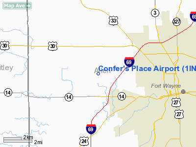
Location
& QuickFacts
|
FAA
Information Effective: |
2007-12-20 |
|
Airport
Identifier: |
1IN3 |
|
Airport
Status: |
Operational |
|
Longitude/Latitude: |
085-14-32.9030W/41-05-52.1720N
-85.242473/41.097826 (Estimated) |
|
Elevation: |
865 ft / 263.65 m (Estimated) |
|
Land: |
0 acres |
|
From nearest
city: |
2 nautical miles E of Arcola, IN |
|
Location: |
Allen County, IN |
|
Magnetic
Variation: |
03W (1985) |
Owner
& Manager
|
Ownership: |
Privately
owned |
|
Owner: |
Mark & Candela Confer |
|
Address: |
2602 O'day Rd
Ft
Wayne, IN 46818 |
|
Phone
number: |
260-625-5251 |
|
Manager: |
Mark Confer |
|
Address: |
2602 O'day Rd
Ft
Wayne, IN 46818 |
|
Phone
number: |
260-747-7521 |
Airport Operations
and Facilities
|
Airport
Use: |
Private |
|
Wind indicator: |
Yes |
|
Segmented
Circle: |
No |
|
Control
Tower: |
No |
|
Landing
fee charge: |
No |
|
Sectional
chart: |
Chicago |
|
Region: |
AGL - Great Lakes |
|
Boundary
ARTCC: |
ZAU - Chicago |
|
Tie-in
FSS: |
HUF - Terre Haute |
|
FSS on
Airport: |
No |
|
FSS Toll
Free: |
1-800-WX-BRIEF |
|
Runway Information
Runway 09/27
|
Dimension: |
2000 x 70 ft
/ 609.6 x 21.3 m |
|
Surface: |
TURF, |
|
|
Runway 09 |
Runway 27 |
|
Traffic
Pattern: |
Left |
Left |
|
Radio Navigation
Aids
|
ID |
Type |
Name |
Ch |
Freq |
Var |
Dist |
|
HHG |
NDB |
Huntington |
|
417.00 |
03W |
17.7 nm |
|
VFU |
NDB |
Stanley |
|
411.00 |
05W |
31.8 nm |
|
IWH |
NDB |
Wabash |
|
329.00 |
03W |
32.2 nm |
|
ANQ |
NDB |
Angola |
|
347.00 |
05W |
33.3 nm |
|
DFI |
NDB |
Defiance |
|
246.00 |
05W |
39.5 nm |
|
PLD |
NDB |
Portland |
|
257.00 |
03W |
40.5 nm |
|
BYN |
NDB |
Bryan |
|
260.00 |
04W |
41.9 nm |
|
RCR |
NDB |
Rochester |
|
216.00 |
03W |
43.0 nm |
|
IRS |
NDB |
Sturgis |
|
382.00 |
04W |
43.9 nm |
|
CQA |
NDB |
Lakefield |
|
205.00 |
04W |
48.2 nm |
|
OLK |
VOR |
Wolf Lake |
|
110.40 |
03W |
14.6 nm |
|
MZZ |
VOR/DME |
Marion |
023X |
108.60 |
03W |
41.4 nm |
|
FWA |
VORTAC |
Fort Wayne |
125X |
117.80 |
00E |
7.6 nm |
|
GSH |
VORTAC |
Goshen |
084X |
113.70 |
00E |
43.8 nm |
|
GUS |
VORTAC |
Grissom |
21Y |
108.45 |
02W |
49.5 nm |
|
FWA |
VOT |
Fort Wayne Baer |
|
111.00 |
|
7.6 nm |
Based Aircraft
|
Aircraft
based on field: |
3 |
|
Single Engine
Airplanes: |
3 |
Confer's Place Airport
Address:
Allen County, IN
Tel:
260-625-5251,
260-747-7521
Images
and information placed above are from
http://www.airport-data.com/airport/1IN3/
We
thank them for the data!
| General
Info |
| Country |
United
States |
| State |
INDIANA
|
| FAA ID |
1IN3 |
| Latitude |
41-05-52.172N
|
| Longitude |
085-14-32.903W
|
| Elevation |
865 feet
|
| Near City |
ARCOLA
|
We don't guarantee the information is fresh and accurate. The data may
be wrong or outdated.
For more up-to-date information please refer to other sources.
|
|


