 |
|
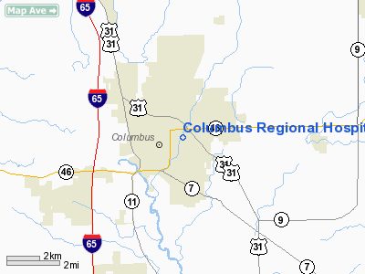
Columbus Regional Hospital Heliport |
Location
& QuickFacts
|
FAA
Information Effective: |
2007-12-20 |
|
Airport
Identifier: |
2IN7 |
|
Airport
Status: |
Operational |
|
Longitude/Latitude: |
085-53-41.9640W/39-13-06.1850N
-85.894990/39.218385 (Estimated) |
|
Elevation: |
632 ft / 192.63 m (Estimated) |
|
Land: |
0 acres |
|
From nearest
city: |
0 nautical miles N of Columbus, IN |
|
Location: |
Bartholomew County, IN |
|
Magnetic
Variation: |
02W (1985) |
Owner
& Manager
|
Ownership: |
Privately
owned |
|
Owner: |
Columbus Rgnl Hosp Trustees |
|
Address: |
2400 E 17th St
Columbus,
IN 47201 |
|
Phone
number: |
812-379-4441 |
|
Manager: |
H Steven Thomas |
|
Address: |
2400 E 17th St
Columbus,
IN 47201 |
|
Phone
number: |
812-376-5801 |
Airport Operations
and Facilities
|
Airport
Use: |
Private
MEDICAL USE. |
|
Wind indicator: |
Yes |
|
Segmented
Circle: |
Yes |
|
Control
Tower: |
No |
|
Landing
fee charge: |
No |
|
Sectional
chart: |
St Louis |
|
Region: |
AGL - Great Lakes |
|
Boundary
ARTCC: |
ZID - Indianapolis |
|
Tie-in
FSS: |
HUF - Terre Haute |
|
FSS on
Airport: |
No |
|
FSS Toll
Free: |
1-800-WX-BRIEF |
|
Runway Information
Helipad H1
|
Dimension: |
40 x 40 ft /
12.2 x 12.2 m |
|
Surface: |
ASPH-CONC, |
|
|
Runway H1 |
Runway |
|
Traffic
Pattern: |
Left |
Left |
|
Radio Navigation
Aids
|
ID |
Type |
Name |
Ch |
Freq |
Var |
Dist |
|
BA |
NDB |
Clifs |
|
410.00 |
03W |
7.2 nm |
|
OVO |
NDB |
North Vernon |
|
374.00 |
02W |
17.0 nm |
|
EQZ |
NDB |
Captain |
|
308.00 |
02W |
21.4 nm |
|
HFY |
NDB |
Greenwood |
|
398.00 |
02W |
26.5 nm |
|
HLB |
NDB |
Batesville |
|
254.00 |
02W |
30.7 nm |
|
BFR |
NDB |
Bedford |
|
344.00 |
02W |
34.0 nm |
|
IMS |
NDB |
Madison |
|
404.00 |
03W |
34.2 nm |
|
BM |
NDB |
Claye |
|
382.00 |
02W |
34.2 nm |
|
UMP |
NDB |
Metropolitan |
|
338.00 |
03W |
43.8 nm |
|
HZP |
NDB |
Zionsville |
|
248.00 |
03W |
46.4 nm |
|
UWL |
NDB |
New Castle |
|
385.00 |
02W |
47.9 nm |
|
SHB |
VORTAC |
Shelbyville |
057X |
112.00 |
01E |
25.1 nm |
|
OOM |
VORTAC |
Hoosier |
039X |
110.20 |
02W |
33.8 nm |
|
ABB |
VORTAC |
Nabb |
071X |
112.40 |
01E |
39.7 nm |
|
VHP |
VORTAC |
Brickyard |
110X |
116.30 |
01E |
42.0 nm |
|
IND |
VOT |
Indianapolis Intl |
|
109.60 |
|
35.4 nm |
Remarks
- PROVIDED
INGRESS/EGRESS IS ESTAB FROM 200-360 DEG (CLOCKWISE) WITH HELIPAD AS
CENTER OF COMPASS ROSE.
INITIAL APCH ALONG HAW CREEK.
Columbus Regional Hospital Heliport
Address:
Bartholomew County, IN
Tel:
812-379-4441,
812-376-5801
Images
and information placed above are from
http://www.airport-data.com/airport/2IN7/
We
thank them for the data!
| General
Info |
| Country |
United
States |
| State |
INDIANA
|
| FAA ID |
2IN7 |
| Latitude |
39-13-06.185N
|
| Longitude |
085-53-41.964W
|
| Elevation |
632 feet
|
| Near City |
COLUMBUS
|
We don't guarantee the information is fresh and accurate. The data may
be wrong or outdated.
For more up-to-date information please refer to other sources.
|
|


