|
|
Columbus Municipal Airport |
- For the military use of this facility, see Bakalar Air Force Base
Columbus Municipal Airport (IATA: CLU, ICAO: KBAK, FAA LID: BAK) is a city-owned public-use airport located three nautical miles (6 km) north of the central business district of Columbus, a city in Bartholomew County, Indiana, United States.
Although most U.S. airports use the same three-letter location identifier for the FAA and IATA, this airport is assigned BAK by the FAA and CLU by the IATA. The airport's ICAO identifier is KBAK.
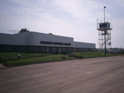 | |
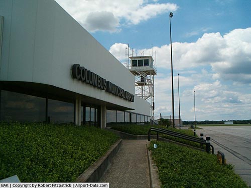
Airport terminal and control tower |
History
Columbus Municipal Airport is on the site of the former World War II Atterbury Army Airfield and United States Air Force Bakalar Air Force Base.
Facilities and aircraft
Columbus Municipal Airport covers an area of 2,000 acres (809 ha) at an elevation of 656 feet (200 m) above mean sea level. It has two asphalt paved runways: 5/23 is 6,400 by 150 feet (1,951 x 46 m) and 14/32 is 5,000 by 100 feet (1,524 x 30 m).
For the 12-month period ending December 31, 2005, the airport had 39,155 aircraft operations, an average of 107 per day: 91% general aviation and 9% military. At that time there were 68 aircraft based at this airport: 72% single-engine, 16% multi-engine, 7% jet and 4% helicopter.
The above content comes from Wikipedia and is published under free licenses – click here to read more.
|
 |
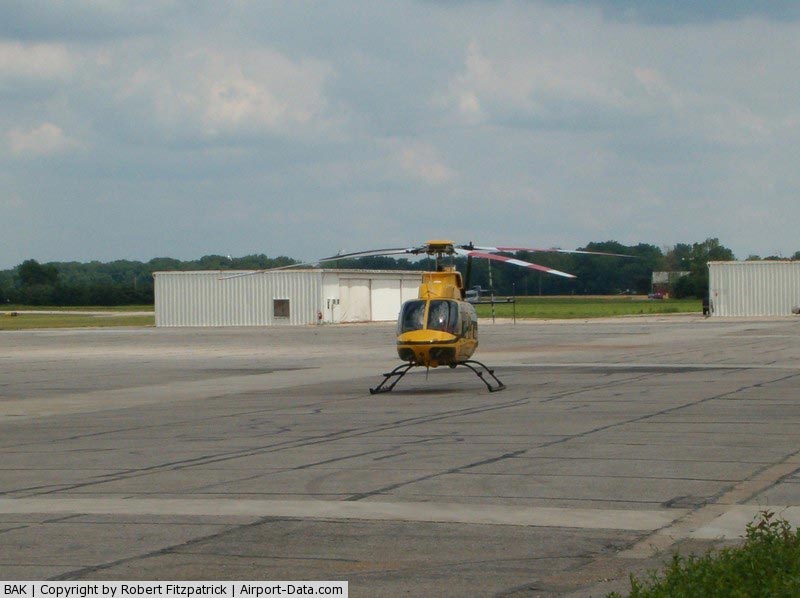
(Click on the photo to enlarge) |
|
 |
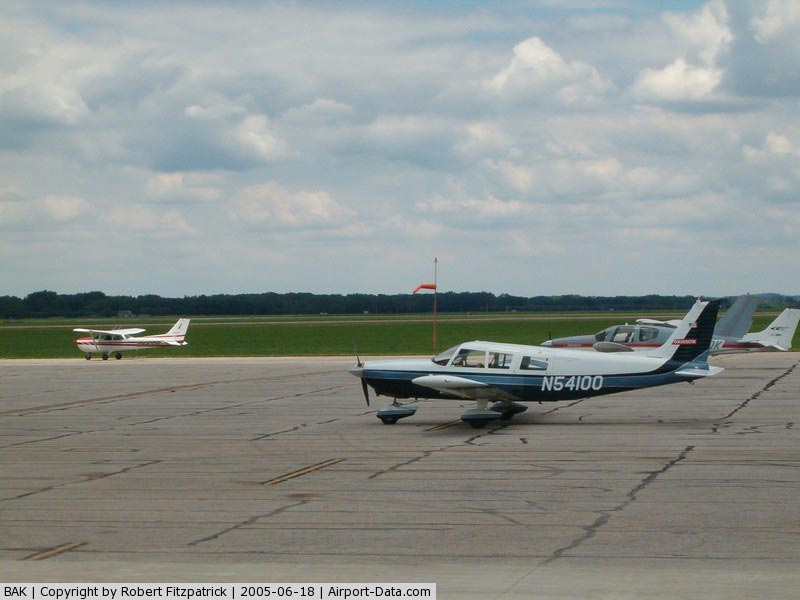
(Click on the photo to enlarge) |
|
 |
(Click on the photo to enlarge) |
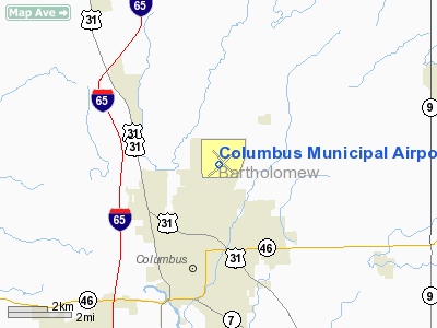
Location
& QuickFacts
|
FAA
Information Effective: |
2007-12-20 |
|
Airport
Identifier: |
BAK |
|
Airport
Status: |
Operational |
|
Longitude/Latitude: |
085-53-46.8000W/39-15-42.9000N
-85.896333/39.261917 (Estimated) |
|
Elevation: |
656 ft / 199.95 m (Surveyed) |
|
Land: |
2000 acres |
|
From nearest
city: |
3 nautical miles N of Columbus, IN |
|
Location: |
Bartholomew County, IN |
|
Magnetic
Variation: |
03W (1995) |
Owner
& Manager
|
Ownership: |
Publicly
owned |
|
Owner: |
City Of Columbus |
|
Address: |
4770 Ray Boll Blvd
Columbus,
IN 47203 |
|
Phone
number: |
812-376-2519 |
|
Manager: |
Rod Blasdel |
|
Address: |
4770 Ray Boll Blvd
Columbus,
IN 47203 |
|
Phone
number: |
812-376-2519 |
Airport Operations
and Facilities
|
Airport
Use: |
Open
to public |
|
Wind indicator: |
Yes |
|
Segmented
Circle: |
No |
|
Control
Tower: |
Yes |
|
Lighting
Schedule: |
DUSK-DAWN
WHEN ATCT IS CLSD HIRL RY 05/23 & MIRL RY 14/32 &
MALSR RY 23 ARE PRESET ON LOW INTST; TO INCREASE INTST &
ACTVT REIL RY 05 & PAPI RYS 5, 14 & 32 - CTAF. |
|
Beacon
Color: |
Clear-Green (lighted land airport) |
|
Landing
fee charge: |
No |
|
Sectional
chart: |
St Louis |
|
Region: |
AGL - Great Lakes |
|
Boundary
ARTCC: |
ZID - Indianapolis |
|
Tie-in
FSS: |
HUF - Terre Haute |
|
FSS on
Airport: |
No |
|
FSS Toll
Free: |
1-800-WX-BRIEF |
|
NOTAMs
Facility: |
BAK (NOTAM-d service avaliable) |
|
Certification
type/date: |
IV A U 03/197
CLSD TO SCHEDULED ACR OPNS WITH GREATER THAN 9 PSGR SEATS
& UNSCHEDULED ACR OPS GREATER THAN 30 PSGR SEATS. 90-DAY
PPR;CALL AMGR 812-376-2519 OR 379-9942. |
|
Federal
Agreements: |
NGPY |
Airport Communications
|
CTAF: |
118.600 |
|
Unicom: |
122.950
|
Airport
Services
|
Fuel
available: |
100LLA |
|
Airframe
Repair: |
MAJOR |
|
Power
Plant Repair: |
MAJOR |
|
Bulk Oxygen: |
HIGH |
|
Runway Information
Runway 05/23
|
Dimension: |
6400 x 150 ft
/ 1950.7 x 45.7 m |
|
Surface: |
ASPH, Good Condition |
|
Weight Limit: |
Single wheel: 75000 lbs.
Dual wheel: 100000 lbs.
Dual tandem wheel: 160000 lbs. |
|
Edge Lights: |
High |
|
|
Runway 05 |
Runway 23 |
|
Longitude: |
085-54-17.5785W |
085-53-19.9993W |
|
Latitude: |
39-15-18.8632N |
39-16-03.5611N |
|
Elevation: |
650.00 ft |
656.00 ft |
|
Alignment: |
45 |
127 |
|
ILS Type: |
|
ILS |
|
Traffic
Pattern: |
Left |
Left |
|
Markings: |
Precision instrument, Fair Condition |
Precision instrument, Fair Condition |
|
Crossing
Height: |
54.00 ft |
0.00 ft |
|
VASI: |
4-light PAPI on left side |
4-light PAPI on left side |
|
Visual Glide
Angle: |
3.00° |
0.00° |
|
Approach
lights: |
|
MALSR |
|
Runway End
Identifier: |
Yes
REIL OTS INDEFLY. |
No |
|
Centerline
Lights: |
No |
No |
|
Touchdown
Lights: |
No |
No |
|
Obstruction: |
74 ft tree, 3040.0 ft from runway, 94 ft right
of centerline, 38:1 slope to clear |
, 50:1 slope to clear |
|
Runway 14/32
|
Dimension: |
5000 x 100 ft
/ 1524.0 x 30.5 m |
|
Surface: |
ASPH, Fair Condition |
|
Weight Limit: |
Single wheel: 75000 lbs.
Dual wheel: 100000 lbs.
Dual tandem wheel: 160000 lbs. |
|
Edge Lights: |
Medium |
|
|
Runway 14 |
Runway 32 |
|
Longitude: |
085-54-06.7567W |
085-53-21.8435W |
|
Latitude: |
39-16-02.5348N |
39-15-27.5572N |
|
Elevation: |
654.00 ft |
651.00 ft |
|
Alignment: |
127 |
127 |
|
Traffic
Pattern: |
Left |
Left |
|
Markings: |
Non-precision instrument, Good Condition |
Non-precision instrument, Good Condition |
|
Crossing
Height: |
45.00 ft |
45.00 ft |
|
VASI: |
4-light PAPI on left side |
4-light PAPI on left side |
|
Visual Glide
Angle: |
3.00° |
3.00° |
|
Runway End
Identifier: |
Yes |
Yes |
|
Centerline
Lights: |
No |
No |
|
Touchdown
Lights: |
No |
No |
|
Obstruction: |
, 50:1 slope to clear |
38 ft tree, 1591.0 ft from runway, 306 ft left
of centerline, 36:1 slope to clear |
|
Radio Navigation
Aids
|
ID |
Type |
Name |
Ch |
Freq |
Var |
Dist |
|
BA |
NDB |
Clifs |
|
410.00 |
03W |
5.1 nm |
|
OVO |
NDB |
North Vernon |
|
374.00 |
02W |
18.8 nm |
|
EQZ |
NDB |
Captain |
|
308.00 |
02W |
24.0 nm |
|
HFY |
NDB |
Greenwood |
|
398.00 |
02W |
24.0 nm |
|
HLB |
NDB |
Batesville |
|
254.00 |
02W |
30.2 nm |
|
BM |
NDB |
Claye |
|
382.00 |
02W |
35.0 nm |
|
BFR |
NDB |
Bedford |
|
344.00 |
02W |
35.8 nm |
|
IMS |
NDB |
Madison |
|
404.00 |
03W |
36.3 nm |
|
UMP |
NDB |
Metropolitan |
|
338.00 |
03W |
41.2 nm |
|
HZP |
NDB |
Zionsville |
|
248.00 |
03W |
43.9 nm |
|
UWL |
NDB |
New Castle |
|
385.00 |
02W |
45.8 nm |
|
SHB |
VORTAC |
Shelbyville |
057X |
112.00 |
01E |
22.5 nm |
|
OOM |
VORTAC |
Hoosier |
039X |
110.20 |
02W |
34.1 nm |
|
VHP |
VORTAC |
Brickyard |
110X |
116.30 |
01E |
39.8 nm |
|
ABB |
VORTAC |
Nabb |
071X |
112.40 |
01E |
42.3 nm |
|
IND |
VOT |
Indianapolis Intl |
|
109.60 |
|
33.1 nm |
Based Aircraft
|
Aircraft
based on field: |
74 |
|
Single Engine
Airplanes: |
43 |
|
Multi Engine Airplanes: |
24 |
|
Jet Engine Airplanes: |
7 |
Operational Statistics
Time
Period: 2005-01-01 - 2005-12-31
|
Aircraft
Operations: |
108/Day |
|
General Aviation
Local: |
29.1% |
|
General Aviation
Itinerant: |
62.0% |
|
Military: |
8.9% |
Columbus Municipal Airport
Address:
Bartholomew County, IN
Tel:
812-376-2519
Images
and information placed above are from
http://www.airport-data.com/airport/BAK/
We
thank them for the data!
| General
Info |
| Country |
United
States |
| State |
INDIANA
|
| FAA ID |
BAK |
| Latitude |
39-15-42.900N
|
| Longitude |
085-53-46.800W
|
| Elevation |
656 feet
|
| Near City |
COLUMBUS
|
We don't guarantee the information is fresh and accurate. The data may
be wrong or outdated.
For more up-to-date information please refer to other sources.
|
|