 |
|
| Clinton Airport |
| IATA: none – ICAO: none – FAA LID: 1I7 |
| Summary |
| Airport type |
Public use |
| Owner |
White Construction Inc. |
| Serves |
Clinton, Indiana |
| Elevation AMSL |
526 ft / 160 m |
| Coordinates |
39°42′45″N 087°24′05″W / 39.7125°N 87.40139°W / 39.7125; -87.40139 |
| Runways |
| Direction |
Length |
Surface |
| ft |
m |
| 18/36 |
3,750 |
1,143 |
Asphalt |
| Statistics (2004) |
| Aircraft operations |
6,026 |
| Based aircraft |
11 |
| Source: Federal Aviation Administration |
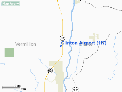
Clinton Airport (FAA LID: 1I7) is a privately-owned, public-use airport located three miles (5 km) north of the central business district of Clinton, a city in Vermillion County, Indiana, United States.
Facilities and aircraft
Clinton Airport covers an area of 120 acres (49 ha) and has one runway, 18/36, with a 3,750 x 40 ft (1,143 x 12 m) asphalt surface. For the 12-month period ending December 31, 2004, the airport had 6,026 general aviation aircraft operations, an average of 16 per day. At that time there were 11 single-engine aircraft based at this airport.
The above content comes from Wikipedia and is published under free licenses – click here to read more.
Location
& QuickFacts
|
FAA
Information Effective: |
2007-12-20 |
|
Airport
Identifier: |
1I7 |
|
Airport
Status: |
Operational |
|
Longitude/Latitude: |
087-24-05.0640W/39-42-45.1350N
-87.401407/39.712538 (Estimated) |
|
Elevation: |
526 ft / 160.32 m (Surveyed) |
|
Land: |
120 acres |
|
From nearest
city: |
3 nautical miles N of Clinton, IN |
|
Location: |
Vermillion County, IN |
|
Magnetic
Variation: |
01W (1985) |
Owner & Manager
|
Ownership: |
Privately
owned |
|
Owner: |
White Construction Inc |
|
Address: |
Box 249
Clinton,
IN 47842 |
|
Phone
number: |
765-832-8526 |
|
Manager: |
John P. Roehm |
|
Address: |
Box 249
Clinton,
IN 47842 |
|
Phone
number: |
765-832-8526 |
Airport
Operations and Facilities
|
Airport
Use: |
Open
to public |
|
Wind indicator: |
Yes |
|
Segmented
Circle: |
No |
|
Control
Tower: |
No |
|
Landing
fee charge: |
No |
|
Sectional
chart: |
St Louis |
|
Region: |
AGL - Great Lakes |
|
Boundary
ARTCC: |
ZID - Indianapolis |
|
Tie-in
FSS: |
HUF - Terre Haute |
|
FSS on
Airport: |
No |
|
FSS Toll
Free: |
1-800-WX-BRIEF
OR LOCAL CALL 877-2571. |
|
NOTAMs
Facility: |
HUF (NOTAM-d
service avaliable) |
Airport Communications
|
CTAF: |
122.800 |
|
Unicom: |
122.800
|
Airport Services
|
Airframe
Repair: |
NONE |
|
Power
Plant Repair: |
NONE |
|
Bottled
Oxygen: |
NONE |
|
Bulk Oxygen: |
NONE |
|
Runway Information
Runway 18/36
|
Dimension: |
3750 x 40 ft
/ 1143.0 x 12.2 m |
|
Surface: |
ASPH, Fair Condition |
|
|
Runway 18 |
Runway 36 |
|
Longitude: |
087-24-01.0600W |
087-24-01.0600W |
|
Latitude: |
39-43-02.1300N |
39-42-24.2900N |
|
Elevation: |
520.00 ft |
520.00 ft |
|
Traffic
Pattern: |
Left |
Left |
|
Markings: |
Basic, Fair Condition |
Basic, Fair Condition |
|
Displaced
threshold: |
145.00 ft |
0.00 ft |
|
Obstruction: |
10 ft crops, 201.0 ft from runway
APCH RATIO 34:1 TO DSPLCD THR.
10 FT CROPS 100 FT FM RY END ON CNTRLN. |
10 ft crops, 250.0 ft from runway, 5:1 slope
to clear |
|
Radio Navigation
Aids
|
ID |
Type |
Name |
Ch |
Freq |
Var |
Dist |
|
PRG |
NDB |
Paris |
|
341.00 |
01E |
12.6 nm |
|
HU |
NDB |
Yinno |
|
245.00 |
02W |
19.5 nm |
|
TVX |
NDB |
Greencastle |
|
521.00 |
03W |
27.5 nm |
|
CFJ |
NDB |
Crawfordsville |
|
388.00 |
02W |
27.6 nm |
|
HMJ |
NDB |
Homer |
|
281.00 |
01E |
31.7 nm |
|
SIV |
NDB |
Sullivan |
|
326.00 |
02W |
36.1 nm |
|
CZB |
NDB |
Casey |
|
359.00 |
00E |
37.1 nm |
|
MT |
NDB |
Zebre |
|
347.00 |
00E |
39.3 nm |
|
PLX |
NDB |
Palestine |
|
391.00 |
00W |
43.5 nm |
|
RSV |
VOR/DME |
Robinson |
021X |
108.40 |
02E |
43.3 nm |
|
MTO |
VOR/DME |
Mattoon |
031X |
109.40 |
03E |
43.3 nm |
|
TTH |
VORTAC |
Terre Haute |
100X |
115.30 |
02E |
15.2 nm |
|
DNV |
VORTAC |
Danville |
047X |
111.00 |
02E |
35.7 nm |
|
CMI |
VORTAC |
Champaign |
037X |
110.00 |
03E |
44.7 nm |
|
VHP |
VORTAC |
Brickyard |
110X |
116.30 |
01E |
48.2 nm |
Remarks
- SEASONAL
CROPS 108 FT W & 118 FT E PENETRATE PRIMARY SFC AREA.
- RWY
18/36 - LOW GRASS GROWING THROUGH CRACKS.
Based Aircraft
|
Aircraft
based on field: |
7 |
|
Single Engine
Airplanes: |
7 |
Operational Statistics
Time
Period: 2004-01-02 - 2004-12-31
|
Aircraft
Operations: |
116/Week |
|
General Aviation
Local: |
67.8% |
|
General Aviation
Itinerant: |
32.2% |
Clinton Airport
Address:
Vermillion County, IN
Tel:
765-832-8526
Images
and information placed above are from
http://www.airport-data.com/airport/1I7/
We
thank them for the data!
| General
Info |
| Country |
United
States |
| State |
INDIANA
|
| FAA ID |
1I7 |
| Latitude |
39-42-45.135N
|
| Longitude |
087-24-05.064W
|
| Elevation |
526 feet
|
| Near City |
CLINTON
|
We don't guarantee the information is fresh and accurate. The data may
be wrong or outdated.
For more up-to-date information please refer to other sources.
|
|


