 |
|
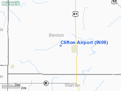
Location
& QuickFacts
|
FAA
Information Effective: |
2007-12-20 |
|
Airport
Identifier: |
IN09 |
|
Airport
Status: |
Operational |
|
Longitude/Latitude: |
087-24-43.0000W/40-31-27.0000N
-87.411944/40.524167 (Estimated) |
|
Elevation: |
760 ft / 231.65 m (Estimated) |
|
Land: |
6 acres |
|
From nearest
city: |
2 nautical miles W of Boswell, IN |
|
Location: |
Benton County, IN |
|
Magnetic
Variation: |
02W (1995) |
Owner
& Manager
|
Ownership: |
Privately
owned |
|
Owner: |
Gary Clifton |
|
Address: |
4719 West St Rd 352
Fowler, IN 47944 |
|
Phone
number: |
765-869-5385 |
|
Manager: |
Gary Clifton |
|
Address: |
4719 West St Rd 352
Fowler, IN 47944 |
|
Phone
number: |
765-869-5385 |
Airport Operations
and Facilities
|
Airport
Use: |
Private |
|
Segmented
Circle: |
No |
|
Control
Tower: |
No |
|
Sectional
chart: |
Chicago |
|
Region: |
AGL - Great Lakes |
|
Boundary
ARTCC: |
ZAU - Chicago |
|
Tie-in
FSS: |
HUF - Terre Haute |
|
FSS on
Airport: |
No |
|
FSS Toll
Free: |
1-800-WX-BRIEF |
|
Runway Information
Runway 18/36
|
Dimension: |
2400 x 120 ft
/ 731.5 x 36.6 m |
|
Surface: |
TURF, |
|
|
Runway 18 |
Runway 36 |
|
Traffic
Pattern: |
Left |
Left |
|
Displaced
threshold: |
0.00 ft |
360.00 ft |
|
Obstruction: |
|
30 ft pline, 180.0 ft from runway |
|
Radio Navigation
Aids
|
ID |
Type |
Name |
Ch |
Freq |
Var |
Dist |
|
RZL |
NDB |
Rensselaer |
|
362.00 |
02W |
27.5 nm |
|
MCX |
NDB |
White County |
|
377.00 |
03W |
31.7 nm |
|
HMJ |
NDB |
Homer |
|
281.00 |
01E |
38.9 nm |
|
CFJ |
NDB |
Crawfordsville |
|
388.00 |
02W |
39.8 nm |
|
FKR |
NDB |
Frankfort |
|
278.00 |
02W |
41.8 nm |
|
GGP |
NDB |
Logansport |
|
263.00 |
01W |
48.7 nm |
|
RBS |
VOR/DME |
Roberts |
115X |
116.80 |
02E |
34.5 nm |
|
IKK |
VOR/DME |
Kankakee |
053X |
111.60 |
00E |
38.6 nm |
|
DNV |
VORTAC |
Danville |
047X |
111.00 |
02E |
15.4 nm |
|
BVT |
VORTAC |
Boiler |
098X |
115.10 |
01E |
15.8 nm |
|
EON |
VORTAC |
Peotone |
079X |
113.20 |
02E |
48.0 nm |
|
CMI |
VORTAC |
Champaign |
037X |
110.00 |
03E |
49.4 nm |
Remarks
- 125
FT EITHER SIDE OF RY CNTRLN CLEAR OF OBSTNS.
Based Aircraft
|
Aircraft
based on field: |
1 |
|
Single Engine
Airplanes: |
1 |
Clifton Airport
Address:
Benton County, IN
Tel:
765-869-5385
Images
and information placed above are from
http://www.airport-data.com/airport/IN09/
We
thank them for the data!
| General
Info |
| Country |
United
States |
| State |
INDIANA
|
| FAA ID |
IN09 |
| Latitude |
40-31-27.000N
|
| Longitude |
087-24-43.000W
|
| Elevation |
760 feet
|
| Near City |
BOSWELL
|
We don't guarantee the information is fresh and accurate. The data may
be wrong or outdated.
For more up-to-date information please refer to other sources.
|
|


