 |
|
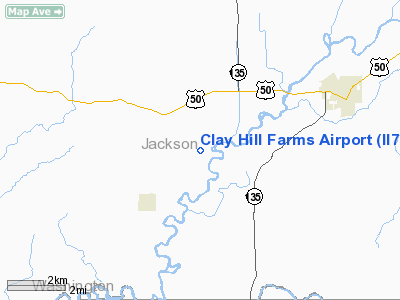
Location
& QuickFacts
|
FAA
Information Effective: |
2007-12-20 |
|
Airport
Identifier: |
II76 |
|
Airport
Status: |
Operational |
|
Longitude/Latitude: |
086-08-12.4360W/38-51-02.6920N
-86.136788/38.850748 (Estimated) |
|
Elevation: |
528 ft / 160.93 m (Estimated) |
|
Land: |
0 acres |
|
From nearest
city: |
3 nautical miles NE of Medora, IN |
|
Location: |
Jackson County, IN |
|
Magnetic
Variation: |
02W (1985) |
Owner
& Manager
|
Ownership: |
Privately
owned |
|
Owner: |
George W. Hall |
|
Address: |
5511 W Co Rd 150s-po Box 307
Medora, IN 47260 |
|
Phone
number: |
812-966-2908 |
|
Address: |
|
Airport Operations
and Facilities
|
Airport
Use: |
Private |
|
Wind indicator: |
Yes |
|
Segmented
Circle: |
No |
|
Control
Tower: |
No |
|
Sectional
chart: |
St Louis |
|
Region: |
AGL - Great Lakes |
|
Boundary
ARTCC: |
ZID - Indianapolis |
|
Tie-in
FSS: |
HUF - Terre Haute |
|
FSS Toll
Free: |
1-800-WX-BRIEF |
|
Runway Information
Runway 18/36
|
Dimension: |
2300 x 60 ft
/ 701.0 x 18.3 m |
|
Surface: |
TURF, |
|
|
Runway 18 |
Runway 36 |
|
Traffic
Pattern: |
Left |
Left |
|
Displaced
threshold: |
0.00 ft |
500.00 ft |
|
Obstruction: |
40 ft pline, 1500.0 ft from runway |
60 ft trees, 500.0 ft from runway |
|
Radio Navigation
Aids
|
ID |
Type |
Name |
Ch |
Freq |
Var |
Dist |
|
EQZ |
NDB |
Captain |
|
308.00 |
02W |
7.7 nm |
|
BFR |
NDB |
Bedford |
|
344.00 |
02W |
14.1 nm |
|
BM |
NDB |
Claye |
|
382.00 |
02W |
24.9 nm |
|
RRJ |
NDB |
Oranj |
|
368.00 |
02W |
26.7 nm |
|
OVO |
NDB |
North Vernon |
|
374.00 |
02W |
27.8 nm |
|
BA |
NDB |
Clifs |
|
410.00 |
03W |
32.0 nm |
|
IMS |
NDB |
Madison |
|
404.00 |
03W |
32.1 nm |
|
HFY |
NDB |
Greenwood |
|
398.00 |
02W |
47.0 nm |
|
DCY |
NDB |
Washington |
|
212.00 |
03W |
47.6 nm |
|
FNZ |
NDB |
Ferdinand |
|
239.00 |
00E |
48.9 nm |
|
BQM |
VOR/DME |
Bowman |
059X |
112.20 |
01W |
43.4 nm |
|
ABB |
VORTAC |
Nabb |
071X |
112.40 |
01E |
28.3 nm |
|
OOM |
VORTAC |
Hoosier |
039X |
110.20 |
02W |
28.4 nm |
|
SHB |
VORTAC |
Shelbyville |
057X |
112.00 |
01E |
49.2 nm |
|
SDF |
VOT |
Louisville Standifd |
|
111.00 |
|
44.6 nm |
Remarks
- RY
18/36 EDGES MKD WITH WHITE TIRES.
- OBSTS
BE REMOVED/LOWERED OR THR DSPLCD TO PROVIDE A CLEAR 20:1 APCH.
Based Aircraft
|
Aircraft
based on field: |
2 |
|
Single Engine
Airplanes: |
2 |
Clay Hill Farms Airport
Address:
Jackson County, IN
Tel:
812-966-2908
Images
and information placed above are from
http://www.airport-data.com/airport/II76/
We
thank them for the data!
| General
Info |
| Country |
United
States |
| State |
INDIANA
|
| FAA ID |
II76 |
| Latitude |
38-51-02.692N
|
| Longitude |
086-08-12.436W
|
| Elevation |
528 feet
|
| Near City |
MEDORA
|
We don't guarantee the information is fresh and accurate. The data may
be wrong or outdated.
For more up-to-date information please refer to other sources.
|
|


