 |
|
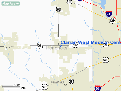
Clarian West Medical Center Heliport |
Location
& QuickFacts
|
FAA
Information Effective: |
2007-12-20 |
|
Airport
Identifier: |
5IN1 |
|
Airport
Status: |
Operational |
|
Longitude/Latitude: |
086-23-44.0000W/39-45-44.0000N
-86.395556/39.762222 (Estimated) |
|
Elevation: |
832 ft / 253.59 m (Estimated) |
|
Land: |
0 acres |
|
From nearest
city: |
0 nautical miles N of Avon, IN |
|
Location: |
Hendricks County, IN |
|
Magnetic
Variation: |
() |
Owner
& Manager
|
Ownership: |
Privately
owned |
|
Owner: |
Clarian West Medical Center |
|
Address: |
1111 N Ronald Reagan Pkwy
Avon,
IN 46123 |
|
Phone
number: |
317-217-3000 |
|
Manager: |
Paul Ivkovich |
|
Address: |
1111 N Ronald Reagan Pkwy
Avon,
IN 46123 |
|
Phone
number: |
317-217-3000 |
Airport Operations
and Facilities
|
Airport
Use: |
Private |
|
Wind indicator: |
Yes |
|
Control
Tower: |
No |
|
Sectional
chart: |
St Louis |
|
Region: |
AGL - Great Lakes |
|
Boundary
ARTCC: |
ZID - Indianapolis |
|
Tie-in
FSS: |
HUF - Terre Haute |
|
FSS Toll
Free: |
1-800-WX-BRIEF |
|
Runway Information
Helipad H1
|
Dimension: |
40 x 40 ft /
12.2 x 12.2 m |
|
Surface: |
ALUMINUM, |
|
|
Runway H1 |
Runway |
|
Traffic
Pattern: |
Left |
Left |
|
Radio Navigation
Aids
|
ID |
Type |
Name |
Ch |
Freq |
Var |
Dist |
|
HZP |
NDB |
Zionsville |
|
248.00 |
03W |
12.6 nm |
|
HFY |
NDB |
Greenwood |
|
398.00 |
02W |
16.1 nm |
|
UMP |
NDB |
Metropolitan |
|
338.00 |
03W |
19.1 nm |
|
TVX |
NDB |
Greencastle |
|
521.00 |
03W |
19.2 nm |
|
CFJ |
NDB |
Crawfordsville |
|
388.00 |
02W |
27.4 nm |
|
FKR |
NDB |
Frankfort |
|
278.00 |
02W |
31.5 nm |
|
BA |
NDB |
Clifs |
|
410.00 |
03W |
37.6 nm |
|
BM |
NDB |
Claye |
|
382.00 |
02W |
43.5 nm |
|
AI |
NDB |
Video |
|
371.00 |
03W |
44.8 nm |
|
VHP |
VORTAC |
Brickyard |
110X |
116.30 |
01E |
3.4 nm |
|
SHB |
VORTAC |
Shelbyville |
057X |
112.00 |
01E |
27.5 nm |
|
OOM |
VORTAC |
Hoosier |
039X |
110.20 |
02W |
38.5 nm |
|
TTH |
VORTAC |
Terre Haute |
100X |
115.30 |
02E |
42.8 nm |
|
OKK |
VORTAC |
Kokomo |
082X |
113.50 |
00E |
48.6 nm |
|
IND |
VOT |
Indianapolis Intl |
|
109.60 |
|
5.7 nm |
Remarks
- PRVDD
ALL APCHS FR 270 TO 305 DEG 7 FR 350 TO 040 DEG & FR 080 TO 120
DEG & FR 145 TO 165 DEG; AREA IS MARKED; WIND INDICATOR IS MAINTAINED.
Clarian West Medical Center Heliport
Address:
Hendricks County, IN
Tel:
317-217-3000
Images
and information placed above are from
http://www.airport-data.com/airport/5IN1/
We
thank them for the data!
We don't guarantee the information is fresh and accurate. The data may
be wrong or outdated.
For more up-to-date information please refer to other sources.
|
|


