 |
|
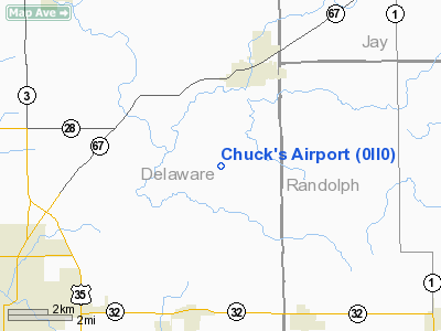
Location
& QuickFacts
|
FAA
Information Effective: |
2007-12-20 |
|
Airport
Identifier: |
0II0 |
|
Airport
Status: |
Operational |
|
Longitude/Latitude: |
085-15-11.8910W/40-15-36.1530N
-85.253303/40.260042 (Estimated) |
|
Elevation: |
955 ft / 291.08 m (Estimated) |
|
Land: |
0 acres |
|
From nearest
city: |
5 nautical miles S of Albany, IN |
|
Location: |
Delaware County, IN |
|
Magnetic
Variation: |
03W (1985) |
Owner & Manager
|
Ownership: |
Privately
owned |
|
Owner: |
Chuck Ondrejko |
|
Address: |
Rr 1
Albany, IN 47320 |
|
Phone
number: |
317-789-4217 |
|
Address: |
|
Airport
Operations and Facilities
|
Airport
Use: |
Private |
|
Wind indicator: |
Yes |
|
Segmented
Circle: |
No |
|
Control
Tower: |
No |
|
Sectional
chart: |
Chicago |
|
Region: |
AGL - Great Lakes |
|
Boundary
ARTCC: |
ZID - Indianapolis |
|
Tie-in
FSS: |
HUF - Terre Haute |
|
FSS on
Airport: |
No |
|
FSS Toll
Free: |
1-800-WX-BRIEF |
|
Runway Information
Runway E/W
|
Dimension: |
1500 x 50 ft
/ 457.2 x 15.2 m |
|
Surface: |
TURF, |
|
|
Runway E |
Runway W |
|
Traffic
Pattern: |
Left |
Left |
|
Obstruction: |
|
30 ft pline |
|
Radio Navigation
Aids
|
ID |
Type |
Name |
Ch |
Freq |
Var |
Dist |
|
AI |
NDB |
Video |
|
371.00 |
03W |
16.5 nm |
|
PLD |
NDB |
Portland |
|
257.00 |
03W |
17.0 nm |
|
UWL |
NDB |
New Castle |
|
385.00 |
02W |
23.0 nm |
|
VES |
NDB |
Versailles |
|
356.00 |
04W |
33.7 nm |
|
CQA |
NDB |
Lakefield |
|
205.00 |
04W |
34.3 nm |
|
HHG |
NDB |
Huntington |
|
417.00 |
03W |
37.1 nm |
|
IWH |
NDB |
Wabash |
|
329.00 |
03W |
39.2 nm |
|
UMP |
NDB |
Metropolitan |
|
338.00 |
03W |
41.4 nm |
|
VFU |
NDB |
Stanley |
|
411.00 |
05W |
46.5 nm |
|
HZP |
NDB |
Zionsville |
|
248.00 |
03W |
49.7 nm |
|
MIE |
VOR/DME |
Muncie |
091X |
114.40 |
03W |
6.6 nm |
|
MZZ |
VOR/DME |
Marion |
023X |
108.60 |
03W |
24.0 nm |
|
DQN |
VOR/DME |
Dayton |
092X |
114.50 |
01W |
42.0 nm |
|
RID |
VORTAC |
Richmond |
043X |
110.60 |
03W |
35.9 nm |
|
OKK |
VORTAC |
Kokomo |
082X |
113.50 |
00E |
40.2 nm |
|
FWA |
VORTAC |
Fort Wayne |
125X |
117.80 |
00E |
43.3 nm |
|
SHB |
VORTAC |
Shelbyville |
057X |
112.00 |
01E |
46.0 nm |
|
GUS |
VORTAC |
Grissom |
21Y |
108.45 |
02W |
47.2 nm |
|
FWA |
VOT |
Fort Wayne Baer |
|
111.00 |
|
43.3 nm |
Remarks
- FILED
FOR RECORD PURPOSES ONLY.
Based Aircraft
|
Aircraft
based on field: |
1 |
|
Single Engine
Airplanes: |
1 |
Chuck's Airport
Address:
Delaware County, IN
Tel:
317-789-4217
Images
and information placed above are from
http://www.airport-data.com/airport/0II0/
We
thank them for the data!
| General
Info |
| Country |
United
States |
| State |
INDIANA
|
| FAA ID |
0II0 |
| Latitude |
40-15-36.153N
|
| Longitude |
085-15-11.891W
|
| Elevation |
955 feet
|
| Near City |
ALBANY
|
We don't guarantee the information is fresh and accurate. The data may
be wrong or outdated.
For more up-to-date information please refer to other sources.
|
|


