 |
|
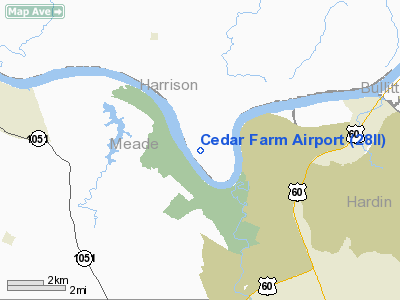
Location
& QuickFacts
|
FAA
Information Effective: |
2007-12-20 |
|
Airport
Identifier: |
28II |
|
Airport
Status: |
Operational |
|
Longitude/Latitude: |
086-03-22.3780W/37-58-28.7570N
-86.056216/37.974655 (Estimated) |
|
Elevation: |
453 ft / 138.07 m (Estimated) |
|
Land: |
4 acres |
|
From nearest
city: |
4 nautical miles S of Laconia, IN |
|
Location: |
Harrison County, IN |
|
Magnetic
Variation: |
01W (1985) |
Owner
& Manager
|
Ownership: |
Privately
owned |
|
Owner: |
Steven L. Ferguson |
|
Address: |
973 S Kirby Rd
Bloomington,
IN 47401 |
|
Phone
number: |
812-825-4033 |
|
Address: |
|
Airport Operations
and Facilities
|
Airport Use: |
Private
PERSONAL USE. |
|
Wind
indicator: |
Yes |
|
Segmented
Circle: |
No |
|
Control
Tower: |
No |
|
Sectional
chart: |
St Louis |
|
Region: |
AGL - Great Lakes |
|
Boundary
ARTCC: |
ZID - Indianapolis |
|
Tie-in
FSS: |
HUF - Terre Haute |
|
FSS Toll
Free: |
1-800-WX-BRIEF |
Airport
Communications
|
Runway Information
Runway 13/31
|
Dimension: |
4000 x 40 ft
/ 1219.2 x 12.2 m |
|
Surface: |
TURF, |
|
|
Runway 13 |
Runway 31 |
|
Traffic
Pattern: |
Right |
Right |
|
Radio Navigation
Aids
|
ID |
Type |
Name |
Ch |
Freq |
Var |
Dist |
|
GOI |
NDB |
Godman |
|
396.00 |
02W |
3.9 nm |
|
BRY |
NDB |
Bardstown/dcmsnd |
|
248.00 |
02W |
28.2 nm |
|
TEL |
NDB |
Tell City |
|
206.00 |
02W |
30.1 nm |
|
RRJ |
NDB |
Oranj |
|
368.00 |
02W |
40.0 nm |
|
FNZ |
NDB |
Ferdinand |
|
239.00 |
00E |
40.5 nm |
|
IKY |
NDB |
Springfield |
|
429.00 |
03W |
44.0 nm |
|
MYS |
VOR |
Mystic |
|
108.20 |
01W |
10.2 nm |
|
FTK |
VOR/DME |
Fort Knox |
033X |
109.60 |
01W |
5.7 nm |
|
BQM |
VOR/DME |
Bowman |
059X |
112.20 |
01W |
24.1 nm |
|
EWO |
VOR/DME |
New Hope |
045X |
110.80 |
01E |
27.4 nm |
|
HNB |
VOR/DME |
Huntingburg |
029X |
109.20 |
00E |
45.7 nm |
|
IIU |
VORTAC |
Louisville |
095X |
114.80 |
01E |
24.0 nm |
|
ABB |
VORTAC |
Nabb |
071X |
112.40 |
01E |
41.9 nm |
|
SDF |
VOT |
Louisville Standifd |
|
111.00 |
|
19.5 nm |
Remarks
- OWNER
DESIRES ARPT NOT BE CHARTED.
Cedar Farm Airport
Address:
Harrison County, IN
Tel:
812-825-4033
Images
and information placed above are from
http://www.airport-data.com/airport/28II/
We
thank them for the data!
| General
Info |
| Country |
United
States |
| State |
INDIANA
|
| FAA ID |
28II |
| Latitude |
37-58-28.757N
|
| Longitude |
086-03-22.378W
|
| Elevation |
453 feet
|
| Near City |
LACONIA
|
We don't guarantee the information is fresh and accurate. The data may
be wrong or outdated.
For more up-to-date information please refer to other sources.
|
|


