 |
|
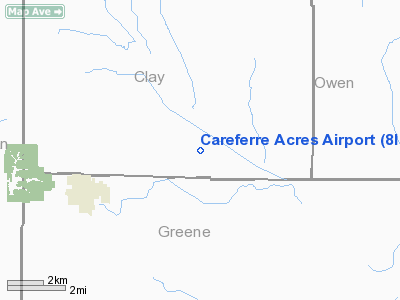
Location
& QuickFacts
|
FAA
Information Effective: |
2007-12-20 |
|
Airport
Identifier: |
8II1 |
|
Airport
Status: |
Operational |
|
Longitude/Latitude: |
087-07-34.0000W/39-10-59.0000N
-87.126111/39.183056 (Estimated) |
|
Elevation: |
520 ft / 158.50 m (Estimated) |
|
Land: |
0 acres |
|
From nearest
city: |
4 nautical miles E of Jasonville, IN |
|
Location: |
Clay County, IN |
|
Magnetic
Variation: |
01W (1990) |
Owner & Manager
|
Ownership: |
Privately
owned |
|
Owner: |
Bradley Ferre |
|
Address: |
Rt 2 Box 240
Jasonville, IN 47438 |
|
Phone
number: |
812-665-3803 |
|
Address: |
|
Airport
Operations and Facilities
|
Airport
Use: |
Private |
|
Segmented
Circle: |
No |
|
Control
Tower: |
No |
|
Sectional
chart: |
St Louis |
|
Region: |
AGL - Great Lakes |
|
Boundary
ARTCC: |
ZID - Indianapolis |
|
Tie-in
FSS: |
HUF - Terre Haute |
|
FSS Toll
Free: |
1-800-WX-BRIEF |
|
Runway Information
Runway 09/27
|
Dimension: |
1320 x 66 ft
/ 402.3 x 20.1 m |
|
Surface: |
TURF, |
|
|
Runway 09 |
Runway 27 |
|
Traffic
Pattern: |
Left |
Left |
|
Displaced
threshold: |
600.00 ft |
0.00 ft |
|
Obstruction: |
20 ft pline |
|
|
Radio Navigation
Aids
|
ID |
Type |
Name |
Ch |
Freq |
Var |
Dist |
|
SIV |
NDB |
Sullivan |
|
326.00 |
02W |
15.5 nm |
|
HU |
NDB |
Yinno |
|
245.00 |
02W |
17.6 nm |
|
BM |
NDB |
Claye |
|
382.00 |
02W |
25.7 nm |
|
PLX |
NDB |
Palestine |
|
391.00 |
00W |
26.1 nm |
|
DCY |
NDB |
Washington |
|
212.00 |
03W |
29.3 nm |
|
TVX |
NDB |
Greencastle |
|
521.00 |
03W |
35.2 nm |
|
OEA |
NDB |
Vincennes |
|
251.00 |
00E |
35.7 nm |
|
BFR |
NDB |
Bedford |
|
344.00 |
02W |
38.3 nm |
|
PRG |
NDB |
Paris |
|
341.00 |
01E |
40.1 nm |
|
CZB |
NDB |
Casey |
|
359.00 |
00E |
41.4 nm |
|
AJG |
NDB |
Mount Carmel |
|
524.00 |
02W |
44.3 nm |
|
RRJ |
NDB |
Oranj |
|
368.00 |
02W |
48.3 nm |
|
CFJ |
NDB |
Crawfordsville |
|
388.00 |
02W |
48.9 nm |
|
RSV |
VOR/DME |
Robinson |
021X |
108.40 |
02E |
26.3 nm |
|
LWV |
VOR/DME |
Lawrenceville |
025X |
108.80 |
01W |
33.4 nm |
|
TTH |
VORTAC |
Terre Haute |
100X |
115.30 |
02E |
19.3 nm |
|
OOM |
VORTAC |
Hoosier |
039X |
110.20 |
02W |
24.0 nm |
Remarks
- PRVDD
OBS IN RY APCH ARE REMOVED/LOWERED OR THR DSPLCD TO PRVD 20:1 SLOPES;
125' EITHER SIDE OF CNTRLN & 200' AT RY ENDS ARE CLEAR OF OBS.
Careferre Acres Airport
Address:
Clay County, IN
Tel:
812-665-3803
Images
and information placed above are from
http://www.airport-data.com/airport/8II1/
We
thank them for the data!
| General
Info |
| Country |
United
States |
| State |
INDIANA
|
| FAA ID |
8II1 |
| Latitude |
39-10-59.000N
|
| Longitude |
087-07-34.000W
|
| Elevation |
520 feet
|
| Near City |
JASONVILLE
|
We don't guarantee the information is fresh and accurate. The data may
be wrong or outdated.
For more up-to-date information please refer to other sources.
|
|


