 |
|
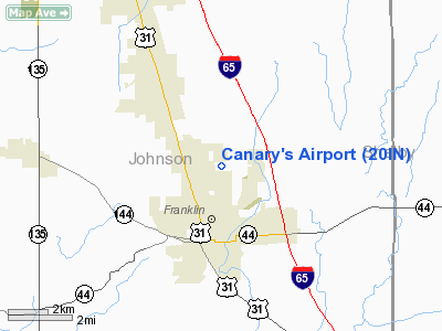
Location
& QuickFacts
|
FAA
Information Effective: |
2007-12-20 |
|
Airport
Identifier: |
20IN |
|
Airport
Status: |
Operational |
|
Longitude/Latitude: |
086-03-04.9470W/39-30-50.1780N
-86.051374/39.513938 (Estimated) |
|
Elevation: |
760 ft / 231.65 m (Estimated) |
|
Land: |
0 acres |
|
From nearest
city: |
2 nautical miles N of Franklin, IN |
|
Location: |
Johnson County, IN |
|
Magnetic
Variation: |
02W (1985) |
Owner
& Manager
|
Ownership: |
Privately
owned |
|
Owner: |
Raymond Eugene Canary |
|
Address: |
2385 North Graham Rd
Franklin,
IN 46131 |
|
Phone
number: |
317-736-4211 |
|
Address: |
|
Airport Operations
and Facilities
|
Airport
Use: |
Private |
|
Segmented
Circle: |
No |
|
Control
Tower: |
No |
|
Sectional
chart: |
St Louis |
|
Region: |
AGL - Great Lakes |
|
Boundary
ARTCC: |
ZID - Indianapolis |
|
Tie-in
FSS: |
HUF - Terre Haute |
|
FSS on
Airport: |
No |
|
FSS Toll
Free: |
1-800-WX-BRIEF |
|
Runway Information
Runway 09/27
|
Dimension: |
2500 x 60 ft
/ 762.0 x 18.3 m |
|
Surface: |
TURF, |
|
|
Runway 09 |
Runway 27 |
|
Traffic
Pattern: |
Left |
Left |
|
Radio Navigation
Aids
|
ID |
Type |
Name |
Ch |
Freq |
Var |
Dist |
|
HFY |
NDB |
Greenwood |
|
398.00 |
02W |
7.4 nm |
|
BA |
NDB |
Clifs |
|
410.00 |
03W |
15.8 nm |
|
UMP |
NDB |
Metropolitan |
|
338.00 |
03W |
25.5 nm |
|
HZP |
NDB |
Zionsville |
|
248.00 |
03W |
27.2 nm |
|
OVO |
NDB |
North Vernon |
|
374.00 |
02W |
34.9 nm |
|
TVX |
NDB |
Greencastle |
|
521.00 |
03W |
37.0 nm |
|
BM |
NDB |
Claye |
|
382.00 |
02W |
37.5 nm |
|
HLB |
NDB |
Batesville |
|
254.00 |
02W |
38.1 nm |
|
EQZ |
NDB |
Captain |
|
308.00 |
02W |
39.0 nm |
|
UWL |
NDB |
New Castle |
|
385.00 |
02W |
40.4 nm |
|
AI |
NDB |
Video |
|
371.00 |
03W |
41.7 nm |
|
BFR |
NDB |
Bedford |
|
344.00 |
02W |
44.3 nm |
|
CFJ |
NDB |
Crawfordsville |
|
388.00 |
02W |
48.8 nm |
|
SHB |
VORTAC |
Shelbyville |
057X |
112.00 |
01E |
12.7 nm |
|
VHP |
VORTAC |
Brickyard |
110X |
116.30 |
01E |
23.3 nm |
|
OOM |
VORTAC |
Hoosier |
039X |
110.20 |
02W |
34.3 nm |
|
IND |
VOT |
Indianapolis Intl |
|
109.60 |
|
16.6 nm |
Canary's Airport
Address:
Johnson County, IN
Tel:
317-736-4211
Images
and information placed above are from
http://www.airport-data.com/airport/20IN/
We
thank them for the data!
| General
Info |
| Country |
United
States |
| State |
INDIANA
|
| FAA ID |
20IN |
| Latitude |
39-30-50.178N
|
| Longitude |
086-03-04.947W
|
| Elevation |
760 feet
|
| Near City |
FRANKLIN
|
We don't guarantee the information is fresh and accurate. The data may
be wrong or outdated.
For more up-to-date information please refer to other sources.
|
|


