 |
|
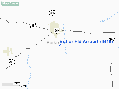
Location
& QuickFacts
|
FAA
Information Effective: |
2007-12-20 |
|
Airport
Identifier: |
IN46 |
|
Airport
Status: |
Operational |
|
Longitude/Latitude: |
087-13-10.0510W/39-44-20.1450N
-87.219459/39.738929 (Estimated) |
|
Elevation: |
687 ft / 209.40 m (Surveyed) |
|
Land: |
0 acres |
|
From nearest
city: |
2 nautical miles S of Rockville, IN |
|
Location: |
Parke County, IN |
|
Magnetic
Variation: |
01W (1985) |
Owner
& Manager
|
Ownership: |
Privately
owned |
|
Owner: |
Lochel E. Butler |
|
Address: |
503 S. Market St.
Rockville,
IN 47872 |
|
Phone
number: |
812-569-6379 |
|
Address: |
|
Airport Operations
and Facilities
|
Airport Use: |
Private |
|
Wind
indicator: |
Yes |
|
Segmented
Circle: |
No |
|
Control
Tower: |
No |
|
Landing
fee charge: |
No |
|
Sectional
chart: |
St Louis |
|
Region: |
AGL - Great Lakes |
|
Boundary
ARTCC: |
ZID - Indianapolis |
|
Tie-in
FSS: |
HUF - Terre Haute |
|
FSS on
Airport: |
No |
|
FSS Toll
Free: |
1-800-WX-BRIEF |
Airport Services
|
Fuel
available: |
100LL
FUEL NOT FOR SALE TO PUBLIC. |
|
Airframe
Repair: |
NONE |
|
Power
Plant Repair: |
NONE |
|
Bottled
Oxygen: |
NONE |
|
Bulk Oxygen: |
NONE |
|
Runway Information
Runway 09/27
|
Dimension: |
2081 x 65 ft
/ 634.3 x 19.8 m |
|
Surface: |
TURF, |
|
|
Runway 09 |
Runway 27 |
|
Traffic
Pattern: |
Left |
Left |
|
Centerline
Lights: |
No |
No |
|
Radio Navigation
Aids
|
ID |
Type |
Name |
Ch |
Freq |
Var |
Dist |
|
TVX |
NDB |
Greencastle |
|
521.00 |
03W |
19.2 nm |
|
CFJ |
NDB |
Crawfordsville |
|
388.00 |
02W |
20.2 nm |
|
PRG |
NDB |
Paris |
|
341.00 |
01E |
21.2 nm |
|
HU |
NDB |
Yinno |
|
245.00 |
02W |
22.7 nm |
|
HMJ |
NDB |
Homer |
|
281.00 |
01E |
38.0 nm |
|
SIV |
NDB |
Sullivan |
|
326.00 |
02W |
39.0 nm |
|
FKR |
NDB |
Frankfort |
|
278.00 |
02W |
44.0 nm |
|
CZB |
NDB |
Casey |
|
359.00 |
00E |
44.7 nm |
|
HZP |
NDB |
Zionsville |
|
248.00 |
03W |
46.4 nm |
|
MT |
NDB |
Zebre |
|
347.00 |
00E |
47.6 nm |
|
PLX |
NDB |
Palestine |
|
391.00 |
00W |
47.8 nm |
|
RSV |
VOR/DME |
Robinson |
021X |
108.40 |
02E |
47.7 nm |
|
TTH |
VORTAC |
Terre Haute |
100X |
115.30 |
02E |
15.1 nm |
|
DNV |
VORTAC |
Danville |
047X |
111.00 |
02E |
36.8 nm |
|
VHP |
VORTAC |
Brickyard |
110X |
116.30 |
01E |
39.6 nm |
|
OOM |
VORTAC |
Hoosier |
039X |
110.20 |
02W |
45.5 nm |
|
BVT |
VORTAC |
Boiler |
098X |
115.10 |
01E |
49.6 nm |
|
IND |
VOT |
Indianapolis Intl |
|
109.60 |
|
43.3 nm |
Remarks
Based Aircraft
|
Aircraft
based on field: |
8 |
|
Single Engine
Airplanes: |
8 |
Butler Field Airport
Address:
Parke County, IN
Tel:
812-569-6379
Images
and information placed above are from
http://www.airport-data.com/airport/IN46/
We
thank them for the data!
| General
Info |
| Country |
United
States |
| State |
INDIANA
|
| FAA ID |
IN46 |
| Latitude |
39-44-20.145N
|
| Longitude |
087-13-10.051W
|
| Elevation |
687 feet
|
| Near City |
ROCKVILLE
|
We don't guarantee the information is fresh and accurate. The data may
be wrong or outdated.
For more up-to-date information please refer to other sources.
|
|


