 |
|
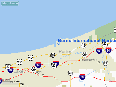
Burns International Harbor Heliport |
Location
& QuickFacts
|
FAA
Information Effective: |
2007-12-20 |
|
Airport
Identifier: |
2II5 |
|
Airport
Status: |
Operational |
|
Longitude/Latitude: |
087-09-08.1250W/41-38-13.1330N
-87.152257/41.636981 (Estimated) |
|
Elevation: |
596 ft / 181.66 m (Estimated) |
|
Land: |
0 acres |
|
From nearest
city: |
5 nautical miles SW of Portage, IN |
|
Location: |
Porter County, IN |
|
Magnetic
Variation: |
02W (1985) |
Owner
& Manager
|
Ownership: |
Publicly
owned |
|
Owner: |
Indiana Port Commission |
|
Address: |
6600 Us Hwy. 12
Portage, IN 46368 |
|
Phone
number: |
219-787-8636 |
|
Manager: |
Peter E. Mccarthy |
|
Address: |
6600 U.s. Hwy. 12
Portage, IN 46368 |
|
Phone
number: |
219-787-8636 |
Airport Operations
and Facilities
|
Airport
Use: |
Private |
|
Wind indicator: |
Yes |
|
Segmented
Circle: |
No |
|
Control
Tower: |
No |
|
Sectional
chart: |
Chicago |
|
Region: |
AGL - Great Lakes |
|
Boundary
ARTCC: |
ZAU - Chicago |
|
Tie-in
FSS: |
HUF - Terre Haute |
|
FSS on
Airport: |
No |
|
FSS Toll
Free: |
1-800-WX-BRIEF |
|
Runway Information
Helipad H1
|
Dimension: |
150 x 100 ft
/ 45.7 x 30.5 m |
|
Surface: |
CONC, |
|
|
Runway H1 |
Runway |
|
Traffic
Pattern: |
Left |
Left |
|
Radio Navigation
Aids
|
ID |
Type |
Name |
Ch |
Freq |
Var |
Dist |
|
MGC |
NDB |
Michigan City |
|
203.00 |
01W |
15.6 nm |
|
VP |
NDB |
Sedly |
|
212.00 |
02W |
16.7 nm |
|
IUL |
NDB |
La Porte |
|
356.00 |
03W |
19.0 nm |
|
MX |
NDB |
Kedzi |
|
248.00 |
01W |
24.9 nm |
|
HK |
NDB |
Ermin |
|
332.00 |
01W |
31.1 nm |
|
RWN |
NDB |
Winamac/dcmsnd |
|
335.00 |
00W |
40.9 nm |
|
RZL |
NDB |
Rensselaer |
|
362.00 |
02W |
41.5 nm |
|
CPB |
NDB |
Culver |
|
391.00 |
01W |
42.8 nm |
|
ME |
NDB |
Deana |
|
350.00 |
00E |
43.9 nm |
|
OXI |
VOR/DME |
Knox |
103X |
115.60 |
00E |
29.5 nm |
|
ORD |
VOR/DME |
Chicago O'hare |
086X |
113.90 |
02E |
39.8 nm |
|
IKK |
VOR/DME |
Kankakee |
053X |
111.60 |
00E |
46.2 nm |
|
CGT |
VORTAC |
Chicago Heights |
089X |
114.20 |
02E |
20.3 nm |
|
EON |
VORTAC |
Peotone |
079X |
113.20 |
02E |
36.3 nm |
|
GIJ |
VORTAC |
Gipper |
101X |
115.40 |
00E |
38.2 nm |
|
MDW |
VOT |
Chicago Midway |
|
111.00 |
|
28.4 nm |
|
ORD |
VOT |
Chicago O'hare Intl |
|
112.00 |
|
39.7 nm |
Remarks
- PROVIDED
APP/DEP OPERATIONS ARE CONDUCTED IN AN AREA FROM 330 DEGREES CLOCKWISE
TO 30 DEGREES AND SUBSEQUENT TO THE BURIAL OF PLINES E AND W FROM 300
DEGREES TO 90 DEGREES USING PAD AS CENTER OF COMPASS ROSE; AREA IS APPROPRIATELY
MARKED;WIND INDICATOR IS MAINTAINED.
Burns International Harbor Heliport
Address:
Porter County, IN
Tel:
219-787-8636
Images
and information placed above are from
http://www.airport-data.com/airport/2II5/
We
thank them for the data!
| General
Info |
| Country |
United
States |
| State |
INDIANA
|
| FAA ID |
2II5 |
| Latitude |
41-38-13.133N
|
| Longitude |
087-09-08.125W
|
| Elevation |
596 feet
|
| Near City |
PORTAGE
|
We don't guarantee the information is fresh and accurate. The data may
be wrong or outdated.
For more up-to-date information please refer to other sources.
|
|


