 |
|
Location
& QuickFacts
|
FAA
Information Effective: |
2007-12-20 |
|
Airport
Identifier: |
II53 |
|
Airport
Status: |
Operational |
|
Longitude/Latitude: |
085-29-04.8560W/38-46-13.2100N
-85.484682/38.770336 (Estimated) |
|
Elevation: |
810 ft / 246.89 m (Estimated) |
|
Land: |
0 acres |
|
From nearest
city: |
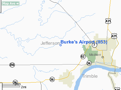
7 nautical miles NW of Madison, IN |
|
Location: |
Jefferson County, IN |
|
Magnetic
Variation: |
02W (1985) |
Owner & Manager
|
Ownership: |
Privately
owned |
|
Owner: |
Glen Burke |
|
Address: |
Rr 5
Madison, IN 47250 |
|
Address: |
|
Airport
Operations and Facilities
|
Airport
Use: |
Private |
|
Wind indicator: |
Yes |
|
Segmented
Circle: |
No |
|
Control
Tower: |
No |
|
Landing
fee charge: |
No |
|
Sectional
chart: |
Cincinnati |
|
Region: |
AGL - Great Lakes |
|
Boundary
ARTCC: |
ZID - Indianapolis |
|
Tie-in
FSS: |
HUF - Terre Haute |
|
FSS on
Airport: |
No |
|
FSS Toll
Free: |
1-800-WX-BRIEF |
|
Runway Information
Runway 18/36
|
Dimension: |
2000 x 60 ft
/ 609.6 x 18.3 m |
|
Surface: |
TURF, |
|
|
Runway 18 |
Runway 36 |
|
Traffic
Pattern: |
Left |
Left |
|
Obstruction: |
25 ft pline |
30 ft road, 0.0 ft from runway |
|
Radio Navigation
Aids
|
ID |
Type |
Name |
Ch |
Freq |
Var |
Dist |
|
IMS |
NDB |
Madison |
|
404.00 |
03W |
1.3 nm |
|
OVO |
NDB |
North Vernon |
|
374.00 |
02W |
17.7 nm |
|
EQZ |
NDB |
Captain |
|
308.00 |
02W |
23.6 nm |
|
HLB |
NDB |
Batesville |
|
254.00 |
02W |
36.4 nm |
|
BA |
NDB |
Clifs |
|
410.00 |
03W |
36.6 nm |
|
UR |
NDB |
Burln |
|
321.00 |
04W |
37.2 nm |
|
BFR |
NDB |
Bedford |
|
344.00 |
02W |
44.8 nm |
|
FEU |
NDB |
Arnold |
|
521.00 |
03W |
45.8 nm |
|
FFT |
VOR |
Frankfort |
|
109.40 |
03W |
44.5 nm |
|
BQM |
VOR/DME |
Bowman |
059X |
112.20 |
01W |
33.6 nm |
|
ABB |
VORTAC |
Nabb |
071X |
112.40 |
01E |
13.0 nm |
|
CVG |
VORTAC |
Cincinnati |
120X |
117.30 |
04W |
39.4 nm |
|
IIU |
VORTAC |
Louisville |
095X |
114.80 |
01E |
40.3 nm |
|
SDF |
VOT |
Louisville Standifd |
|
111.00 |
|
37.5 nm |
Remarks
- FILED
FOR RECORD PURPOSES ONLY.
Based Aircraft
|
Aircraft
based on field: |
1 |
|
Single Engine
Airplanes: |
1 |
Burke's Airport
Address:
Jefferson County, IN
Tel:
Images
and information placed above are from
http://www.airport-data.com/airport/II53/
We
thank them for the data!
| General
Info |
| Country |
United
States |
| State |
INDIANA
|
| FAA ID |
II53 |
| Latitude |
38-46-13.210N
|
| Longitude |
085-29-04.856W
|
| Elevation |
810 feet
|
| Near City |
MADISON
|
We don't guarantee the information is fresh and accurate. The data may
be wrong or outdated.
For more up-to-date information please refer to other sources.
|
|


