 |
|
Location
& QuickFacts
|
FAA
Information Effective: |
2007-12-20 |
|
Airport
Identifier: |
II96 |
|
Airport
Status: |
Operational |
|
Longitude/Latitude: |
086-55-59.0010W/38-29-34.1870N
-86.933056/38.492830 (Estimated) |
|
Elevation: |
520 ft / 158.50 m (Estimated) |
|
Land: |
3 acres |
|
From nearest
city: |
2 nautical miles W of Haysville, IN |
|
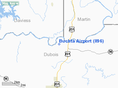
Location: |
Dubois County, IN |
|
Magnetic
Variation: |
01W (1985) |
Owner
& Manager
|
Ownership: |
Privately
owned |
|
Owner: |
Robert G. Buchta |
|
Address: |
1415 W Haysville Road
Jasper,
IN 47546 |
|
Phone
number: |
812-482-3113 |
|
Manager: |
Robert G. Buchta |
|
Address: |
1415 W Haysville Road
Jasper,
IN 47546 |
|
Phone
number: |
812-482-3113 |
Airport Operations
and Facilities
|
Airport
Use: |
Private |
|
Wind indicator: |
Yes |
|
Segmented
Circle: |
No |
|
Control
Tower: |
No |
|
Sectional
chart: |
St Louis |
|
Region: |
AGL - Great Lakes |
|
Boundary
ARTCC: |
ZID - Indianapolis |
|
Tie-in
FSS: |
HUF - Terre Haute |
|
FSS Toll
Free: |
1-800-WX-BRIEF |
|
Runway Information
Runway 17/35
|
Dimension: |
2000 x 100 ft
/ 609.6 x 30.5 m |
|
Surface: |
TURF, |
|
|
Runway 17 |
Runway 35 |
|
Traffic
Pattern: |
Left |
Left |
|
Obstruction: |
, 100.0 ft from runway |
25 ft pline, 300.0 ft from runway |
|
Radio Navigation
Aids
|
ID |
Type |
Name |
Ch |
Freq |
Var |
Dist |
|
FNZ |
NDB |
Ferdinand |
|
239.00 |
00E |
15.3 nm |
|
DCY |
NDB |
Washington |
|
212.00 |
03W |
15.4 nm |
|
RRJ |
NDB |
Oranj |
|
368.00 |
02W |
19.2 nm |
|
TEL |
NDB |
Tell City |
|
206.00 |
02W |
31.0 nm |
|
BFR |
NDB |
Bedford |
|
344.00 |
02W |
31.2 nm |
|
OEA |
NDB |
Vincennes |
|
251.00 |
00E |
31.6 nm |
|
BM |
NDB |
Claye |
|
382.00 |
02W |
37.3 nm |
|
AJG |
NDB |
Mount Carmel |
|
524.00 |
02W |
38.0 nm |
|
PDW |
NDB |
Evansville |
|
284.00 |
00E |
39.2 nm |
|
SIV |
NDB |
Sullivan |
|
326.00 |
02W |
44.4 nm |
|
PLX |
NDB |
Palestine |
|
391.00 |
00W |
45.6 nm |
|
MYS |
VOR |
Mystic |
|
108.20 |
01W |
48.5 nm |
|
HNB |
VOR/DME |
Huntingburg |
029X |
109.20 |
00E |
14.6 nm |
|
LWV |
VOR/DME |
Lawrenceville |
025X |
108.80 |
01W |
35.6 nm |
|
RSV |
VOR/DME |
Robinson |
021X |
108.40 |
02E |
46.1 nm |
|
OWB |
VOR/DME |
Owensboro |
023X |
108.60 |
01E |
46.4 nm |
|
OOM |
VORTAC |
Hoosier |
039X |
110.20 |
02W |
41.9 nm |
Remarks
- ANY
OBSTRUCTIONS REMOVED/LOWERED TO PROVIDE 20:1 APCH SURFACE CLEARANCE;
REFERENCE FAA AC TO ESTABLISH ACCEPTABLE LEVEL OF SAFETY.
Based Aircraft
|
Aircraft
based on field: |
2 |
|
Single Engine
Airplanes: |
2 |
Buchta Airport
Address:
Dubois County, IN
Tel:
812-482-3113
Images
and information placed above are from
http://www.airport-data.com/airport/II96/
We
thank them for the data!
| General
Info |
| Country |
United
States |
| State |
INDIANA
|
| FAA ID |
II96 |
| Latitude |
38-29-34.187N
|
| Longitude |
086-55-59.001W
|
| Elevation |
520 feet
|
| Near City |
HAYSVILLE
|
We don't guarantee the information is fresh and accurate. The data may
be wrong or outdated.
For more up-to-date information please refer to other sources.
|
|


