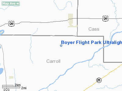
Boyer Flight Park Ultralight |
 |
|
Location
& QuickFacts
|
FAA
Information Effective: |
2007-12-20 |
|
Airport
Identifier: |
7W7 |
|
Airport
Status: |
Operational |
|
Longitude/Latitude: |
086-36-58.0240W/40-43-12.1400N
-86.616118/40.720039 (Estimated) |
|
Elevation: |
710 ft / 216.41 m (Estimated) |
|
Land: |
7 acres |
|
From nearest
city: |
4 nautical miles SW of Burnettsville, IN |
|
Location: |
Carroll County, IN |
|
Magnetic
Variation: |
02W (1990) |
Owner & Manager
|
Ownership: |
Privately
owned |
|
Owner: |
Gayle Boyer-high |
|
Address: |
4828 W 1200 N
Burnettsville, IN 47926 |
|
Phone
number: |
574-583-5566 |
|
Manager: |
Gayle Boyer-high |
|
Address: |
4828 W 1200 N
Burnettsville, IN 47926 |
|
Phone
number: |
574-943-3424 |
Airport
Operations and Facilities
|
Airport
Use: |
Open
to public |
|
Wind indicator: |
Yes |
|
Segmented
Circle: |
No |
|
Control
Tower: |
No |
|
Sectional
chart: |
Chicago |
|
Region: |
AGL - Great Lakes |
|
Boundary
ARTCC: |
ZAU - Chicago |
|
Tie-in
FSS: |
HUF - Terre Haute |
|
FSS on
Airport: |
No |
|
FSS Toll
Free: |
1-800-WX-BRIEF |
|
NOTAMs
Facility: |
HUF (NOTAM-d service avaliable) |
Airport Communications
Airport Services
|
Power
Plant Repair: |
MINOR |
|
Runway Information
Runway 18/36
|
Dimension: |
1770 x 120 ft
/ 539.5 x 36.6 m |
|
Surface: |
TURF, Good Condition |
|
|
Runway 18 |
Runway 36 |
|
Longitude: |
086-36-58.2000W |
086-36-58.2000W |
|
Latitude: |
40-43-17.9200N |
40-43-00.1300N |
|
Elevation: |
705.00 ft |
710.00 ft |
|
Traffic
Pattern: |
Left |
Left |
|
Displaced
threshold: |
300.00 ft |
200.00 ft |
|
Obstruction: |
15 ft road
RWY 18 APCH SLOPE 20:1 TO DSPLCD THLD. |
10 ft crops
RWY 36 APPCH SLOPE TO DISP THLD 20:1 |
|
Radio Navigation
Aids
|
ID |
Type |
Name |
Ch |
Freq |
Var |
Dist |
|
MCX |
NDB |
White County |
|
377.00 |
03W |
6.7 nm |
|
GGP |
NDB |
Logansport |
|
263.00 |
01W |
11.1 nm |
|
RWN |
NDB |
Winamac/dcmsnd |
|
335.00 |
00W |
22.5 nm |
|
FKR |
NDB |
Frankfort |
|
278.00 |
02W |
27.1 nm |
|
RCR |
NDB |
Rochester |
|
216.00 |
03W |
28.4 nm |
|
RZL |
NDB |
Rensselaer |
|
362.00 |
02W |
29.2 nm |
|
CPB |
NDB |
Culver |
|
391.00 |
01W |
31.6 nm |
|
IWH |
NDB |
Wabash |
|
329.00 |
03W |
37.4 nm |
|
VP |
NDB |
Sedly |
|
212.00 |
02W |
45.5 nm |
|
CFJ |
NDB |
Crawfordsville |
|
388.00 |
02W |
46.5 nm |
|
IUL |
NDB |
La Porte |
|
356.00 |
03W |
47.3 nm |
|
HZP |
NDB |
Zionsville |
|
248.00 |
03W |
49.8 nm |
|
OXI |
VOR/DME |
Knox |
103X |
115.60 |
00E |
36.2 nm |
|
MZZ |
VOR/DME |
Marion |
023X |
108.60 |
03W |
44.9 nm |
|
GUS |
VORTAC |
Grissom |
21Y |
108.45 |
02W |
21.6 nm |
|
BVT |
VORTAC |
Boiler |
098X |
115.10 |
01E |
22.9 nm |
|
OKK |
VORTAC |
Kokomo |
082X |
113.50 |
00E |
28.0 nm |
Remarks
- BIRDS
& DEER ON & INVOF ARPT.
- NO
SNOW REMOVAL.
Based Aircraft
|
Aircraft
based on field: |
4 |
|
Ultralights: |
4 |
Operational Statistics
Time
Period: 2006-01-01 - 2006-12-31
|
Aircraft
Operations: |
19/Month |
|
General Aviation
Local: |
90.4% |
|
General Aviation
Itinerant: |
9.6% |
Boyer Flight Park Ultralight
Address:
Carroll County, IN
Tel:
574-583-5566,
574-943-3424
Images
and information placed above are from
http://www.airport-data.com/airport/7W7/
We
thank them for the data!
| General
Info |
| Country |
United
States |
| State |
INDIANA
|
| FAA ID |
7W7 |
| Latitude |
40-43-12.140N
|
| Longitude |
086-36-58.024W
|
| Elevation |
710 feet
|
| Near City |
BURNETTSVILLE
|
We don't guarantee the information is fresh and accurate. The data may
be wrong or outdated.
For more up-to-date information please refer to other sources.
|


