 |
|
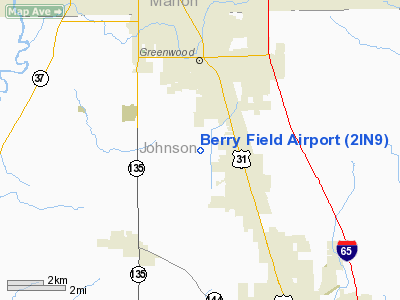
Location
& QuickFacts
|
FAA
Information Effective: |
2007-12-20 |
|
Airport
Identifier: |
2IN9 |
|
Airport
Status: |
Operational |
|
Longitude/Latitude: |
086-07-05.0000W/39-34-00.0000N
-86.118056/39.566667 (Estimated) |
|
Elevation: |
795 ft / 242.32 m (Estimated) |
|
Land: |
5 acres |
|
From nearest
city: |
1 nautical miles W of New Whiteland, IN |
|
Location: |
Johnson County, IN |
|
Magnetic
Variation: |
03W (1995) |
Owner & Manager
|
Ownership: |
Privately
owned |
|
Owner: |
Mark H. Berry |
|
Address: |
6208 N. 75 W.
Whiteland, IN 46184 |
|
Phone
number: |
317-345-6261 |
|
Manager: |
Mark H. Berry |
|
Address: |
6208 N. 75 W.
Whiteland, IN 46184 |
|
Phone
number: |
317-345-6261 |
Airport
Operations and Facilities
|
Airport
Use: |
Private |
|
Wind indicator: |
Yes |
|
Segmented
Circle: |
No |
|
Control
Tower: |
No |
|
Sectional
chart: |
St Louis |
|
Region: |
AGL - Great Lakes |
|
Boundary
ARTCC: |
ZID - Indianapolis |
|
Tie-in
FSS: |
HUF - Terre Haute |
|
FSS on
Airport: |
No |
|
FSS Toll
Free: |
1-800-WX-BRIEF |
|
Runway Information
Runway 10/28
|
Dimension: |
1300 x 50 ft
/ 396.2 x 15.2 m |
|
Surface: |
TURF, |
|
|
Runway 10 |
Runway 28 |
|
Traffic
Pattern: |
Left |
Right |
|
Obstruction: |
50 ft trees, 600.0 ft from runway |
25 ft bldg, 1700.0 ft from runway |
|
Radio Navigation
Aids
|
ID |
Type |
Name |
Ch |
Freq |
Var |
Dist |
|
HFY |
NDB |
Greenwood |
|
398.00 |
02W |
4.2 nm |
|
BA |
NDB |
Clifs |
|
410.00 |
03W |
20.2 nm |
|
UMP |
NDB |
Metropolitan |
|
338.00 |
03W |
22.5 nm |
|
HZP |
NDB |
Zionsville |
|
248.00 |
03W |
23.2 nm |
|
TVX |
NDB |
Greencastle |
|
521.00 |
03W |
33.1 nm |
|
BM |
NDB |
Claye |
|
382.00 |
02W |
38.0 nm |
|
OVO |
NDB |
North Vernon |
|
374.00 |
02W |
39.3 nm |
|
AI |
NDB |
Video |
|
371.00 |
03W |
41.2 nm |
|
UWL |
NDB |
New Castle |
|
385.00 |
02W |
41.5 nm |
|
HLB |
NDB |
Batesville |
|
254.00 |
02W |
42.0 nm |
|
EQZ |
NDB |
Captain |
|
308.00 |
02W |
42.6 nm |
|
CFJ |
NDB |
Crawfordsville |
|
388.00 |
02W |
44.5 nm |
|
BFR |
NDB |
Bedford |
|
344.00 |
02W |
46.2 nm |
|
FKR |
NDB |
Frankfort |
|
278.00 |
02W |
47.0 nm |
|
SHB |
VORTAC |
Shelbyville |
057X |
112.00 |
01E |
14.2 nm |
|
VHP |
VORTAC |
Brickyard |
110X |
116.30 |
01E |
18.9 nm |
|
OOM |
VORTAC |
Hoosier |
039X |
110.20 |
02W |
34.3 nm |
|
IND |
VOT |
Indianapolis Intl |
|
109.60 |
|
12.2 nm |
Remarks
- PRVDD
CLEAR 125 FT EITHER SIDE OF RY CNTRLN; OBSTNS REMOVED/LOWERED TO PROVIDE
20:1 CLNC; AREA AROUND RY CLEARED & GRADED.
Based Aircraft
|
Aircraft
based on field: |
1 |
|
Single Engine
Airplanes: |
1 |
Berry Field Airport
Address:
Johnson County, IN
Tel:
317-345-6261
Images
and information placed above are from
http://www.airport-data.com/airport/2IN9/
We
thank them for the data!
| General
Info |
| Country |
United
States |
| State |
INDIANA
|
| FAA ID |
2IN9 |
| Latitude |
39-34-00.000N
|
| Longitude |
086-07-05.000W
|
| Elevation |
795 feet
|
| Near City |
NEW WHITELAND
|
We don't guarantee the information is fresh and accurate. The data may
be wrong or outdated.
For more up-to-date information please refer to other sources.
|
|


