 |
|
Location
& QuickFacts
|
FAA
Information Effective: |
2007-12-20 |
|
Airport
Identifier: |
73IN |
|
Airport
Status: |
Operational |
|
Longitude/Latitude: |
087-01-21.0000W/38-58-36.0000N
-87.022500/38.976667 (Estimated) |
|
Elevation: |
500 ft / 152.40 m (Surveyed) |
|
Land: |
5 acres |
|
From nearest
city: |
3 nautical miles E of Lyons, IN |
|
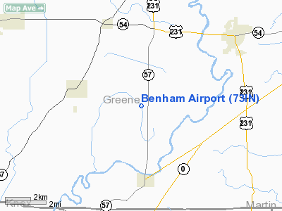
Location: |
Greene County, IN |
|
Magnetic
Variation: |
01W (1990) |
Owner & Manager
|
Ownership: |
Privately
owned |
|
Owner: |
Dallas L. Benham |
|
Address: |
Rr 1 Box 109
Lyons, IN 47443 |
|
Phone
number: |
812-659-3321 |
|
Manager: |
Dallas L. Benham |
|
Address: |
Rr 1 Box 109
Lyons, IN 47443 |
|
Phone
number: |
812-659-3321 |
Airport
Operations and Facilities
|
Airport
Use: |
Private |
|
Wind indicator: |
Yes |
|
Segmented
Circle: |
No |
|
Control
Tower: |
No |
|
Sectional
chart: |
St Louis |
|
Region: |
AGL - Great Lakes |
|
Boundary
ARTCC: |
ZID - Indianapolis |
|
Tie-in
FSS: |
HUF - Terre Haute |
|
FSS Toll
Free: |
1-800-WX-BRIEF |
|
Runway Information
Runway 16/34
|
Dimension: |
1320 x 150 ft
/ 402.3 x 45.7 m |
|
Surface: |
TURF, |
|
|
Runway 16 |
Runway 34 |
|
Traffic
Pattern: |
Left |
Left |
|
Displaced
threshold: |
0.00 ft |
308.00 ft |
|
Radio Navigation
Aids
|
ID |
Type |
Name |
Ch |
Freq |
Var |
Dist |
|
DCY |
NDB |
Washington |
|
212.00 |
03W |
17.6 nm |
|
BM |
NDB |
Claye |
|
382.00 |
02W |
20.3 nm |
|
SIV |
NDB |
Sullivan |
|
326.00 |
02W |
21.4 nm |
|
BFR |
NDB |
Bedford |
|
344.00 |
02W |
28.6 nm |
|
PLX |
NDB |
Palestine |
|
391.00 |
00W |
29.0 nm |
|
OEA |
NDB |
Vincennes |
|
251.00 |
00E |
30.3 nm |
|
HU |
NDB |
Yinno |
|
245.00 |
02W |
30.3 nm |
|
RRJ |
NDB |
Oranj |
|
368.00 |
02W |
35.6 nm |
|
AJG |
NDB |
Mount Carmel |
|
524.00 |
02W |
39.6 nm |
|
FNZ |
NDB |
Ferdinand |
|
239.00 |
00E |
44.6 nm |
|
TVX |
NDB |
Greencastle |
|
521.00 |
03W |
45.5 nm |
|
EQZ |
NDB |
Captain |
|
308.00 |
02W |
49.5 nm |
|
CZB |
NDB |
Casey |
|
359.00 |
00E |
49.7 nm |
|
RSV |
VOR/DME |
Robinson |
021X |
108.40 |
02E |
29.4 nm |
|
LWV |
VOR/DME |
Lawrenceville |
025X |
108.80 |
01W |
29.9 nm |
|
HNB |
VOR/DME |
Huntingburg |
029X |
109.20 |
00E |
43.8 nm |
|
OOM |
VORTAC |
Hoosier |
039X |
110.20 |
02W |
21.6 nm |
|
TTH |
VORTAC |
Terre Haute |
100X |
115.30 |
02E |
32.5 nm |
Remarks
- 125
FT EITHER SIDE OF CNTRLN & 200 FT AT ENDS OF RY REMAIN OBSTN FREE:
OBSTNS BE REMOVED/LOWERED OR THRS DSPLCD TO PRVD 20:1 APCH SLOPE.
Based Aircraft
|
Aircraft
based on field: |
1 |
|
Single Engine
Airplanes: |
1 |
Benham Airport
Address:
Greene County, IN
Tel:
812-659-3321
Images
and information placed above are from
http://www.airport-data.com/airport/73IN/
We
thank them for the data!
| General
Info |
| Country |
United
States |
| State |
INDIANA
|
| FAA ID |
73IN |
| Latitude |
38-58-36.000N
|
| Longitude |
087-01-21.000W
|
| Elevation |
500 feet
|
| Near City |
LYONS
|
We don't guarantee the information is fresh and accurate. The data may
be wrong or outdated.
For more up-to-date information please refer to other sources.
|
|


