 |
|
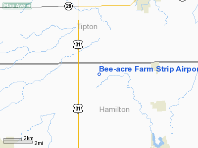
Bee-acre Farm Strip Airport |
Location
& QuickFacts
|
FAA
Information Effective: |
2007-12-20 |
|
Airport
Identifier: |
99IN |
|
Airport
Status: |
Operational |
|
Longitude/Latitude: |
086-06-01.9590W/40-12-22.1330N
-86.100544/40.206148 (Estimated) |
|
Elevation: |
885 ft / 269.75 m (Estimated) |
|
Land: |
0 acres |
|
From nearest
city: |
5 nautical miles W of Atlanta, IN |
|
Location: |
Hamilton County, IN |
|
Magnetic
Variation: |
02W (1985) |
Owner
& Manager
|
Ownership: |
Privately
owned |
|
Owner: |
William E. Baker |
|
Address: |
4412 E. 28th St.
Atlanta,
IN 46031 |
|
Phone
number: |
317-292-2382 |
|
Manager: |
William E. Baker |
|
Address: |
Route 2, Box 233
Atlanta, IN 46031 |
|
Phone
number: |
317-292-2382 |
Airport
Operations and Facilities
|
Airport
Use: |
Private |
|
Segmented
Circle: |
No |
|
Control
Tower: |
No |
|
Landing
fee charge: |
No |
|
Sectional
chart: |
Chicago |
|
Region: |
AGL - Great Lakes |
|
Boundary
ARTCC: |
ZAU - Chicago |
|
Tie-in
FSS: |
HUF - Terre Haute |
|
FSS on
Airport: |
No |
|
FSS Toll
Free: |
1-800-WX-BRIEF |
|
Runway Information
Runway 09/27
|
Dimension: |
1400 x 75 ft
/ 426.7 x 22.9 m |
|
Surface: |
TURF, |
|
|
Runway 09 |
Runway 27 |
|
Traffic
Pattern: |
Left |
Left |
|
Radio Navigation
Aids
|
ID |
Type |
Name |
Ch |
Freq |
Var |
Dist |
|
UMP |
NDB |
Metropolitan |
|
338.00 |
03W |
16.3 nm |
|
HZP |
NDB |
Zionsville |
|
248.00 |
03W |
17.4 nm |
|
FKR |
NDB |
Frankfort |
|
278.00 |
02W |
21.6 nm |
|
AI |
NDB |
Video |
|
371.00 |
03W |
28.3 nm |
|
GGP |
NDB |
Logansport |
|
263.00 |
01W |
32.7 nm |
|
HFY |
NDB |
Greenwood |
|
398.00 |
02W |
34.5 nm |
|
IWH |
NDB |
Wabash |
|
329.00 |
03W |
36.3 nm |
|
CFJ |
NDB |
Crawfordsville |
|
388.00 |
02W |
39.9 nm |
|
UWL |
NDB |
New Castle |
|
385.00 |
02W |
41.0 nm |
|
MCX |
NDB |
White County |
|
377.00 |
03W |
42.8 nm |
|
TVX |
NDB |
Greencastle |
|
521.00 |
03W |
43.9 nm |
|
HHG |
NDB |
Huntington |
|
417.00 |
03W |
48.7 nm |
|
MZZ |
VOR/DME |
Marion |
023X |
108.60 |
03W |
25.9 nm |
|
MIE |
VOR/DME |
Muncie |
091X |
114.40 |
03W |
32.5 nm |
|
OKK |
VORTAC |
Kokomo |
082X |
113.50 |
00E |
19.4 nm |
|
GUS |
VORTAC |
Grissom |
21Y |
108.45 |
02W |
26.5 nm |
|
VHP |
VORTAC |
Brickyard |
110X |
116.30 |
01E |
26.5 nm |
|
SHB |
VORTAC |
Shelbyville |
057X |
112.00 |
01E |
36.8 nm |
|
BVT |
VORTAC |
Boiler |
098X |
115.10 |
01E |
49.1 nm |
|
IND |
VOT |
Indianapolis Intl |
|
109.60 |
|
30.2 nm |
Remarks
- OWNER
DOES NOT DESIRE CHARTING.
- FILED
FOR RECORD PURPOSES ONLY.
Based Aircraft
|
Aircraft
based on field: |
1 |
|
Single Engine
Airplanes: |
1 |
Bee-acre Farm Strip Airport
Address:
Hamilton County, IN
Tel:
317-292-2382
Images
and information placed above are from
http://www.airport-data.com/airport/99IN/
We
thank them for the data!
| General
Info |
| Country |
United
States |
| State |
INDIANA
|
| FAA ID |
99IN |
| Latitude |
40-12-22.133N
|
| Longitude |
086-06-01.959W
|
| Elevation |
885 feet
|
| Near City |
ATLANTA
|
We don't guarantee the information is fresh and accurate. The data may
be wrong or outdated.
For more up-to-date information please refer to other sources.
|
|


