 |
|
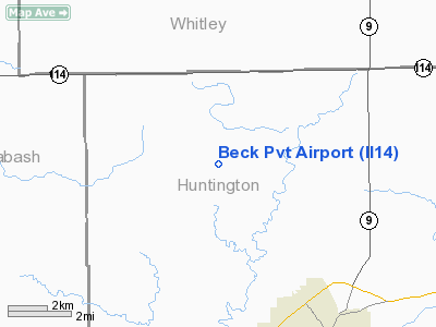
Location
& QuickFacts
|
FAA
Information Effective: |
2007-12-20 |
|
Airport
Identifier: |
II14 |
|
Airport
Status: |
Operational |
|
Longitude/Latitude: |
085-33-44.9240W/40-57-40.1630N
-85.562479/40.961156 (Estimated) |
|
Elevation: |
840 ft / 256.03 m (Estimated) |
|
Land: |
0 acres |
|
From nearest
city: |
7 nautical miles NW of Huntington, IN |
|
Location: |
Huntington County, IN |
|
Magnetic
Variation: |
03W (1985) |
Owner
& Manager
|
Ownership: |
Privately
owned |
|
Owner: |
Max R. Beck |
|
Address: |
9018 N Goshen Road
Huntington,
IN 46750 |
|
Phone
number: |
219-344-1134 |
|
Manager: |
Max R. Beck |
|
Address: |
9018 N Goshen Road
Huntington,
IN 46750 |
|
Phone
number: |
219-344-1134 |
Airport Operations
and Facilities
|
Airport
Use: |
Private |
|
Wind indicator: |
Yes |
|
Segmented
Circle: |
No |
|
Control
Tower: |
No |
|
Landing
fee charge: |
No |
|
Sectional
chart: |
Chicago |
|
Region: |
AGL - Great Lakes |
|
Boundary
ARTCC: |
ZAU - Chicago |
|
Tie-in
FSS: |
HUF - Terre Haute |
|
FSS on
Airport: |
No |
|
FSS Toll
Free: |
1-800-WX-BRIEF |
|
Runway Information
Runway 09/27
|
Dimension: |
1900 x 50 ft
/ 579.1 x 15.2 m |
|
Surface: |
TURF, |
|
|
Runway 09 |
Runway 27 |
|
Traffic
Pattern: |
Left |
Left |
|
Obstruction: |
|
30 ft plines, 50.0 ft from runway |
|
Radio Navigation
Aids
|
ID |
Type |
Name |
Ch |
Freq |
Var |
Dist |
|
HHG |
NDB |
Huntington |
|
417.00 |
03W |
7.8 nm |
|
IWH |
NDB |
Wabash |
|
329.00 |
03W |
16.0 nm |
|
RCR |
NDB |
Rochester |
|
216.00 |
03W |
29.2 nm |
|
GGP |
NDB |
Logansport |
|
263.00 |
01W |
39.9 nm |
|
CPB |
NDB |
Culver |
|
391.00 |
01W |
40.3 nm |
|
PLD |
NDB |
Portland |
|
257.00 |
03W |
40.3 nm |
|
VFU |
NDB |
Stanley |
|
411.00 |
05W |
43.5 nm |
|
ANQ |
NDB |
Angola |
|
347.00 |
05W |
46.1 nm |
|
RWN |
NDB |
Winamac/dcmsnd |
|
335.00 |
00W |
47.9 nm |
|
OLK |
VOR |
Wolf Lake |
|
110.40 |
03W |
17.4 nm |
|
MZZ |
VOR/DME |
Marion |
023X |
108.60 |
03W |
28.6 nm |
|
MIE |
VOR/DME |
Muncie |
091X |
114.40 |
03W |
44.2 nm |
|
FWA |
VORTAC |
Fort Wayne |
125X |
117.80 |
00E |
17.0 nm |
|
GUS |
VORTAC |
Grissom |
21Y |
108.45 |
02W |
32.9 nm |
|
OKK |
VORTAC |
Kokomo |
082X |
113.50 |
00E |
34.5 nm |
|
GSH |
VORTAC |
Goshen |
084X |
113.70 |
00E |
39.9 nm |
|
FWA |
VOT |
Fort Wayne Baer |
|
111.00 |
|
16.9 nm |
Remarks
- FILED
FOR RECORD PURPOSES ONLY.
Based Aircraft
|
Aircraft
based on field: |
1 |
|
Single Engine
Airplanes: |
1 |
Beck Private
Airport
Address:
Huntington County, IN
Tel:
219-344-1134
Images
and information placed above are from
http://www.airport-data.com/airport/II14/
We
thank them for the data!
| General
Info |
| Country |
United
States |
| State |
INDIANA
|
| FAA ID |
II14 |
| Latitude |
40-57-40.163N
|
| Longitude |
085-33-44.924W
|
| Elevation |
840 feet
|
| Near City |
HUNTINGTON
|
We don't guarantee the information is fresh and accurate. The data may
be wrong or outdated.
For more up-to-date information please refer to other sources.
|
|


