 |
|
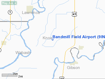
Location
& QuickFacts
|
FAA
Information Effective: |
2007-12-20 |
|
Airport
Identifier: |
9IN4 |
|
Airport
Status: |
Operational |
|
Longitude/Latitude: |
087-35-31.0000W/38-32-03.0000N
-87.591944/38.534167 (Estimated) |
|
Elevation: |
400 ft / 121.92 m (Estimated) |
|
Land: |
0 acres |
|
From nearest
city: |
3 nautical miles WN of Decker, IN |
|
Location: |
Knox County, IN |
|
Magnetic
Variation: |
() |
Owner
& Manager
|
Ownership: |
Privately
owned |
|
Owner: |
John K Snider |
|
Address: |
10000 S Horrall Road
Vincennes,
IN 47591 |
|
Phone
number: |
812-882-7515 |
|
Manager: |
John K Snider |
|
Address: |
10000 S Horrall Road
Vincennes,
IN 47591 |
|
Phone
number: |
812-882-7515 |
Airport Operations
and Facilities
|
Airport
Use: |
Private |
|
Control
Tower: |
No |
|
Sectional
chart: |
St Louis |
|
Region: |
AGL - Great Lakes |
|
Boundary
ARTCC: |
ZID - Indianapolis |
|
Tie-in
FSS: |
HUF - Terre Haute |
|
FSS Toll
Free: |
1-800-WX-BRIEF |
|
Runway Information
Runway 18/36
|
Dimension: |
2000 x 100 ft
/ 609.6 x 30.5 m |
|
Surface: |
TURF, |
|
|
Runway 18 |
Runway 36 |
|
Traffic
Pattern: |
Left |
Left |
|
Obstruction: |
30 ft pline, 667.0 ft from runway |
|
|
Radio Navigation
Aids
|
ID |
Type |
Name |
Ch |
Freq |
Var |
Dist |
|
AJG |
NDB |
Mount Carmel |
|
524.00 |
02W |
7.9 nm |
|
OEA |
NDB |
Vincennes |
|
251.00 |
00E |
9.6 nm |
|
DCY |
NDB |
Washington |
|
212.00 |
03W |
23.7 nm |
|
PLX |
NDB |
Palestine |
|
391.00 |
00W |
28.9 nm |
|
OLY |
NDB |
Olney |
|
272.00 |
00W |
29.4 nm |
|
PDW |
NDB |
Evansville |
|
284.00 |
00E |
29.8 nm |
|
SIV |
NDB |
Sullivan |
|
326.00 |
02W |
35.5 nm |
|
CUL |
NDB |
Carmi |
|
332.00 |
01W |
36.3 nm |
|
FNZ |
NDB |
Ferdinand |
|
239.00 |
00E |
39.5 nm |
|
FWC |
NDB |
Wayne County |
|
257.00 |
01E |
39.6 nm |
|
FOA |
NDB |
Elm River |
|
353.00 |
00E |
41.3 nm |
|
GVA |
NDB |
Geneva |
|
224.00 |
01W |
44.7 nm |
|
LWV |
VOR/DME |
Lawrenceville |
025X |
108.80 |
01W |
14.2 nm |
|
SAM |
VOR/DME |
Samsville |
113X |
116.60 |
03E |
23.4 nm |
|
RSV |
VOR/DME |
Robinson |
021X |
108.40 |
02E |
29.2 nm |
|
HNB |
VOR/DME |
Huntingburg |
029X |
109.20 |
00E |
34.5 nm |
|
PXV |
VORTAC |
Pocket City |
080X |
113.30 |
03E |
37.3 nm |
|
BIB |
VORTAC |
Bible Grove |
027X |
109.00 |
03E |
47.7 nm |
Remarks
- OWNER
DESIRES ARPT NOT BE CHARTED.
- 100
FT PLINE 1 NM N; 100 FT PLINE 2.5 NM S; 400 FT TWR 4.5 NM NNE &
250 FT TWR 4.5 NM SSE OF ARPT.
- PRVDD
CLEAR 20:1 APCHS & CLEAR OBSTACLE FREE ZONE.
Bandmill Field Airport
Address:
Knox County, IN
Tel:
812-882-7515
Images
and information placed above are from
http://www.airport-data.com/airport/9IN4/
We
thank them for the data!
We don't guarantee the information is fresh and accurate. The data may
be wrong or outdated.
For more up-to-date information please refer to other sources.
|
|


