 |
|
Location
& QuickFacts
|
FAA
Information Effective: |
2007-12-20 |
|
Airport
Identifier: |
II37 |
|
Airport
Status: |
Operational |
|
Longitude/Latitude: |
085-46-28.9210W/39-44-47.1560N
-85.774700/39.746432 (Estimated) |
|
Elevation: |
905 ft / 275.84 m (Estimated) |
|
Land: |
0 acres |
|
From nearest
city: |
3 nautical miles S of Greenfield, IN |
|
Location: |
Hancock County, IN |
|
Magnetic
Variation: |
03W (1985) |
Owner
& Manager
|
Ownership: |
Privately
owned |
|
Owner: |
William J. Arthur |
|
Address: |
1162 E. 300 S. Rd
Greenfield, IN 46140 |
|
Phone
number: |
317-462-3280 |
|
Manager: |
William J. Arthur |
|
Address: |
1162 E. 300 S. Rd
Greenfield, IN 46140 |
|
Phone
number: |
317-462-3280 |
Airport Operations
and Facilities
|
Airport
Use: |
Private
PERSONAL USE. |
|
Segmented
Circle: |
No |
|
Control
Tower: |
No |
|
Sectional
chart: |
St Louis |
|
Region: |
AGL - Great Lakes |
|
Boundary
ARTCC: |
ZID - Indianapolis |
|
Tie-in
FSS: |
HUF - Terre Haute |
|
FSS Toll
Free: |
1-800-WX-BRIEF |
|
Runway Information
Runway 18/36
|
Dimension: |
1800 x 60 ft
/ 548.6 x 18.3 m |
|
Surface: |
TURF, |
|
|
Runway 18 |
Runway 36 |
|
Traffic
Pattern: |
Left |
Left |
|
Radio Navigation
Aids
|
ID |
Type |
Name |
Ch |
Freq |
Var |
Dist |
|
HFY |
NDB |
Greenwood |
|
398.00 |
02W |
16.1 nm |
|
UMP |
NDB |
Metropolitan |
|
338.00 |
03W |
17.1 nm |
|
UWL |
NDB |
New Castle |
|
385.00 |
02W |
22.5 nm |
|
AI |
NDB |
Video |
|
371.00 |
03W |
22.9 nm |
|
HZP |
NDB |
Zionsville |
|
248.00 |
03W |
24.8 nm |
|
BA |
NDB |
Clifs |
|
410.00 |
03W |
25.6 nm |
|
HLB |
NDB |
Batesville |
|
254.00 |
02W |
33.8 nm |
|
OVO |
NDB |
North Vernon |
|
374.00 |
02W |
42.6 nm |
|
TVX |
NDB |
Greencastle |
|
521.00 |
03W |
47.7 nm |
|
FKR |
NDB |
Frankfort |
|
278.00 |
02W |
48.0 nm |
|
OXD |
NDB |
Oxford |
|
282.00 |
04W |
48.2 nm |
|
MIE |
VOR/DME |
Muncie |
091X |
114.40 |
03W |
34.3 nm |
|
MZZ |
VOR/DME |
Marion |
023X |
108.60 |
03W |
45.1 nm |
|
SHB |
VORTAC |
Shelbyville |
057X |
112.00 |
01E |
7.2 nm |
|
VHP |
VORTAC |
Brickyard |
110X |
116.30 |
01E |
27.7 nm |
|
RID |
VORTAC |
Richmond |
043X |
110.60 |
03W |
43.3 nm |
|
OKK |
VORTAC |
Kokomo |
082X |
113.50 |
00E |
48.7 nm |
|
IND |
VOT |
Indianapolis Intl |
|
109.60 |
|
23.5 nm |
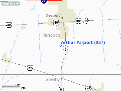
Arthur Airport
Address:
Hancock County, IN
Tel:
317-462-3280
Images
and information placed above are from
http://www.airport-data.com/airport/II37/
We
thank them for the data!
| General
Info |
| Country |
United
States |
| State |
INDIANA
|
| FAA ID |
II37 |
| Latitude |
39-44-47.156N
|
| Longitude |
085-46-28.921W
|
| Elevation |
905 feet
|
| Near City |
GREENFIELD
|
We don't guarantee the information is fresh and accurate. The data may
be wrong or outdated.
For more up-to-date information please refer to other sources.
|
|


