 |
|
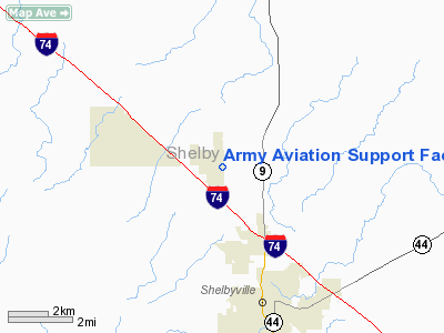
Army Aviation Support Facility Heliport |
|
|
Location
& QuickFacts
|
FAA
Information Effective: |
2007-12-20 |
|
Airport
Identifier: |
3II7 |
|
Airport
Status: |
Operational |
|
Longitude/Latitude: |
085-47-59.9260W/39-35-00.1690N
-85.799979/39.583380 (Estimated) |
|
Elevation: |
790 ft / 240.79 m (Estimated) |
|
Land: |
0 acres |
|
From nearest
city: |
3 nautical miles NW of Shelbyville, IN |
|
Location: |
Shelby County, IN |
|
Magnetic
Variation: |
02W (1985) |
Owner
& Manager
|
Ownership: |
Publicly
owned |
|
Owner: |
Indiana Army National Guard |
|
Address: |
3556 N Michigan Rd
Shelbyville,
IN 46176-9414 |
|
Phone
number: |
317-392-8200 |
|
Manager: |
Stanley R. Spreckelmeyer |
|
Address: |
3556 N Michigan Rd
Shelbyville,
IN 46176-9414 |
|
Phone
number: |
317-392-8200 |
Airport Operations
and Facilities
|
Airport Use: |
Private |
|
Wind
indicator: |
Yes |
|
Segmented
Circle: |
No |
|
Control
Tower: |
No |
|
Lighting
Schedule: |
DUSK-DAWN |
|
Landing
fee charge: |
No |
|
Sectional
chart: |
St Louis |
|
Region: |
AGL - Great Lakes |
|
Boundary
ARTCC: |
ZID - Indianapolis |
|
Tie-in
FSS: |
HUF - Terre Haute |
|
FSS on
Airport: |
No |
|
FSS Toll
Free: |
1-800-WX-BRIEF |
Airport
Communications
|
Runway Information
Helipad H1
|
Dimension: |
50 x 50 ft /
15.2 x 15.2 m |
|
Surface: |
ASPH, |
|
Edge Lights: |
Low |
|
|
Runway H1 |
Runway |
|
Traffic
Pattern: |
Left |
Left |
|
Radio Navigation
Aids
|
ID |
Type |
Name |
Ch |
Freq |
Var |
Dist |
|
HFY |
NDB |
Greenwood |
|
398.00 |
02W |
13.8 nm |
|
BA |
NDB |
Clifs |
|
410.00 |
03W |
15.7 nm |
|
UMP |
NDB |
Metropolitan |
|
338.00 |
03W |
24.2 nm |
|
UWL |
NDB |
New Castle |
|
385.00 |
02W |
28.5 nm |
|
HLB |
NDB |
Batesville |
|
254.00 |
02W |
28.8 nm |
|
HZP |
NDB |
Zionsville |
|
248.00 |
03W |
29.8 nm |
|
AI |
NDB |
Video |
|
371.00 |
03W |
32.1 nm |
|
OVO |
NDB |
North Vernon |
|
374.00 |
02W |
33.4 nm |
|
EQZ |
NDB |
Captain |
|
308.00 |
02W |
43.8 nm |
|
TVX |
NDB |
Greencastle |
|
521.00 |
03W |
47.2 nm |
|
OXD |
NDB |
Oxford |
|
282.00 |
04W |
47.5 nm |
|
BM |
NDB |
Claye |
|
382.00 |
02W |
48.8 nm |
|
MIE |
VOR/DME |
Muncie |
091X |
114.40 |
03W |
43.5 nm |
|
SHB |
VORTAC |
Shelbyville |
057X |
112.00 |
01E |
3.2 nm |
|
VHP |
VORTAC |
Brickyard |
110X |
116.30 |
01E |
29.7 nm |
|
RID |
VORTAC |
Richmond |
043X |
110.60 |
03W |
45.7 nm |
|
OOM |
VORTAC |
Hoosier |
039X |
110.20 |
02W |
46.1 nm |
|
IND |
VOT |
Indianapolis Intl |
|
109.60 |
|
23.9 nm |
Remarks
- PRVDD
INGRESS/EGRESS OPNS CONDUCTED ON BRGS 090 DEG/270 DEG FROM PAD USING
PAD AS COMPASS ROSE;INGRESS FOR ACFT USING 90 DEG ROUTE BE NORTH OF
PAD. WEST OF RWY 18/36 SHELBYVILLE ARPT; ACFT EGRESSING ON THE 90 DEG
ROUTE SHALL TURN NORTH AND REMAIN WEST OF RWY 18/36.
Based Aircraft
|
Aircraft
based on field: |
52 |
|
Multi Engine Airplanes: |
2 |
|
Helicopters: |
50 |
Army Aviation Support Facility Heliport
Address:
Shelby County, IN
Tel:
317-392-8200
Images
and information placed above are from
http://www.airport-data.com/airport/3II7/
We
thank them for the data!
| General
Info |
| Country |
United
States |
| State |
INDIANA
|
| FAA ID |
3II7 |
| Latitude |
39-35-00.169N
|
| Longitude |
085-47-59.926W
|
| Elevation |
790 feet
|
| Near City |
SHELBYVILLE
|
We don't guarantee the information is fresh and accurate. The data may
be wrong or outdated.
For more up-to-date information please refer to other sources.
|
|


