 |
|
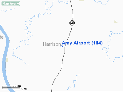
Location
& QuickFacts
|
FAA
Information Effective: |
2007-12-20 |
|
Airport
Identifier: |
1II4 |
|
Airport
Status: |
Operational |
|
Longitude/Latitude: |
086-09-43.8960W/38-07-30.2460N
-86.162193/38.125068 (Estimated) |
|
Elevation: |
665 ft / 202.69 m (Estimated) |
|
Land: |
0 acres |
|
From nearest
city: |
5 nautical miles S of Corydon, IN |
|
Location: |
Harrison County, IN |
|
Magnetic
Variation: |
02W (1990) |
Owner
& Manager
|
Ownership: |
Privately
owned |
|
Owner: |
Vernie R. Amy |
|
Address: |
1615 Lake Road S.w.
Corydon,
IN 47112 |
|
Phone
number: |
812-732-4960 |
|
Manager: |
Vernie R. Amy |
|
Address: |
1615 Lake Road S.w.
Corydon,
IN 47112 |
|
Phone
number: |
812-732-4960 |
Airport Operations
and Facilities
|
Airport
Use: |
Private |
|
Wind indicator: |
Yes |
|
Segmented
Circle: |
No |
|
Control
Tower: |
No |
|
Sectional
chart: |
St Louis |
|
Region: |
AGL - Great Lakes |
|
Boundary
ARTCC: |
ZID - Indianapolis |
|
Tie-in
FSS: |
HUF - Terre Haute |
|
FSS Toll
Free: |
1-800-WX-BRIEF |
|
Runway Information
Runway 09/27
|
Dimension: |
1050 x 60 ft
/ 320.0 x 18.3 m |
|
Surface: |
TURF, |
|
|
Runway 09 |
Runway 27 |
|
Traffic
Pattern: |
Left |
Left |
|
Radio Navigation
Aids
|
ID |
Type |
Name |
Ch |
Freq |
Var |
Dist |
|
GOI |
NDB |
Godman |
|
396.00 |
02W |
13.3 nm |
|
TEL |
NDB |
Tell City |
|
206.00 |
02W |
25.9 nm |
|
RRJ |
NDB |
Oranj |
|
368.00 |
02W |
29.7 nm |
|
FNZ |
NDB |
Ferdinand |
|
239.00 |
00E |
32.8 nm |
|
BRY |
NDB |
Bardstown/dcmsnd |
|
248.00 |
02W |
36.2 nm |
|
BFR |
NDB |
Bedford |
|
344.00 |
02W |
44.8 nm |
|
EQZ |
NDB |
Captain |
|
308.00 |
02W |
45.5 nm |
|
MYS |
VOR |
Mystic |
|
108.20 |
01W |
14.4 nm |
|
FTK |
VOR/DME |
Fort Knox |
033X |
109.60 |
01W |
15.9 nm |
|
BQM |
VOR/DME |
Bowman |
059X |
112.20 |
01W |
24.3 nm |
|
EWO |
VOR/DME |
New Hope |
045X |
110.80 |
01E |
37.6 nm |
|
HNB |
VOR/DME |
Huntingburg |
029X |
109.20 |
00E |
38.3 nm |
|
IIU |
VORTAC |
Louisville |
095X |
114.80 |
01E |
27.7 nm |
|
ABB |
VORTAC |
Nabb |
071X |
112.40 |
01E |
37.3 nm |
|
SDF |
VOT |
Louisville Standifd |
|
111.00 |
|
20.4 nm |
Remarks
- OBSTNS
REMOVED/LOWERED OR THR DSPLCD TO PRVD 20:1 APCH SLOPE; 125 FT EITHER
SIDE OF CNTRLN & 200 FT EACH END OF RY BE CLEAR OF OBSTNS.
Based Aircraft
|
Aircraft
based on field: |
1 |
|
Single Engine
Airplanes: |
1 |
Amy Airport
Address:
Harrison County, IN
Tel:
812-732-4960
Images
and information placed above are from
http://www.airport-data.com/airport/1II4/
We
thank them for the data!
| General
Info |
| Country |
United
States |
| State |
INDIANA
|
| FAA ID |
1II4 |
| Latitude |
38-07-30.246N
|
| Longitude |
086-09-43.896W
|
| Elevation |
665 feet
|
| Near City |
CORYDON
|
We don't guarantee the information is fresh and accurate. The data may
be wrong or outdated.
For more up-to-date information please refer to other sources.
|
|


