 |
|
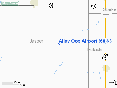
Location
& QuickFacts
|
FAA
Information Effective: |
2007-12-20 |
|
Airport
Identifier: |
68IN |
|
Airport
Status: |
Operational |
|
Longitude/Latitude: |
086-59-51.0800W/41-07-17.1400N
-86.997522/41.121428 (Estimated) |
|
Elevation: |
715 ft / 217.93 m (Estimated) |
|
Land: |
0 acres |
|
From nearest
city: |
6 nautical miles SE of Wheatfield, IN |
|
Location: |
Jasper County, IN |
|
Magnetic
Variation: |
01W (1990) |
Owner
& Manager
|
Ownership: |
Privately
owned |
|
Owner: |
Alan Boushea |
|
Address: |
Rr 2 Box 458d
Wheatfield, IN 46392 |
|
Phone
number: |
219-843-0625 |
|
Manager: |
Alan Boushea |
|
Address: |
Rr 2 Box 458d
Wheatfield, IN 46392 |
|
Phone
number: |
219-843-0625 |
Airport Operations
and Facilities
|
Airport
Use: |
Private
PERSONAL USE. |
|
Wind indicator: |
Yes |
|
Segmented
Circle: |
No |
|
Control
Tower: |
No |
|
Sectional
chart: |
Chicago |
|
Region: |
AGL - Great Lakes |
|
Boundary
ARTCC: |
ZAU - Chicago |
|
Tie-in
FSS: |
HUF - Terre Haute |
|
FSS on
Airport: |
No |
|
FSS Toll
Free: |
1-800-WX-BRIEF |
|
Runway Information
Runway 09/27
|
Dimension: |
1200 x 50 ft
/ 365.8 x 15.2 m |
|
Surface: |
TURF, |
|
|
Runway 09 |
Runway 27 |
|
Traffic
Pattern: |
Left |
Left |
|
Obstruction: |
50 ft trees, 300.0 ft from runway |
20 ft trees, 100.0 ft from runway |
|
Radio Navigation
Aids
|
ID |
Type |
Name |
Ch |
Freq |
Var |
Dist |
|
RZL |
NDB |
Rensselaer |
|
362.00 |
02W |
13.5 nm |
|
RWN |
NDB |
Winamac/dcmsnd |
|
335.00 |
00W |
17.9 nm |
|
VP |
NDB |
Sedly |
|
212.00 |
02W |
20.5 nm |
|
IUL |
NDB |
La Porte |
|
356.00 |
03W |
24.9 nm |
|
MCX |
NDB |
White County |
|
377.00 |
03W |
26.9 nm |
|
CPB |
NDB |
Culver |
|
391.00 |
01W |
28.3 nm |
|
MGC |
NDB |
Michigan City |
|
203.00 |
01W |
36.1 nm |
|
RCR |
NDB |
Rochester |
|
216.00 |
03W |
36.7 nm |
|
GGP |
NDB |
Logansport |
|
263.00 |
01W |
37.7 nm |
|
MX |
NDB |
Kedzi |
|
248.00 |
01W |
48.6 nm |
|
OXI |
VOR/DME |
Knox |
103X |
115.60 |
00E |
19.8 nm |
|
IKK |
VOR/DME |
Kankakee |
053X |
111.60 |
00E |
38.7 nm |
|
BVT |
VORTAC |
Boiler |
098X |
115.10 |
01E |
34.1 nm |
|
CGT |
VORTAC |
Chicago Heights |
089X |
114.20 |
02E |
34.9 nm |
|
EON |
VORTAC |
Peotone |
079X |
113.20 |
02E |
37.0 nm |
|
GUS |
VORTAC |
Grissom |
21Y |
108.45 |
02W |
47.9 nm |
|
GIJ |
VORTAC |
Gipper |
101X |
115.40 |
00E |
49.5 nm |
Remarks
- PROVIDED
OBSTRUCTIONS ARE REMOVED/LOWERED OR THR DSPLCD TO PROVIDE 20:1 APCH
CLEARANCE.
Based Aircraft
|
Aircraft
based on field: |
1 |
|
Single Engine
Airplanes: |
1 |
Alley Oop Airport
Address:
Jasper County, IN
Tel:
219-843-0625
Images
and information placed above are from
http://www.airport-data.com/airport/68IN/
We
thank them for the data!
| General
Info |
| Country |
United
States |
| State |
INDIANA
|
| FAA ID |
68IN |
| Latitude |
41-07-17.140N
|
| Longitude |
086-59-51.080W
|
| Elevation |
715 feet
|
| Near City |
WHEATFIELD
|
We don't guarantee the information is fresh and accurate. The data may
be wrong or outdated.
For more up-to-date information please refer to other sources.
|
|


