 |
|
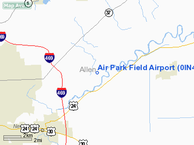
Location
& QuickFacts
|
FAA
Information Effective: |
2007-12-20 |
|
Airport
Identifier: |
0IN4 |
|
Airport
Status: |
Operational |
|
Longitude/Latitude: |
084-56-49.8770W/41-07-40.1760N
-84.947188/41.127827 (Estimated) |
|
Elevation: |
750 ft / 228.60 m (Estimated) |
|
Land: |
0 acres |
|
From nearest
city: |
4 nautical miles NW of Woodburn, IN |
|
Location: |
Allen County, IN |
|
Magnetic
Variation: |
04W (1985) |
Owner & Manager
|
Ownership: |
Privately
owned |
|
Owner: |
Louis Delagrange |
|
Address: |
Box 326
New
Haven, IN 46774 |
|
Phone
number: |
219-632-4811 |
|
Address: |
|
Airport Operations
and Facilities
|
Airport Use: |
Private |
|
Wind
indicator: |
Yes |
|
Segmented
Circle: |
No |
|
Control
Tower: |
No |
|
Landing
fee charge: |
No |
|
Sectional
chart: |
Detroit |
|
Region: |
AGL - Great Lakes |
|
Boundary
ARTCC: |
ZAU - Chicago |
|
Tie-in
FSS: |
HUF - Terre Haute |
|
FSS on
Airport: |
No |
|
FSS Toll
Free: |
1-800-WX-BRIEF |
Airport Services
|
Airframe
Repair: |
NONE |
|
Power
Plant Repair: |
NONE |
|
Runway Information
Runway NW/SE
|
Dimension: |
2440 x 30 ft
/ 743.7 x 9.1 m |
|
Surface: |
ASPH, |
|
|
Runway NW |
Runway SE |
|
Traffic
Pattern: |
Left |
Left |
|
Radio Navigation
Aids
|
ID |
Type |
Name |
Ch |
Freq |
Var |
Dist |
|
VFU |
NDB |
Stanley |
|
411.00 |
05W |
22.0 nm |
|
DFI |
NDB |
Defiance |
|
246.00 |
05W |
26.6 nm |
|
HHG |
NDB |
Huntington |
|
417.00 |
03W |
28.6 nm |
|
BYN |
NDB |
Bryan |
|
260.00 |
04W |
30.3 nm |
|
ANQ |
NDB |
Angola |
|
347.00 |
05W |
31.4 nm |
|
PLD |
NDB |
Portland |
|
257.00 |
03W |
40.6 nm |
|
CQA |
NDB |
Lakefield |
|
205.00 |
04W |
42.5 nm |
|
IWH |
NDB |
Wabash |
|
329.00 |
03W |
44.4 nm |
|
PDR |
NDB |
Ottawa |
|
233.00 |
05W |
44.4 nm |
|
IRS |
NDB |
Sturgis |
|
382.00 |
04W |
46.7 nm |
|
USE |
NDB |
Fulton |
|
375.00 |
05W |
46.8 nm |
|
LYL |
NDB |
Lima |
|
362.00 |
04W |
49.1 nm |
|
OLK |
VOR |
Wolf Lake |
|
110.40 |
03W |
25.9 nm |
|
FWA |
VORTAC |
Fort Wayne |
125X |
117.80 |
00E |
14.1 nm |
|
FWA |
VOT |
Fort Wayne Baer |
|
111.00 |
|
14.3 nm |
Remarks
- RECOMMEND
THRESHOLD DISPLACEMENT NW END TO PROVIDE 20:1 APCH SLOPE OVER E/W ROAD.
Based Aircraft
|
Aircraft
based on field: |
1 |
|
Single Engine
Airplanes: |
1 |
Air Park Field Airport
Address:
Allen County, IN
Tel:
219-632-4811
Images
and information placed above are from
http://www.airport-data.com/airport/0IN4/
We
thank them for the data!
| General
Info |
| Country |
United
States |
| State |
INDIANA
|
| FAA ID |
0IN4 |
| Latitude |
41-07-40.176N
|
| Longitude |
084-56-49.877W
|
| Elevation |
750 feet
|
| Near City |
WOODBURN
|
We don't guarantee the information is fresh and accurate. The data may
be wrong or outdated.
For more up-to-date information please refer to other sources.
|
|


