 |
|
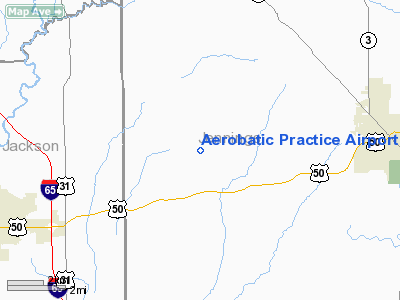
Aerobatic Practice Airport |
Location
& QuickFacts
|
FAA
Information Effective: |
2007-12-20 |
|
Airport
Identifier: |
45IN |
|
Airport
Status: |
Operational |
|
Longitude/Latitude: |
085-44-52.9000W/38-59-47.1930N
-85.748028/38.996443 (Estimated) |
|
Elevation: |
681 ft / 207.57 m (Estimated) |
|
Land: |
0 acres |
|
From nearest
city: |
6 nautical miles W of North Vernon, IN |
|
Location: |
Jennings County, IN |
|
Magnetic
Variation: |
02W (1990) |
Owner
& Manager
|
Ownership: |
Privately
owned |
|
Owner: |
Gregory Ernest Green |
|
Address: |
325 N Co. Rd 750w
North Vernon, IN 47265 |
|
Phone
number: |
812-346-6208 |
|
Manager: |
Gregory Ernest Green
812-522-5409 |
|
Address: |
325 N Co. Rd 750w
North Vernon, IN 47265 |
|
Phone
number: |
812-346-6208 |
Airport Operations
and Facilities
|
Airport
Use: |
Private |
|
Wind indicator: |
Yes |
|
Segmented
Circle: |
No |
|
Control
Tower: |
No |
|
Sectional
chart: |
St Louis |
|
Region: |
AGL - Great Lakes |
|
Boundary
ARTCC: |
ZID - Indianapolis |
|
Tie-in
FSS: |
HUF - Terre Haute |
|
FSS Toll
Free: |
1-800-WX-BRIEF |
|
Runway Information
Runway 17/35
|
Dimension: |
2000 x 50 ft
/ 609.6 x 15.2 m |
|
Surface: |
TURF, |
|
|
Runway 17 |
Runway 35 |
|
Traffic
Pattern: |
Left |
Left |
|
Displaced
threshold: |
500.00 ft |
0.00 ft |
|
Obstruction: |
40 ft silo, 5280.0 ft from runway |
|
|
Radio Navigation
Aids
|
ID |
Type |
Name |
Ch |
Freq |
Var |
Dist |
|
OVO |
NDB |
North Vernon |
|
374.00 |
02W |
7.6 nm |
|
EQZ |
NDB |
Captain |
|
308.00 |
02W |
13.1 nm |
|
IMS |
NDB |
Madison |
|
404.00 |
03W |
19.5 nm |
|
BA |
NDB |
Clifs |
|
410.00 |
03W |
19.8 nm |
|
HLB |
NDB |
Batesville |
|
254.00 |
02W |
31.2 nm |
|
BFR |
NDB |
Bedford |
|
344.00 |
02W |
33.6 nm |
|
BM |
NDB |
Claye |
|
382.00 |
02W |
39.9 nm |
|
HFY |
NDB |
Greenwood |
|
398.00 |
02W |
41.4 nm |
|
UR |
NDB |
Burln |
|
321.00 |
04W |
45.6 nm |
|
RRJ |
NDB |
Oranj |
|
368.00 |
02W |
46.1 nm |
|
BQM |
VOR/DME |
Bowman |
059X |
112.20 |
01W |
46.2 nm |
|
ABB |
VORTAC |
Nabb |
071X |
112.40 |
01E |
25.1 nm |
|
SHB |
VORTAC |
Shelbyville |
057X |
112.00 |
01E |
38.4 nm |
|
OOM |
VORTAC |
Hoosier |
039X |
110.20 |
02W |
41.3 nm |
|
CVG |
VORTAC |
Cincinnati |
120X |
117.30 |
04W |
48.8 nm |
|
SDF |
VOT |
Louisville Standifd |
|
111.00 |
|
49.2 nm |
Based Aircraft
|
Aircraft
based on field: |
2 |
|
Single Engine
Airplanes: |
2 |
Aerobatic Practice Airport
Address:
Jennings County, IN
Tel:
812-346-6208
Images
and information placed above are from
http://www.airport-data.com/airport/45IN/
We
thank them for the data!
| General
Info |
| Country |
United
States |
| State |
INDIANA
|
| FAA ID |
45IN |
| Latitude |
38-59-47.193N
|
| Longitude |
085-44-52.900W
|
| Elevation |
681 feet
|
| Near City |
NORTH
VERNON |
We don't guarantee the information is fresh and accurate. The data may
be wrong or outdated.
For more up-to-date information please refer to other sources.
|
|


