 |
|
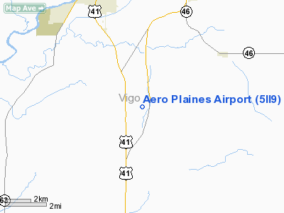
Location
& QuickFacts
|
FAA
Information Effective: |
2007-12-20 |
|
Airport
Identifier: |
5II9 |
|
Airport
Status: |
Operational |
|
Longitude/Latitude: |
087-22-24.0680W/39-21-10.1390N
-87.373352/39.352816 (Estimated) |
|
Elevation: |
570 ft / 173.74 m (Estimated) |
|
Land: |
16 acres |
|
From nearest
city: |
1 nautical miles S of Youngstown, IN |
|
Location: |
Vigo County, IN |
|
Magnetic
Variation: |
01W (1985) |
Owner
& Manager
|
Ownership: |
Privately
owned |
|
Owner: |
J. R. Gibson & D. D. Peterson |
|
Address: |
25 Brookside Drive
Terre
Haute, IN 47802 |
|
Phone
number: |
812-232-4912 |
|
Manager: |
J.r. (jim) Gibson |
|
Address: |
25 Brookside Drive
Terre
Haute, IN 47802 |
|
Phone
number: |
812-232-4912 |
Airport Operations
and Facilities
|
Airport
Use: |
Private |
|
Wind indicator: |
Yes |
|
Segmented
Circle: |
No |
|
Control
Tower: |
No |
|
Landing
fee charge: |
No |
|
Sectional
chart: |
St Louis |
|
Region: |
AGL - Great Lakes |
|
Boundary
ARTCC: |
ZID - Indianapolis |
|
Tie-in
FSS: |
HUF - Terre Haute |
|
FSS on
Airport: |
No |
|
FSS Toll
Free: |
1-800-WX-BRIEF |
|
Runway Information
Runway 09/27
|
Dimension: |
2450 x 200 ft
/ 746.8 x 61.0 m |
|
Surface: |
TURF, |
|
|
Runway 09 |
Runway 27 |
|
Traffic
Pattern: |
Left |
Left |
|
Displaced
threshold: |
480.00 ft |
500.00 ft |
|
Obstruction: |
30 ft pline, 120.0 ft from runway |
25 ft pline, 0.0 ft from runway |
|
Radio Navigation
Aids
|
ID |
Type |
Name |
Ch |
Freq |
Var |
Dist |
|
HU |
NDB |
Yinno |
|
245.00 |
02W |
2.4 nm |
|
SIV |
NDB |
Sullivan |
|
326.00 |
02W |
14.8 nm |
|
PLX |
NDB |
Palestine |
|
391.00 |
00W |
23.9 nm |
|
PRG |
NDB |
Paris |
|
341.00 |
01E |
25.0 nm |
|
CZB |
NDB |
Casey |
|
359.00 |
00E |
29.4 nm |
|
TVX |
NDB |
Greencastle |
|
521.00 |
03W |
34.1 nm |
|
MT |
NDB |
Zebre |
|
347.00 |
00E |
37.6 nm |
|
BM |
NDB |
Claye |
|
382.00 |
02W |
40.2 nm |
|
OEA |
NDB |
Vincennes |
|
251.00 |
00E |
40.7 nm |
|
DCY |
NDB |
Washington |
|
212.00 |
03W |
41.0 nm |
|
CFJ |
NDB |
Crawfordsville |
|
388.00 |
02W |
43.3 nm |
|
AJG |
NDB |
Mount Carmel |
|
524.00 |
02W |
47.5 nm |
|
HMJ |
NDB |
Homer |
|
281.00 |
01E |
48.6 nm |
|
RSV |
VOR/DME |
Robinson |
021X |
108.40 |
02E |
23.9 nm |
|
LWV |
VOR/DME |
Lawrenceville |
025X |
108.80 |
01W |
36.7 nm |
|
MTO |
VOR/DME |
Mattoon |
031X |
109.40 |
03E |
43.0 nm |
|
TTH |
VORTAC |
Terre Haute |
100X |
115.30 |
02E |
10.0 nm |
|
OOM |
VORTAC |
Hoosier |
039X |
110.20 |
02W |
37.6 nm |
Remarks
- RYS
MARKED WITH LARGE YELLOW BUCKETS.
Based Aircraft
|
Aircraft
based on field: |
2 |
|
Single Engine
Airplanes: |
2 |
Aero Plaines Airport
Address:
Vigo County, IN
Tel:
812-232-4912
Images
and information placed above are from
http://www.airport-data.com/airport/5II9/
We
thank them for the data!
| General
Info |
| Country |
United
States |
| State |
INDIANA
|
| FAA ID |
5II9 |
| Latitude |
39-21-10.139N
|
| Longitude |
087-22-24.068W
|
| Elevation |
570 feet
|
| Near City |
YOUNGSTOWN
|
We don't guarantee the information is fresh and accurate. The data may
be wrong or outdated.
For more up-to-date information please refer to other sources.
|
|


