 |
|
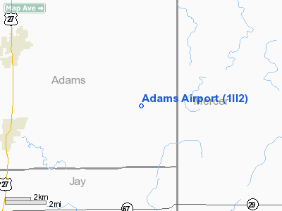
Location
& QuickFacts
|
FAA
Information Effective: |
2007-12-20 |
|
Airport
Identifier: |
1II2 |
|
Airport
Status: |
Operational |
|
Longitude/Latitude: |
084-50-05.3700W/40-36-56.9670N
-84.834825/40.615824 (Estimated) |
|
Elevation: |
850 ft / 259.08 m (Estimated) |
|
Land: |
0 acres |
|
From nearest
city: |
7 nautical miles E of Geneva, IN |
|
Location: |
Adams County, IN |
|
Magnetic
Variation: |
03W (1985) |
Owner & Manager
|
Ownership: |
Privately
owned |
|
Owner: |
Mr. Glenn W. Adams |
|
Address: |
8925 S 550 E
Berne, IN 46711 |
|
Phone
number: |
219-589-3357 |
|
Manager: |
Glenn W Adams |
|
Address: |
8925 S 550 E
Berne, IN 46711 |
Airport
Operations and Facilities
|
Airport
Use: |
Private |
|
Wind indicator: |
Yes |
|
Segmented
Circle: |
No |
|
Control
Tower: |
No |
|
Sectional
chart: |
Detroit |
|
Region: |
AGL - Great Lakes |
|
Boundary
ARTCC: |
ZID - Indianapolis |
|
Tie-in
FSS: |
HUF - Terre Haute |
|
FSS on
Airport: |
No |
|
FSS Toll
Free: |
1-800-WX-BRIEF |
|
Runway Information
Runway E/W
|
Dimension: |
2000 x 150 ft
/ 609.6 x 45.7 m |
|
Surface: |
TURF, |
|
|
Runway E |
Runway W |
|
Traffic
Pattern: |
Left |
Left |
|
Radio Navigation
Aids
|
ID |
Type |
Name |
Ch |
Freq |
Var |
Dist |
|
PLD |
NDB |
Portland |
|
257.00 |
03W |
11.9 nm |
|
CQA |
NDB |
Lakefield |
|
205.00 |
04W |
14.7 nm |
|
VFU |
NDB |
Stanley |
|
411.00 |
05W |
17.9 nm |
|
VES |
NDB |
Versailles |
|
356.00 |
04W |
28.5 nm |
|
HHG |
NDB |
Huntington |
|
417.00 |
03W |
32.1 nm |
|
LYL |
NDB |
Lima |
|
362.00 |
04W |
37.4 nm |
|
IWH |
NDB |
Wabash |
|
329.00 |
03W |
44.8 nm |
|
AI |
NDB |
Video |
|
371.00 |
03W |
45.1 nm |
|
PDR |
NDB |
Ottawa |
|
233.00 |
05W |
46.4 nm |
|
DFI |
NDB |
Defiance |
|
246.00 |
05W |
47.0 nm |
|
EDJ |
NDB |
Bellefontaine |
|
242.00 |
05W |
48.9 nm |
|
UWL |
NDB |
New Castle |
|
385.00 |
02W |
49.5 nm |
|
AOH |
VOR |
Allen County |
|
108.40 |
04W |
39.9 nm |
|
OLK |
VOR |
Wolf Lake |
|
110.40 |
03W |
48.4 nm |
|
MIE |
VOR/DME |
Muncie |
091X |
114.40 |
03W |
34.2 nm |
|
MZZ |
VOR/DME |
Marion |
023X |
108.60 |
03W |
39.3 nm |
|
DQN |
VOR/DME |
Dayton |
092X |
114.50 |
01W |
41.2 nm |
|
FWA |
VORTAC |
Fort Wayne |
125X |
117.80 |
00E |
27.1 nm |
|
ROD |
VORTAC |
Rosewood |
122X |
117.50 |
05W |
41.2 nm |
|
FWA |
VOT |
Fort Wayne Baer |
|
111.00 |
|
27.2 nm |
Remarks
- PRVDD
OBSTN IN RY APCH SLOPE SFC BE REMOVED/LOWERED OR RWY THR BE DSPLCD &
MKD TO PROVIDE MINIMUM 20:1 APCH SFC CLNC OVER OBSTN; AREA 125' EITHER
SIDE OF RY BE CLEAR OF ALL OBSTN.
Adams Airport
Address:
Adams County, IN
Tel:
219-589-3357
Images
and information placed above are from
http://www.airport-data.com/airport/1II2/
We
thank them for the data!
| General
Info |
| Country |
United
States |
| State |
INDIANA
|
| FAA ID |
1II2 |
| Latitude |
40-36-56.967N
|
| Longitude |
084-50-05.370W
|
| Elevation |
850 feet
|
| Near City |
GENEVA
|
We don't guarantee the information is fresh and accurate. The data may
be wrong or outdated.
For more up-to-date information please refer to other sources.
|
|


