 |
|
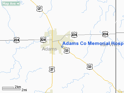
Adams Company Memorial Hospital Heliport |
Location
& QuickFacts
|
FAA
Information Effective: |
2007-12-20 |
|
Airport
Identifier: |
56II |
|
Airport
Status: |
Operational |
|
Longitude/Latitude: |
084-54-57.8760W/40-49-17.1700N
-84.916077/40.821436 (Estimated) |
|
Elevation: |
799 ft / 243.54 m (Estimated) |
|
Land: |
0 acres |
|
From nearest
city: |
0 nautical miles SE of Decatur, IN |
|
Location: |
Adams County, IN |
|
Magnetic
Variation: |
04W (1990) |
Owner & Manager
|
Ownership: |
Publicly
owned |
|
Owner: |
Mark E. Adams |
|
Address: |
805 High Street
Decatur,
IN 46733 |
|
Phone
number: |
219-724-2145 |
|
Manager: |
Mark E. Adams |
|
Address: |
805 High Street
Decatur,
IN 46733 |
|
Phone
number: |
219-724-2145 |
Airport
Operations and Facilities
|
Airport
Use: |
Private
MEDICAL USE. |
|
Wind indicator: |
Yes |
|
Segmented
Circle: |
No |
|
Control
Tower: |
No |
|
Sectional
chart: |
Detroit |
|
Region: |
AGL - Great Lakes |
|
Boundary
ARTCC: |
ZAU - Chicago |
|
Tie-in
FSS: |
HUF - Terre Haute |
|
FSS Toll
Free: |
1-800-WX-BRIEF |
|
Runway Information
Helipad H1
|
Dimension: |
40 x 40 ft /
12.2 x 12.2 m |
|
Surface: |
CONC, |
|
|
Runway H1 |
Runway |
|
Traffic
Pattern: |
Left |
Left |
|
Radio Navigation
Aids
|
ID |
Type |
Name |
Ch |
Freq |
Var |
Dist |
|
VFU |
NDB |
Stanley |
|
411.00 |
05W |
14.0 nm |
|
PLD |
NDB |
Portland |
|
257.00 |
03W |
22.3 nm |
|
HHG |
NDB |
Huntington |
|
417.00 |
03W |
25.0 nm |
|
CQA |
NDB |
Lakefield |
|
205.00 |
04W |
26.0 nm |
|
DFI |
NDB |
Defiance |
|
246.00 |
05W |
38.0 nm |
|
IWH |
NDB |
Wabash |
|
329.00 |
03W |
40.3 nm |
|
VES |
NDB |
Versailles |
|
356.00 |
04W |
41.1 nm |
|
LYL |
NDB |
Lima |
|
362.00 |
04W |
41.3 nm |
|
BYN |
NDB |
Bryan |
|
260.00 |
04W |
44.5 nm |
|
PDR |
NDB |
Ottawa |
|
233.00 |
05W |
44.5 nm |
|
ANQ |
NDB |
Angola |
|
347.00 |
05W |
49.8 nm |
|
OLK |
VOR |
Wolf Lake |
|
110.40 |
03W |
36.7 nm |
|
AOH |
VOR |
Allen County |
|
108.40 |
04W |
43.7 nm |
|
MZZ |
VOR/DME |
Marion |
023X |
108.60 |
03W |
40.0 nm |
|
MIE |
VOR/DME |
Muncie |
091X |
114.40 |
03W |
41.3 nm |
|
FWA |
VORTAC |
Fort Wayne |
125X |
117.80 |
00E |
15.6 nm |
|
FWA |
VOT |
Fort Wayne Baer |
|
111.00 |
|
15.7 nm |
Remarks
- PRVDD
ALL APCH/DEP OPS CONDUCTED IN AREA 190-235 DEGS & 270-285 DEGS.
TAKEOFF/LNDG AREA MKD & NON-OBSTRUCTING SECURITY FENCE OR HEDGE
IS PLACED ALONG SIDEWALK TO THE E; 3 TREES SW ARE TRIMMED TO HEIGHT
OF WIRES & LGT POLE W OF PAD IS REMOVED. NON-OBSTRUCTING
WIND INDICATOR IS MAINAINED.
Adams Company Memorial Hospital Heliport
Address:
Adams County, IN
Tel:
219-724-2145
Images
and information placed above are from
http://www.airport-data.com/airport/56II/
We
thank them for the data!
| General
Info |
| Country |
United
States |
| State |
INDIANA
|
| FAA ID |
56II |
| Latitude |
40-49-17.170N
|
| Longitude |
084-54-57.876W
|
| Elevation |
799 feet
|
| Near City |
DECATUR
|
We don't guarantee the information is fresh and accurate. The data may
be wrong or outdated.
For more up-to-date information please refer to other sources.
|
|


