 |
|
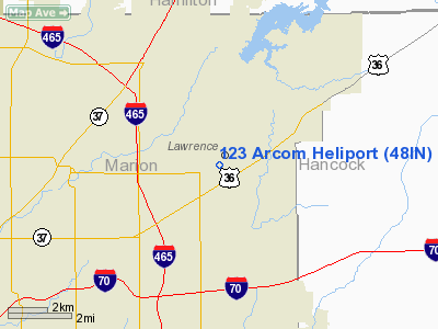
Location
& QuickFacts
|
FAA
Information Effective: |
2007-12-20 |
|
Airport
Identifier: |
48IN |
|
Airport
Status: |
Operational |
|
Longitude/Latitude: |
085-59-53.9370W/39-51-32.1430N
-85.998316/39.858929 (Estimated) |
|
Elevation: |
850 ft / 259.08 m (Estimated) |
|
Land: |
0
acres |
|
From nearest
city: |
1 nautical miles S of Indianapolis, IN |
|
Location: |
Marion County, IN |
|
Magnetic
Variation: |
02W (1985) |
Owner
& Manager
|
Ownership: |
Army owned |
|
Owner: |
Hq 123 Arcom |
|
Address: |
Po Box 16501
Fort Benjamin Harrison, IN |
|
Phone number: |
317-542-3039 |
|
Address: |
|
Airport
Operations and Facilities
|
Airport
Use: |
Private |
|
Segmented
Circle: |
No |
|
Control
Tower: |
No |
|
Sectional
chart: |
St Louis |
|
Region: |
AGL - Great Lakes |
|
Boundary
ARTCC: |
ZID - Indianapolis |
|
Tie-in FSS: |
HUF - Terre Haute |
|
FSS Toll
Free: |
1-800-WX-BRIEF |
|
Runway
Information
Helipad
H1
|
Dimension: |
350 x 275 ft /
106.7 x 83.8 m |
|
Surface: |
TURF,
|
|
|
Runway
H1 |
Runway
|
|
Traffic Pattern: |
Left |
Left |
|
Radio
Navigation Aids
|
ID |
Type |
Name |
Ch |
Freq |
Var |
Dist |
|
UMP |
NDB |
Metropolitan |
|
338.00 |
03W |
5.3
nm |
|
HZP |
NDB |
Zionsville |
|
248.00 |
03W |
12.6
nm |
|
HFY |
NDB |
Greenwood |
|
398.00 |
02W |
14.3
nm |
|
AI |
NDB |
Video |
|
371.00 |
03W |
25.8
nm |
|
UWL |
NDB |
New
Castle |
|
385.00 |
02W |
31.4
nm |
|
BA |
NDB |
Clifs |
|
410.00 |
03W |
33.3
nm |
|
FKR |
NDB |
Frankfort |
|
278.00 |
02W |
35.9
nm |
|
TVX |
NDB |
Greencastle |
|
521.00 |
03W |
38.3
nm |
|
CFJ |
NDB |
Crawfordsville |
|
388.00 |
02W |
42.9
nm |
|
HLB |
NDB |
Batesville |
|
254.00 |
02W |
46.0
nm |
|
MIE |
VOR/DME |
Muncie |
091X |
114.40 |
03W |
35.9
nm |
|
MZZ |
VOR/DME |
Marion |
023X |
108.60 |
03W |
40.9
nm |
|
SHB |
VORTAC |
Shelbyville |
057X |
112.00 |
01E |
15.8
nm |
|
VHP |
VORTAC |
Brickyard |
110X |
116.30 |
01E |
17.2
nm |
|
OKK |
VORTAC |
Kokomo |
082X |
113.50 |
00E |
40.3
nm |
|
GUS |
VORTAC |
Grissom |
21Y |
108.45 |
02W |
47.8
nm |
|
IND |
VOT |
Indianapolis Intl |
|
109.60 |
|
15.4
nm |
Remarks
- OPNS
CONDUCTED AT 180 DEGREES OR 360 DEGREES; AREA IS MARKED; WIND INDICATOR
IS MAINTAINED; NO NGT OPNSUNLESS PROPERLY LGTD; UNAUTHORIZED PERSONS
BE RESTRAINED FROM ACCESS; APPROPRIATE FIRE PROTECTION BE PROVIDED.
123 Arcom Heliport
Address: Marion
County, IN
Tel:
317-542-3039
Images
and information placed above are from
http://www.airport-data.com/airport/48IN/
We
thank them for the data!
| General
Info |
| Country |
United
States |
| State |
INDIANA
|
| FAA ID |
48IN |
| Latitude |
39-51-32.143N
|
| Longitude |
085-59-53.937W
|
| Elevation |
850 feet
|
| Near City |
INDIANAPOLIS
|
We don't guarantee the information is fresh and accurate. The data may
be wrong or outdated.
For more up-to-date information please refer to other sources.
|
|


