 |
|
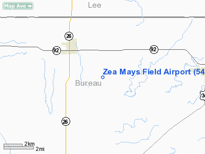
Location
& QuickFacts
|
FAA
Information Effective: |
2007-12-20 |
|
Airport
Identifier: |
54IS |
|
Airport
Status: |
Operational |
|
Longitude/Latitude: |
089-25-05.3320W/41-31-36.1250N
-89.418148/41.526701 (Estimated) |
|
Elevation: |
766 ft / 233.48 m (Estimated) |
|
Land: |
3 acres |
|
From nearest
city: |
3 nautical miles SE of Ohio, IL |
|
Location: |
Bureau County, IL |
|
Magnetic
Variation: |
01E (1985) |
Owner & Manager
|
Ownership: |
Privately
owned |
|
Owner: |
Howard Miller |
|
Address: |
Rr 1
Ohio, IL 61349 |
|
Phone
number: |
815-376-5671 |
|
Address: |
|
Airport
Operations and Facilities
|
Airport
Use: |
Private |
|
Wind indicator: |
Yes |
|
Segmented
Circle: |
No |
|
Control
Tower: |
No |
|
Sectional
chart: |
Chicago |
|
Region: |
AGL - Great Lakes |
|
Boundary
ARTCC: |
ZAU - Chicago |
|
Tie-in
FSS: |
IKK - Kankakee |
|
FSS Toll
Free: |
1-800-WX-BRIEF
OR LOCAL CALL 965-6758. |
Airport
Services
|
Runway Information
Runway 09/27
|
Dimension: |
1700 x 70 ft
/ 518.2 x 21.3 m |
|
Surface: |
TURF, |
|
|
Runway 09 |
Runway 27 |
|
Traffic
Pattern: |
Left |
Left |
|
Obstruction: |
|
20 ft pline, 200.0 ft from runway |
|
Radio Navigation
Aids
|
ID |
Type |
Name |
Ch |
Freq |
Var |
Dist |
|
VYS |
NDB |
Valley |
|
230.00 |
00W |
16.0 nm |
|
BOZ |
NDB |
Whiteside |
|
254.00 |
01E |
19.9 nm |
|
OIX |
NDB |
Ottawa |
|
266.00 |
01E |
27.3 nm |
|
EZI |
NDB |
Kewanee |
|
245.00 |
01E |
31.3 nm |
|
DKB |
NDB |
Dekalb |
|
209.00 |
02W |
40.2 nm |
|
FEP |
NDB |
Freeport |
|
335.00 |
00E |
43.9 nm |
|
CWI |
NDB |
Clinton |
|
377.00 |
01E |
44.7 nm |
|
PLL |
VOR/DME |
Polo |
049X |
111.20 |
03E |
26.8 nm |
|
RFD |
VOR/DME |
Rockford |
045X |
110.80 |
01E |
43.1 nm |
|
BDF |
VORTAC |
Bradford |
094X |
114.70 |
00E |
23.3 nm |
|
CVA |
VORTAC |
Davenport |
085X |
113.80 |
04E |
49.1 nm |
|
JOT |
VORTAC |
Joliet |
070X |
112.30 |
02E |
49.5 nm |
Remarks
- PROVIDED
OBSTRUCTIONS IN APPROACH SURFACES BE REMOVED OR RWY 27 THRESHOLD DISPLACED
TO PROVIDE CLEARANCE OVER ROAD AND PLINE; AND AREA 125' ON EITHER SIDE
OF RWY CENTERLINE BE CLEAR OF ALL OBSTRUCTIONS.
Based Aircraft
|
Aircraft
based on field: |
1 |
|
Single Engine
Airplanes: |
1 |
Zea Mays Field Airport
Address:
Bureau County, IL
Tel:
815-376-5671
Images
and information placed above are from
http://www.airport-data.com/airport/54IS/
We
thank them for the data!
| General
Info |
| Country |
United
States |
| State |
ILLINOIS
|
| FAA ID |
54IS |
| Latitude |
41-31-36.125N
|
| Longitude |
089-25-05.332W
|
| Elevation |
766 feet
|
| Near City |
OHIO |
We don't guarantee the information is fresh and accurate. The data may
be wrong or outdated.
For more up-to-date information please refer to other sources.
|
|


