 |
|
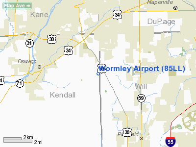
Location
& QuickFacts
|
FAA
Information Effective: |
2007-12-20 |
|
Airport
Identifier: |
85LL |
|
Airport
Status: |
Operational |
|
Longitude/Latitude: |
088-15-44.2450W/41-41-02.1060N
-88.262290/41.683918 (Estimated) |
|
Elevation: |
680 ft / 207.26 m (Estimated) |
|
Land: |
0 acres |
|
From nearest
city: |
3 nautical miles E of Oswego, IL |
|
Location: |
Kendall County, IL |
|
Magnetic
Variation: |
01W (1985) |
Owner
& Manager
|
Ownership: |
Privately
owned |
|
Owner: |
Richard Budd Wormley |
|
Address: |
6 Century Ct.
Oswego, IL 60543 |
|
Phone
number: |
708-554-1069 |
|
Manager: |
R. B. Wormely |
|
Address: |
P.o. Box 833
Oswego,
IL 60543 |
|
Phone
number: |
708-554-1069 |
Airport Operations
and Facilities
|
Airport
Use: |
Private |
|
Wind indicator: |
Yes |
|
Segmented
Circle: |
No |
|
Control
Tower: |
No |
|
Landing
fee charge: |
No |
|
Sectional
chart: |
Chicago |
|
Region: |
AGL - Great Lakes |
|
Boundary
ARTCC: |
ZAU - Chicago |
|
Tie-in
FSS: |
IKK - Kankakee |
|
FSS on
Airport: |
No |
|
FSS Toll
Free: |
1-800-WX-BRIEF |
|
Runway Information
Runway N/S
|
Dimension: |
2300 x 100 ft
/ 701.0 x 30.5 m |
|
Surface: |
TURF, |
|
|
Runway N |
Runway S |
|
Traffic
Pattern: |
Right |
Left |
|
Radio Navigation
Aids
|
ID |
Type |
Name |
Ch |
Freq |
Var |
Dist |
|
HK |
NDB |
Ermin |
|
332.00 |
01W |
19.2 nm |
|
ME |
NDB |
Deana |
|
350.00 |
00E |
20.1 nm |
|
DKB |
NDB |
Dekalb |
|
209.00 |
02W |
25.0 nm |
|
MX |
NDB |
Kedzi |
|
248.00 |
01W |
25.9 nm |
|
OIX |
NDB |
Ottawa |
|
266.00 |
01E |
32.9 nm |
|
VYS |
NDB |
Valley |
|
230.00 |
00W |
44.5 nm |
|
DPA |
VOR/DME |
Dupage |
021X |
108.40 |
02E |
13.0 nm |
|
ORD |
VOR/DME |
Chicago O'hare |
086X |
113.90 |
02E |
24.3 nm |
|
OBK |
VOR/DME |
Northbrook |
077X |
113.00 |
02W |
35.2 nm |
|
IKK |
VOR/DME |
Kankakee |
053X |
111.60 |
00E |
41.1 nm |
|
JOT |
VORTAC |
Joliet |
070X |
112.30 |
02E |
8.6 nm |
|
EON |
VORTAC |
Peotone |
079X |
113.20 |
02E |
32.7 nm |
|
CGT |
VORTAC |
Chicago Heights |
089X |
114.20 |
02E |
32.8 nm |
|
MDW |
VOT |
Chicago Midway |
|
111.00 |
|
23.7 nm |
|
ORD |
VOT |
Chicago O'hare Intl |
|
112.00 |
|
24.0 nm |
Remarks
- E111
PRVDD ALL TRAFFIC PATTERN OPNS ARE CONDUCTED EAST OF N/S RWY.
Wormley Airport
Address:
Kendall County, IL
Tel:
708-554-1069
Images
and information placed above are from
http://www.airport-data.com/airport/85LL/
We
thank them for the data!
| General
Info |
| Country |
United
States |
| State |
ILLINOIS
|
| FAA ID |
85LL |
| Latitude |
41-41-02.106N
|
| Longitude |
088-15-44.245W
|
| Elevation |
680 feet
|
| Near City |
OSWEGO
|
We don't guarantee the information is fresh and accurate. The data may
be wrong or outdated.
For more up-to-date information please refer to other sources.
|
|


