 |
|
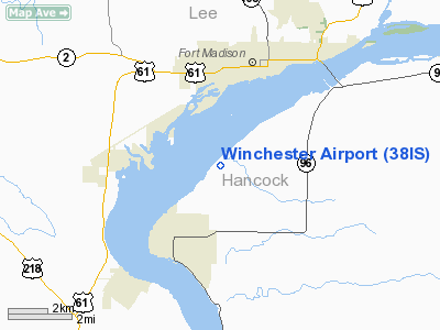
Location
& QuickFacts
|
FAA Information Effective: |
2007-12-20 |
|
Airport
Identifier: |
38IS |
|
Airport
Status: |
Operational |
|
Longitude/Latitude: |
091-21-30.5460W/40-34-55.1490N
-91.358485/40.581986 (Estimated) |
|
Elevation: |
685 ft / 208.79 m (Estimated) |
|
Land: |
0
acres |
|
From
nearest city: |
3 nautical miles N of Nauvoo, IL |
|
Location: |
Hancock County, IL |
|
Magnetic
Variation: |
03E (1985) |
Owner & Manager
|
Ownership: |
Privately
owned |
|
Owner: |
M. J. S. Winchester |
|
Address: |
R 1
Nauvoo, IL 62354 |
|
Phone
number: |
217-453-6445 |
|
Address: |
|
Airport
Operations and Facilities
|
Airport Use: |
Private |
|
Segmented
Circle: |
No |
|
Control
Tower: |
No |
|
Sectional
chart: |
Chicago |
|
Region: |
AGL - Great Lakes |
|
Boundary
ARTCC: |
ZKC - Kansas City |
|
Tie-in
FSS: |
STL - Saint Louis |
|
FSS Toll
Free: |
1-800-WX-BRIEF |
|
Runway Information
Runway N/S
|
Dimension: |
1740 x 70 ft
/ 530.4 x 21.3 m |
|
Surface: |
TURF, |
|
|
Runway N |
Runway S |
|
Traffic
Pattern: |
Left |
Left |
|
Radio Navigation
Aids
|
ID |
Type |
Name |
Ch |
Freq |
Var |
Dist |
|
EOK |
NDB |
Keokuk |
|
366.00 |
02E |
7.8 nm |
|
MPZ |
NDB |
Mount Pleasant |
|
212.00 |
02E |
22.7 nm |
|
JZY |
NDB |
Macomb |
|
251.00 |
01E |
36.6 nm |
|
FFL |
NDB |
Fairfield |
|
332.00 |
03E |
38.6 nm |
|
UI |
NDB |
Quincy |
|
293.00 |
02E |
42.1 nm |
|
AWG |
NDB |
Washington |
|
219.00 |
02E |
44.3 nm |
|
BEX |
NDB |
Bloomfield |
|
269.00 |
02E |
49.8 nm |
|
GBG |
VOR/DME |
Galesburg |
035X |
109.80 |
03E |
47.2 nm |
|
DDD |
VOR/DME |
Port City |
112X |
116.50 |
01E |
48.1 nm |
|
BRL |
VORTAC |
Burlington |
051X |
111.40 |
05E |
21.5 nm |
|
UIN |
VORTAC |
Quincy |
083X |
113.60 |
05E |
44.3 nm |
Based Aircraft
|
Aircraft
based on field: |
1 |
|
Single Engine
Airplanes: |
1 |
Winchester Airport
Address:
Hancock County, IL
Tel:
217-453-6445
Images
and information placed above are from
http://www.airport-data.com/airport/38IS/
We
thank them for the data!
| General
Info |
| Country |
United
States |
| State |
ILLINOIS
|
| FAA ID |
38IS |
| Latitude |
40-34-55.149N
|
| Longitude |
091-21-30.546W
|
| Elevation |
685 feet
|
| Near City |
NAUVOO
|
We don't guarantee the information is fresh and accurate. The data may
be wrong or outdated.
For more up-to-date information please refer to other sources.
|
|


