 |
|
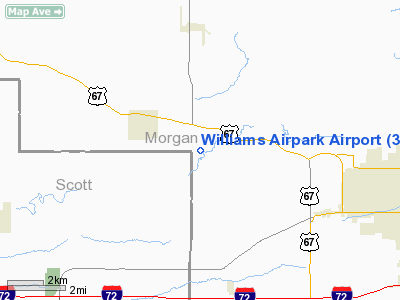
Location
& QuickFacts
|
FAA
Information Effective: |
2007-12-20 |
|
Airport
Identifier: |
30LL |
|
Airport
Status: |
Operational |
|
Longitude/Latitude: |
090-21-55.4440W/39-45-15.1660N
-90.365401/39.754213 (Estimated) |
|
Elevation: |
614 ft / 187.15 m (Estimated) |
|
Land: |
0 acres |
|
From nearest
city: |
2 nautical miles SE of Chapin, IL |
|
Location: |
Morgan County, IL |
|
Magnetic
Variation: |
02E (1985) |
Owner & Manager
|
Ownership: |
Privately
owned |
|
Owner: |
Thomas C. Williams |
|
Address: |
Rr 1
Chapin, IL 62628 |
|
Phone
number: |
217-245-7636 |
|
Manager: |
Thomas C. Williams |
|
Address: |
Rr 1
Chapin, IL 62628 |
|
Phone
number: |
217-245-7636 |
Airport
Operations and Facilities
|
Airport
Use: |
Private |
|
Wind indicator: |
Yes |
|
Segmented
Circle: |
No |
|
Control
Tower: |
No |
|
Landing
fee charge: |
No |
|
Sectional
chart: |
St Louis |
|
Region: |
AGL - Great Lakes |
|
Boundary
ARTCC: |
ZKC - Kansas City |
|
Tie-in
FSS: |
STL - Saint Louis |
|
FSS on
Airport: |
No |
|
FSS Toll
Free: |
1-800-WX-BRIEF |
|
Runway Information
Runway E/W
|
Dimension: |
1960 x 80 ft
/ 597.4 x 24.4 m |
|
Surface: |
TURF, |
|
|
Runway E |
Runway W |
|
Traffic
Pattern: |
Left |
Left |
|
Radio Navigation
Aids
|
ID |
Type |
Name |
Ch |
Freq |
Var |
Dist |
|
PPQ |
NDB |
Pittsfield |
|
344.00 |
02E |
20.5 nm |
|
SP |
NDB |
Huskk |
|
382.00 |
01W |
28.0 nm |
|
LQ |
NDB |
Licol |
|
375.00 |
01W |
36.4 nm |
|
UI |
NDB |
Quincy |
|
293.00 |
02E |
41.8 nm |
|
JZY |
NDB |
Macomb |
|
251.00 |
01E |
46.8 nm |
|
LTD |
NDB |
Litchfield |
|
371.00 |
01E |
47.7 nm |
|
TAZ |
NDB |
Taylorville |
|
395.00 |
00E |
50.0 nm |
|
IJX |
VOR/DME |
Jacksonville |
023X |
108.60 |
02E |
6.0 nm |
|
SPI |
VORTAC |
Spinner |
74X |
112.70 |
01W |
32.2 nm |
|
CAP |
VORTAC |
Capital |
074X |
112.70 |
04E |
35.2 nm |
|
UIN |
VORTAC |
Quincy |
083X |
113.60 |
05E |
42.6 nm |
Based Aircraft
|
Aircraft
based on field: |
1 |
|
Single Engine
Airplanes: |
1 |
Williams Airpark Airport
Address:
Morgan County, IL
Tel:
217-245-7636
Images
and information placed above are from
http://www.airport-data.com/airport/30LL/
We
thank them for the data!
| General
Info |
| Country |
United
States |
| State |
ILLINOIS
|
| FAA ID |
30LL |
| Latitude |
39-45-15.166N
|
| Longitude |
090-21-55.444W
|
| Elevation |
614 feet
|
| Near City |
CHAPIN
|
We don't guarantee the information is fresh and accurate. The data may
be wrong or outdated.
For more up-to-date information please refer to other sources.
|
|


