 |
|
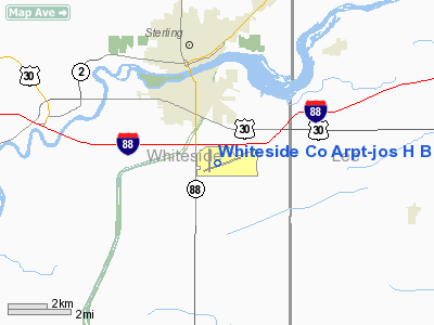
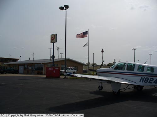
Whiteside Company Airport-jos H Bittorf Field Airport |
|
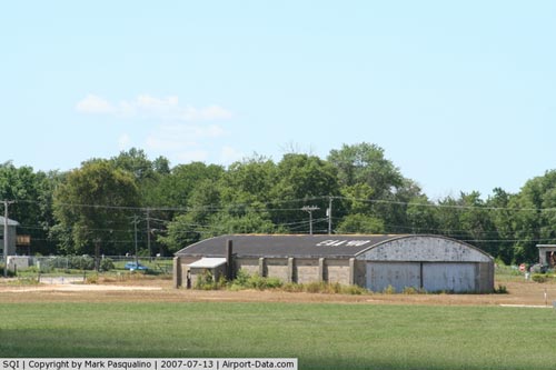 |
(Click on the photo to enlarge) |
|
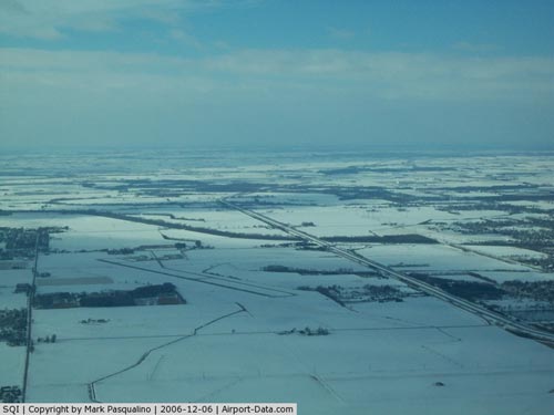 |
(Click on the photo to enlarge) |
|
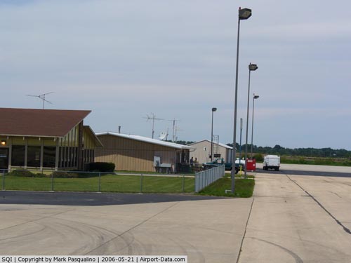 |
(Click on the photo to enlarge) |
|
 |
(Click on the photo to enlarge) |
Location
& QuickFacts
|
FAA
Information Effective: |
2007-12-20 |
|
Airport
Identifier: |
SQI |
|
Airport
Status: |
Operational |
|
Longitude/Latitude: |
089-40-34.6450W/41-44-34.2290N
-89.676290/41.742841 (Estimated) |
|
Elevation: |
647 ft / 197.21 m (Surveyed) |
|
Land: |
437 acres |
|
From nearest
city: |
2 nautical miles S of Sterling/rockfalls,
IL |
|
Location: |
Whiteside County, IL |
|
Magnetic
Variation: |
01E (2000) |
Owner
& Manager
|
Ownership: |
Publicly
owned |
|
Owner: |
Whiteside County |
|
Address: |
Whiteside County Courthouse
Morrison, IL 61270 |
|
Phone
number: |
815-622-3591 |
|
Manager: |
Michael Dowell |
|
Address: |
10950 Hoover Rd
Rockfalls,
IL 61071 |
|
Phone
number: |
815-622-3591 |
Airport
Operations and Facilities
|
Airport
Use: |
Open
to public |
|
Wind indicator: |
Yes |
|
Segmented
Circle: |
Yes |
|
Control
Tower: |
No |
|
Lighting
Schedule: |
DUSK-DAWN
MIRL RY 18/36 PRESET ON LOW INTST; TO INCR INTST & ACTVT
HIRL RY 07/25; MALSR RY 25 & REIL RYS 07, 18 & 36
- CTAF. |
|
Beacon
Color: |
Clear-Green (lighted land airport) |
|
Landing
fee charge: |
No |
|
Sectional
chart: |
Chicago |
|
Region: |
AGL - Great Lakes |
|
Boundary
ARTCC: |
ZAU - Chicago |
|
Tie-in
FSS: |
IKK - Kankakee |
|
FSS on
Airport: |
No |
|
FSS Toll
Free: |
1-800-WX-BRIEF |
|
NOTAMs
Facility: |
SQI (NOTAM-d service avaliable) |
|
Federal
Agreements: |
NGY |
Airport Communications
|
CTAF: |
123.000 |
|
Unicom: |
123.000
|
Airport
Services
|
Fuel
available: |
100LLA |
|
Airframe
Repair: |
MAJOR |
|
Power
Plant Repair: |
MAJOR |
|
Bottled
Oxygen: |
HIGH/LOW |
|
Bulk Oxygen: |
HIGH/LOW |
|
Runway Information
Runway 07/25
|
Dimension: |
6500 x 150 ft
/ 1981.2 x 45.7 m |
|
Surface: |
ASPH, Good Condition |
|
Surface Treatment: |
Porous Friction Course |
|
Weight Limit: |
Single wheel: 50000 lbs.
Dual wheel: 60000 lbs.
Dual tandem wheel: 90000 lbs. |
|
Edge Lights: |
High |
|
|
Runway 07 |
Runway 25 |
|
Longitude: |
089-41-04.9770W |
089-39-44.3360W |
|
Latitude: |
41-44-21.0260N |
41-44-42.8410N |
|
Elevation: |
647.00 ft |
647.00 ft |
|
Alignment: |
70 |
127 |
|
ILS Type: |
|
ILS |
|
Traffic
Pattern: |
Left |
Left |
|
Markings: |
Non-precision instrument, Fair Condition |
Precision instrument, Fair Condition |
|
Crossing
Height: |
46.00 ft |
0.00 ft |
|
VASI: |
4-box on left side |
|
|
Visual Glide
Angle: |
3.00° |
0.00° |
|
Approach
lights: |
|
MALSR |
|
Runway End
Identifier: |
Yes |
No |
|
Centerline
Lights: |
No |
No |
|
Touchdown
Lights: |
No |
No |
|
Obstruction: |
23 ft tree, 699.0 ft from runway, 618 ft left
of centerline, 21:1 slope to clear |
37 ft tree, 1542.0 ft from runway, 282 ft right
of centerline, 36:1 slope to clear |
|
Runway 18/36
|
Dimension: |
3899 x 100 ft
/ 1188.4 x 30.5 m |
|
Surface: |
ASPH, Good Condition |
|
Surface Treatment: |
Porous Friction Course |
|
Weight Limit: |
Single wheel: 18000 lbs. |
|
Edge Lights: |
Medium |
|
|
Runway 18 |
Runway 36 |
|
Longitude: |
089-40-51.2370W |
089-40-51.3500W |
|
Latitude: |
41-44-57.3130N |
41-44-18.7930N |
|
Elevation: |
641.00 ft |
644.00 ft |
|
Alignment: |
127 |
0 |
|
Traffic
Pattern: |
Left |
Left |
|
Markings: |
Basic, Good Condition |
Basic, Good Condition |
|
Runway End
Identifier: |
Yes |
Yes |
|
Centerline
Lights: |
No |
No |
|
Touchdown
Lights: |
No |
No |
|
Obstruction: |
10 ft brush, 567.0 ft from runway, 36:1 slope
to clear |
15 ft road, 800.0 ft from runway, 40:1 slope
to clear |
|
Radio Navigation
Aids
|
ID |
Type |
Name |
Ch |
Freq |
Var |
Dist |
|
BOZ |
NDB |
Whiteside |
|
254.00 |
01E |
5.3 nm |
|
CWI |
NDB |
Clinton |
|
377.00 |
01E |
29.6 nm |
|
FEP |
NDB |
Freeport |
|
335.00 |
00E |
30.5 nm |
|
VYS |
NDB |
Valley |
|
230.00 |
00W |
33.3 nm |
|
EZI |
NDB |
Kewanee |
|
245.00 |
01E |
35.0 nm |
|
OIX |
NDB |
Ottawa |
|
266.00 |
01E |
43.5 nm |
|
DKB |
NDB |
Dekalb |
|
209.00 |
02W |
44.9 nm |
|
PLL |
VOR/DME |
Polo |
049X |
111.20 |
03E |
15.0 nm |
|
RFD |
VOR/DME |
Rockford |
045X |
110.80 |
01E |
36.0 nm |
|
BDF |
VORTAC |
Bradford |
094X |
114.70 |
00E |
35.3 nm |
|
CVA |
VORTAC |
Davenport |
085X |
113.80 |
04E |
36.3 nm |
|
DVN |
VOT |
Davenport Municipal |
|
111.80 |
|
41.6 nm |
Remarks
- RY
07 PREFERRED CALM WIND RY.
Based Aircraft
|
Aircraft
based on field: |
46 |
|
Single Engine
Airplanes: |
45 |
|
Multi Engine Airplanes: |
1 |
Operational Statistics
Time
Period: 2005-01-01 - 2005-12-31
|
Aircraft
Operations: |
90/Day |
|
Air Taxi: |
1.8% |
|
General Aviation
Local: |
68.8% |
|
General Aviation
Itinerant: |
29.0% |
|
Military: |
0.4% |
Whiteside Company Airport-jos H Bittorf
Field Airport
Address:
Whiteside County, IL
Tel:
815-622-3591
Images
and information placed above are from
http://www.airport-data.com/airport/SQI/
We
thank them for the data!
| General
Info |
| Country |
United
States |
| State |
ILLINOIS
|
| FAA ID |
SQI |
| Latitude |
41-44-34.229N
|
| Longitude |
089-40-34.645W
|
| Elevation |
647 feet
|
| Near City |
STERLING/ROCKFALLS
|
We don't guarantee the information is fresh and accurate. The data may
be wrong or outdated.
For more up-to-date information please refer to other sources.
|
|


